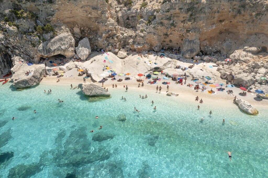
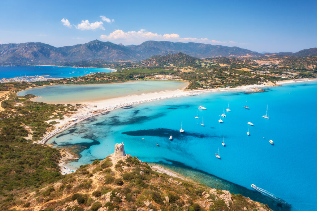
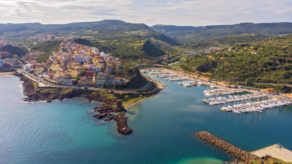
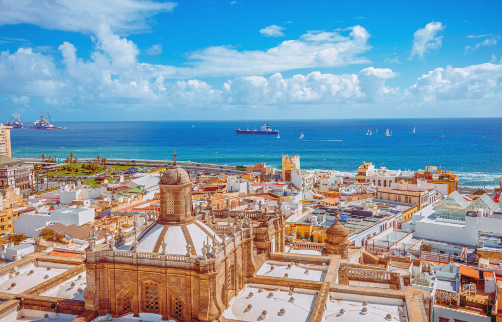
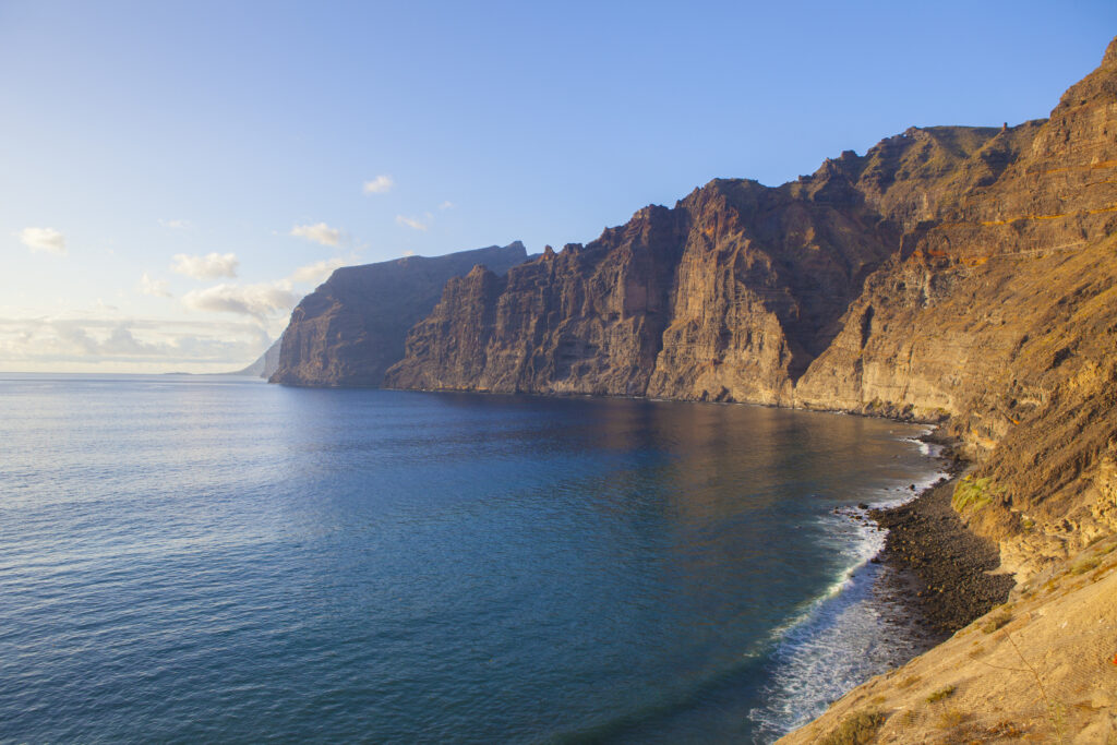
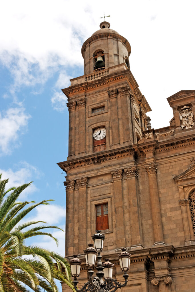
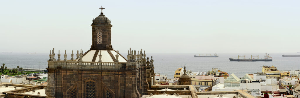
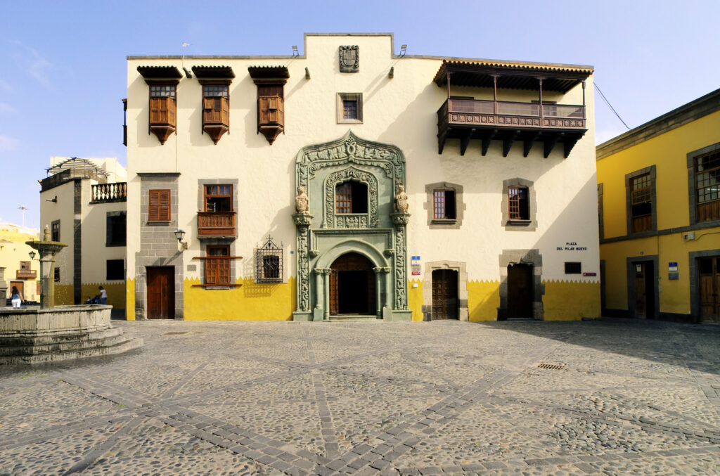
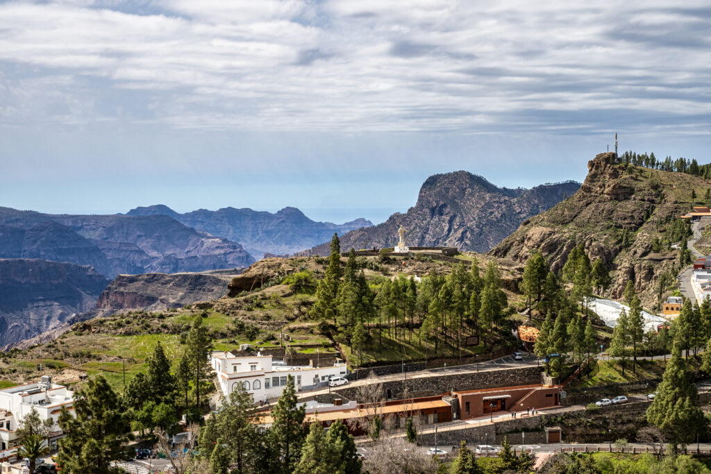
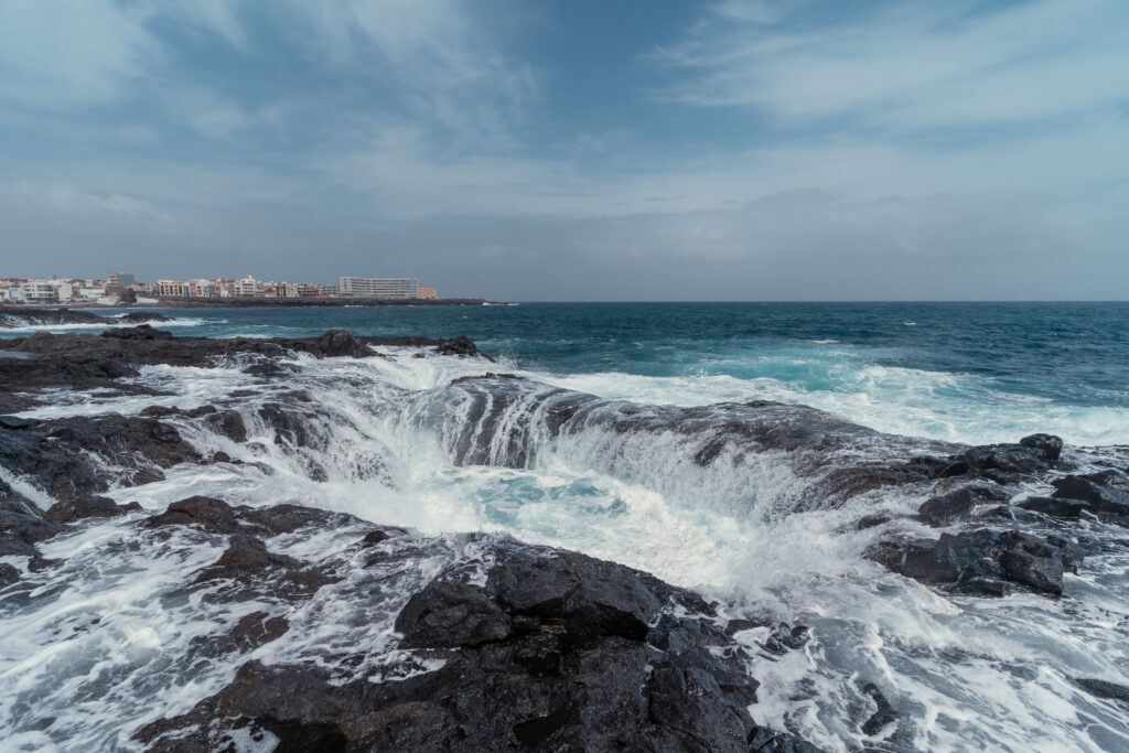
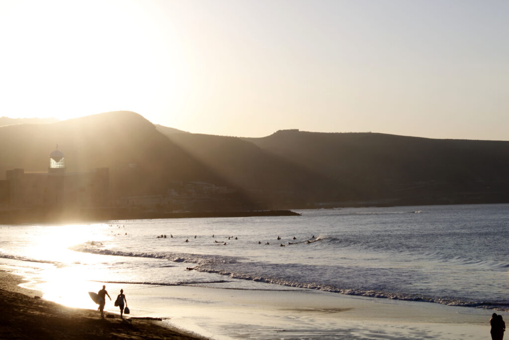
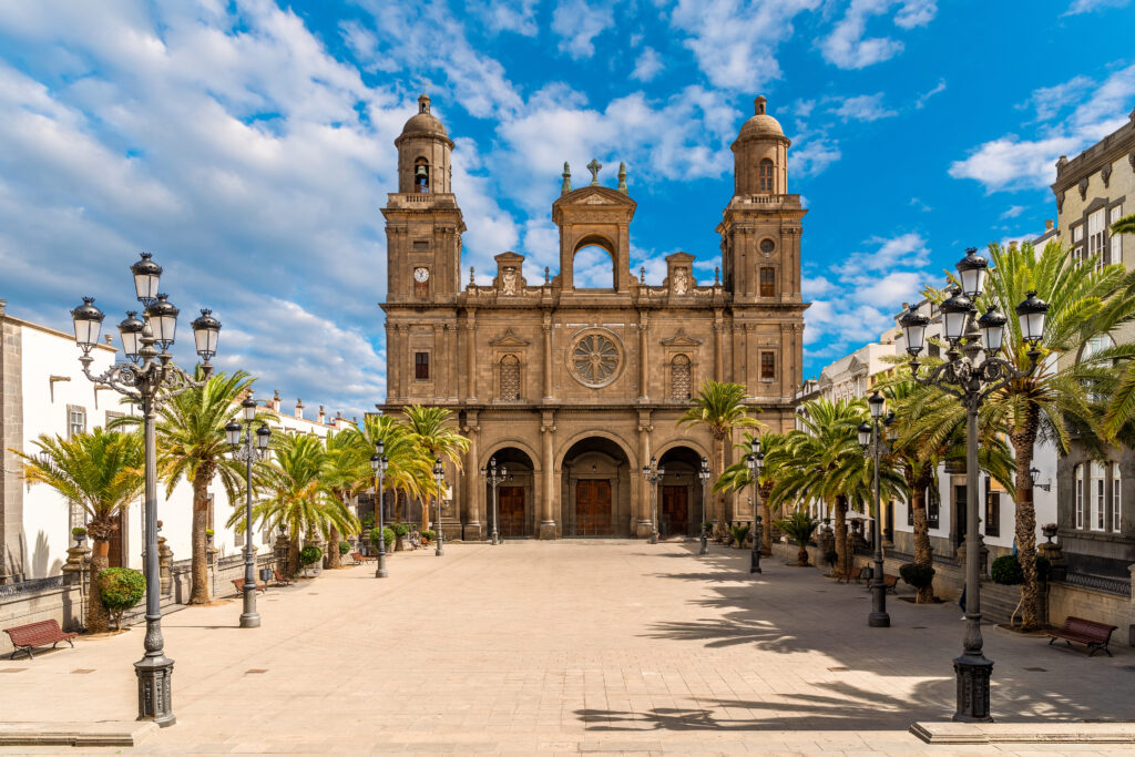
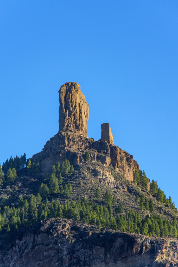
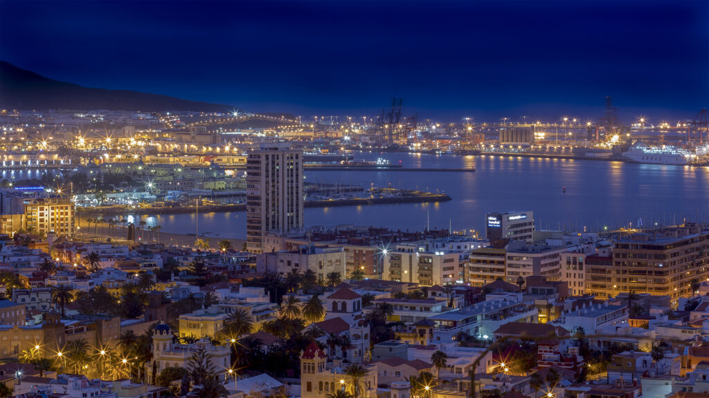
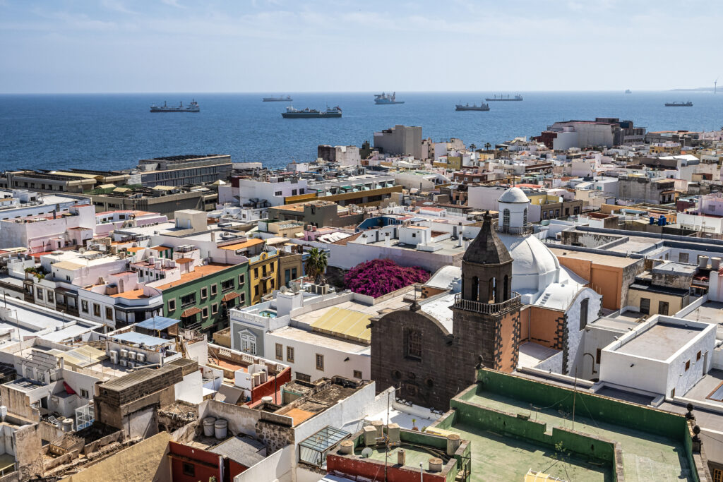
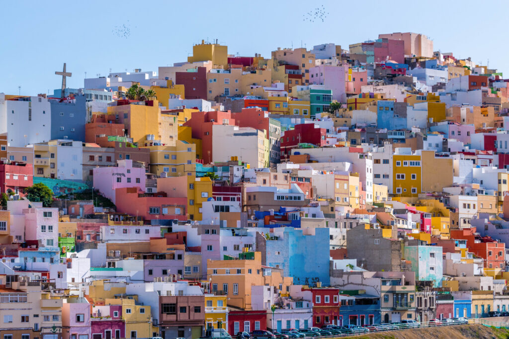
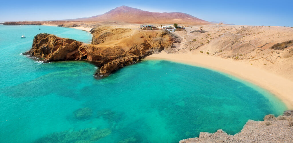
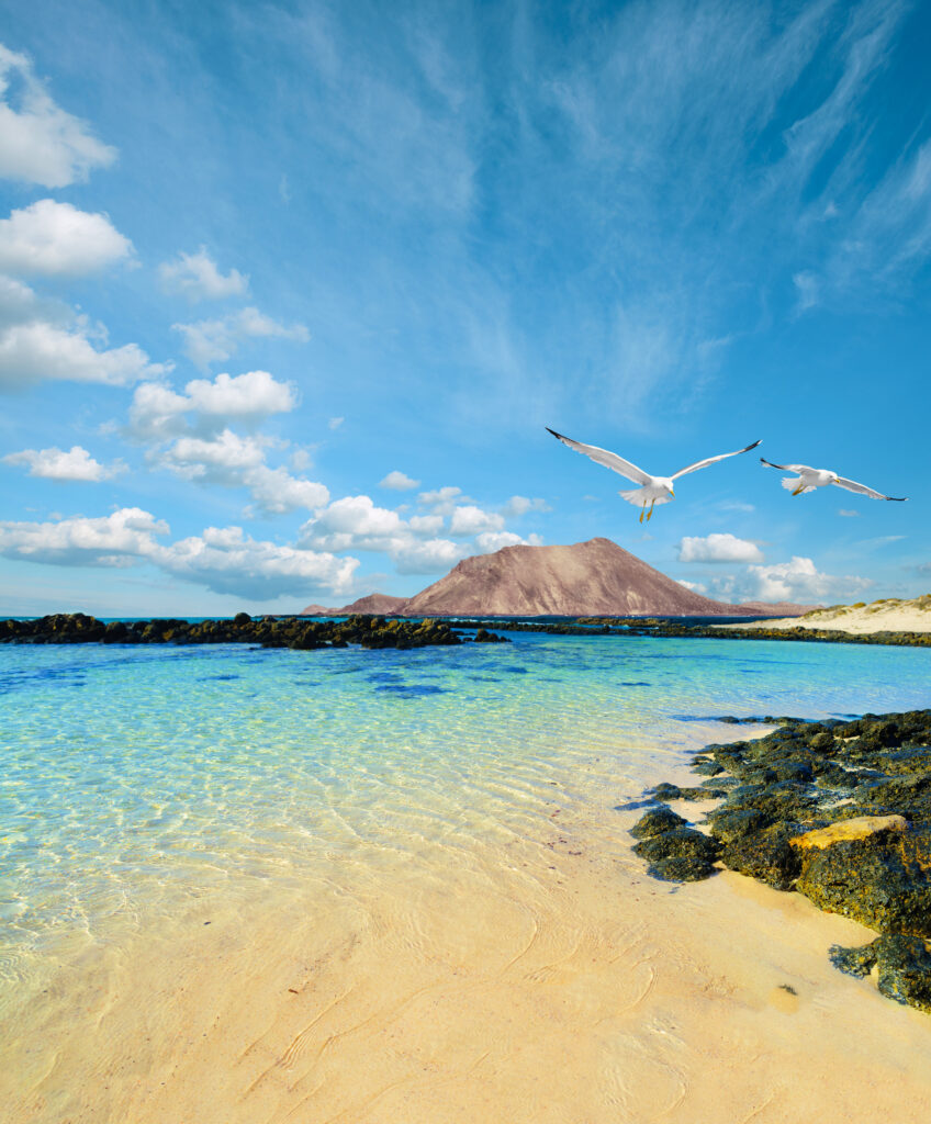
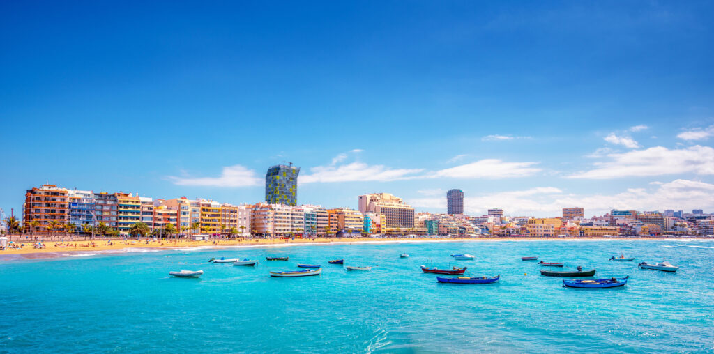
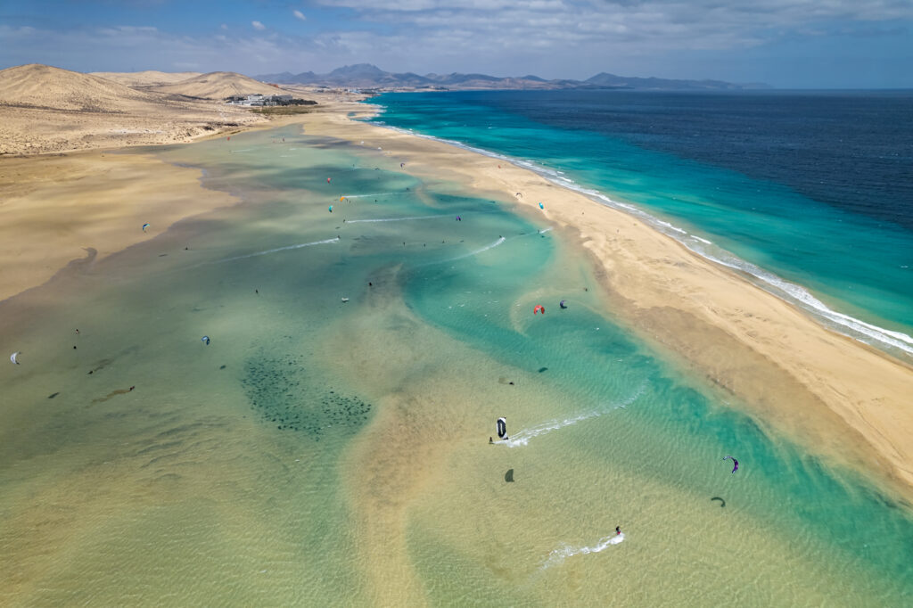
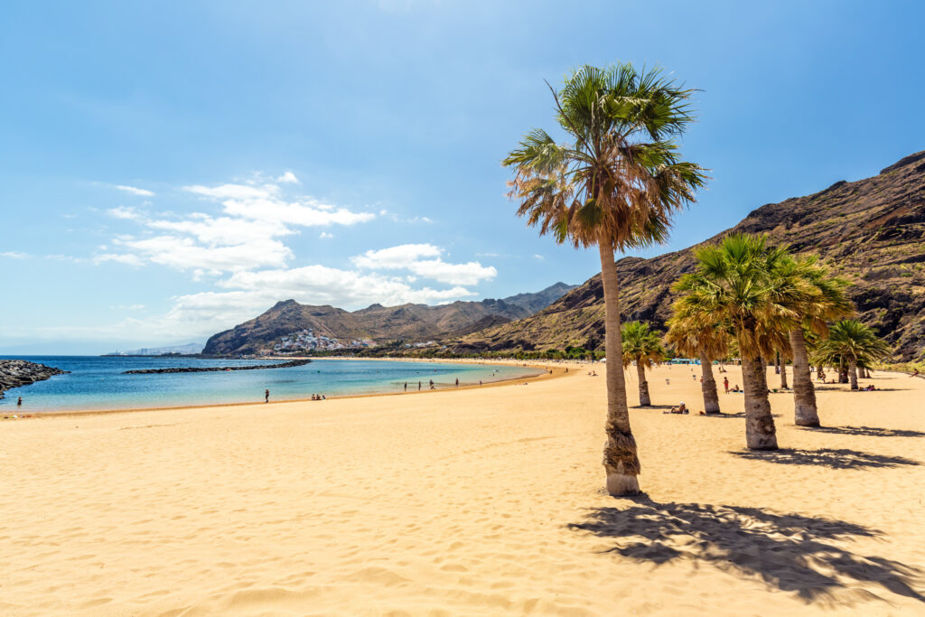
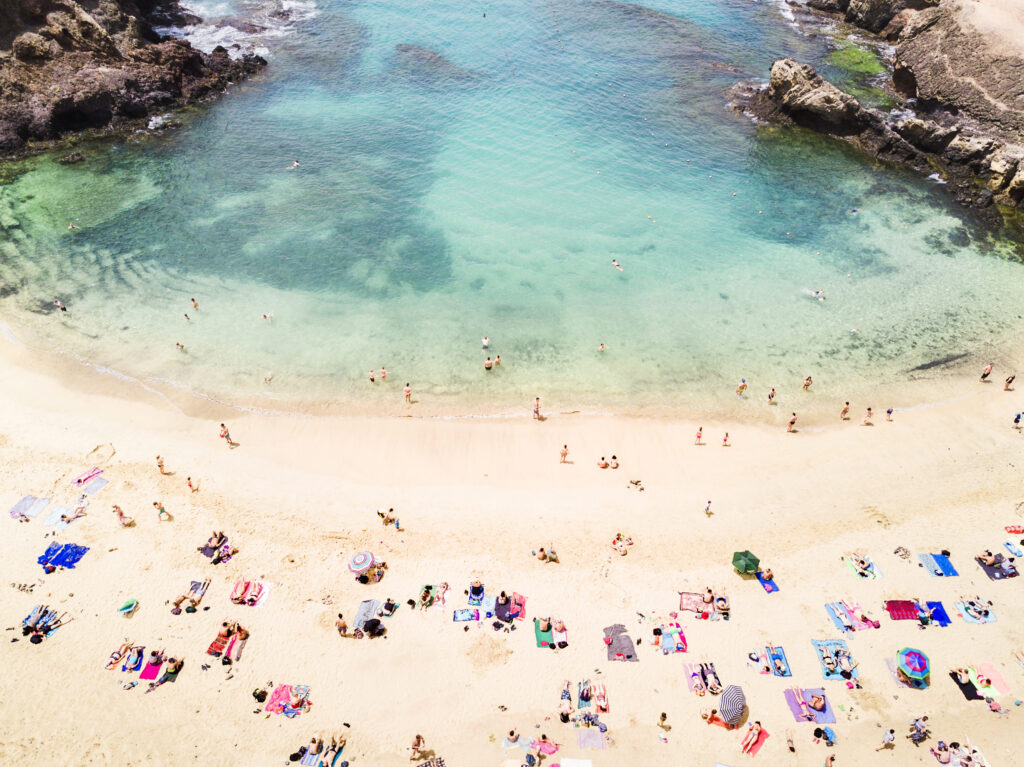
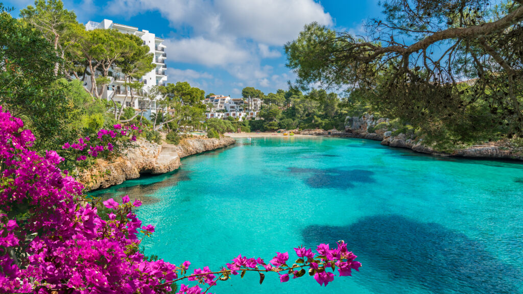
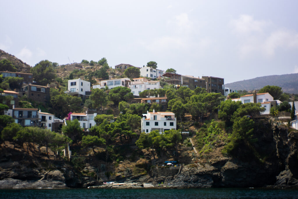
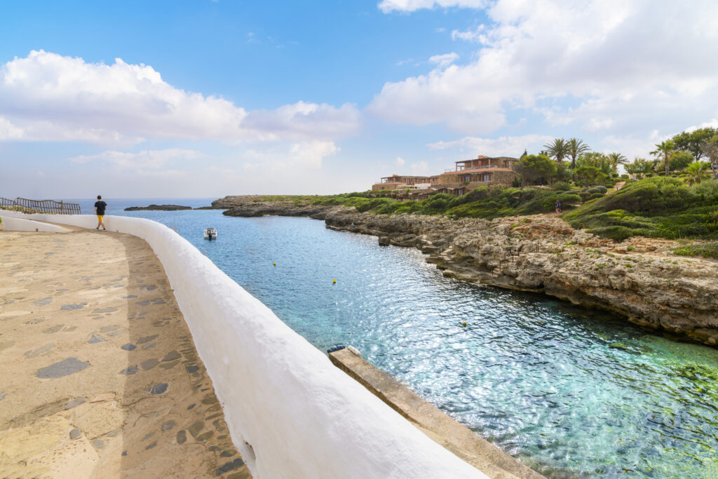
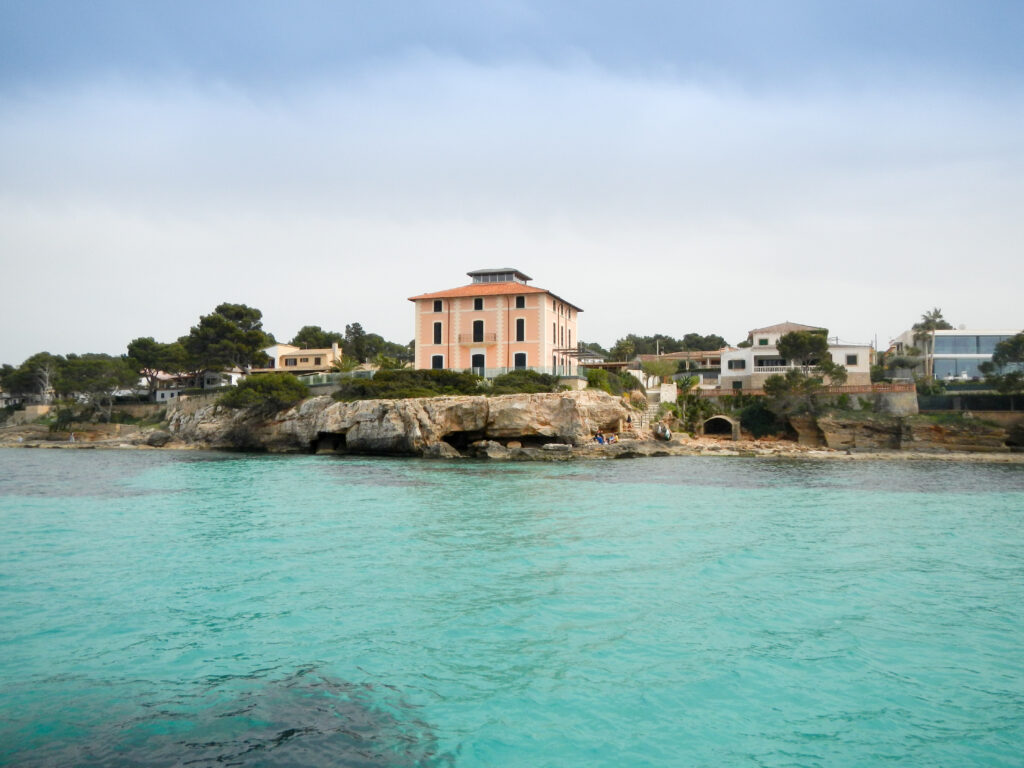
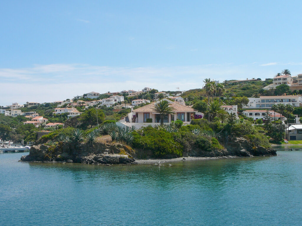
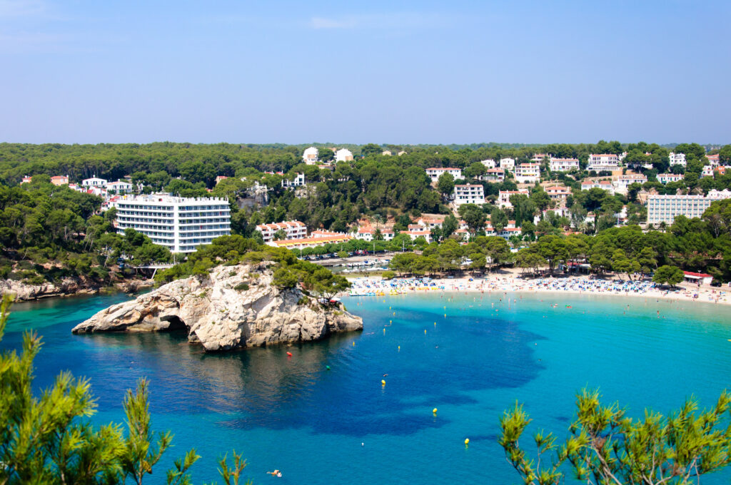
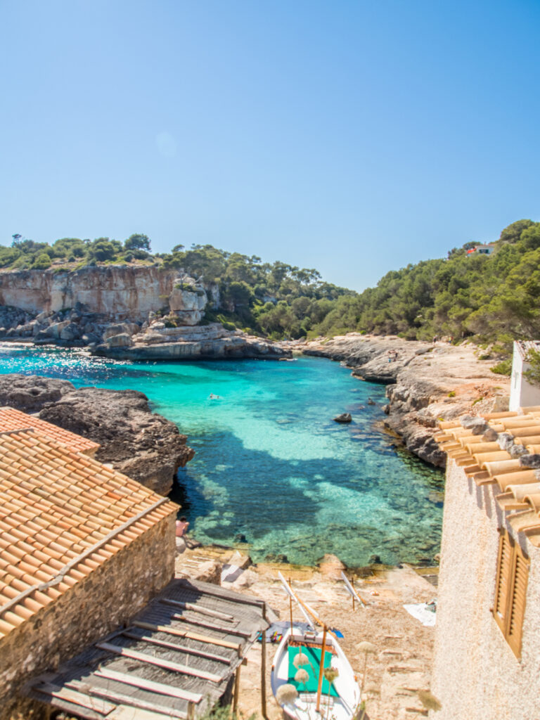
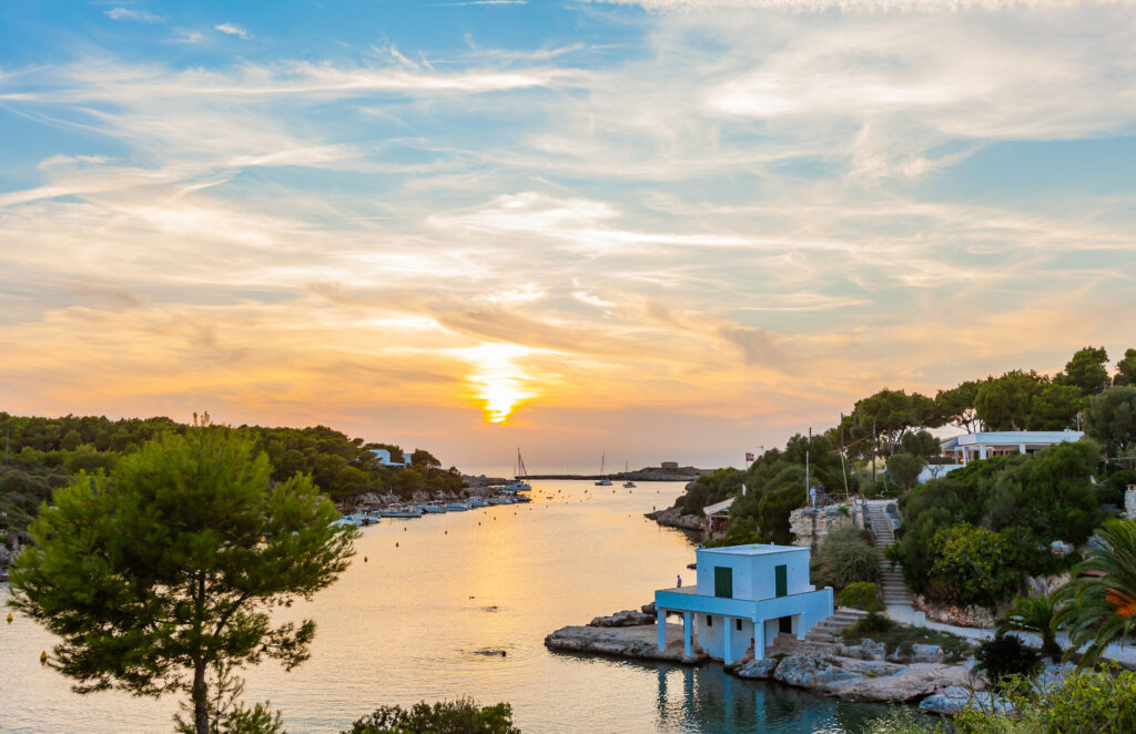
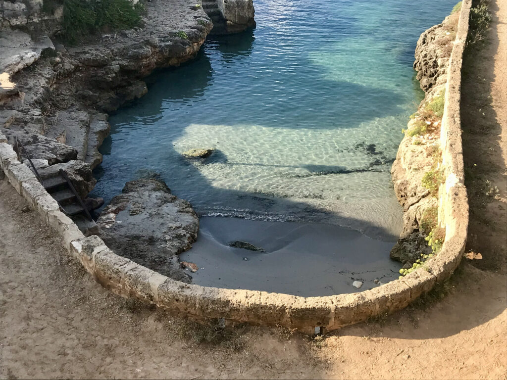
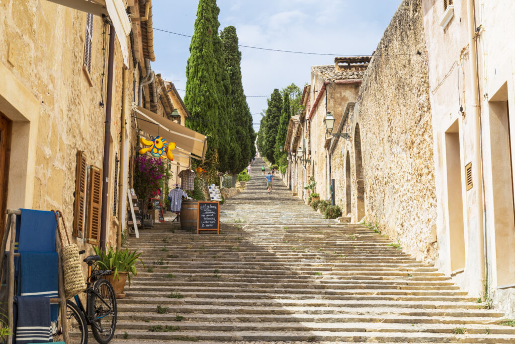
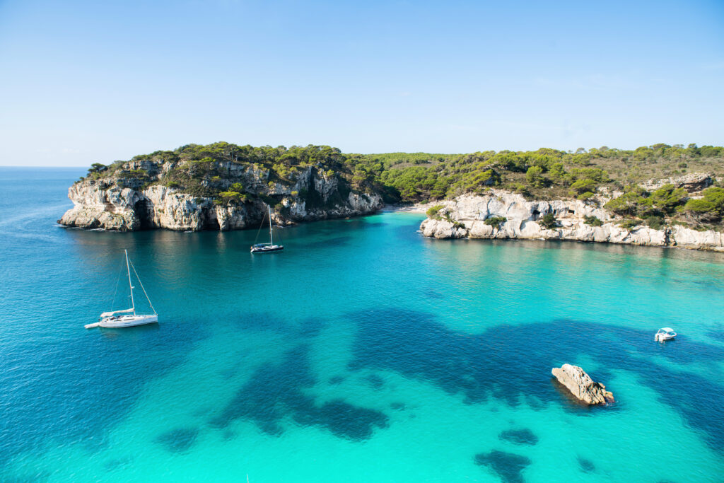
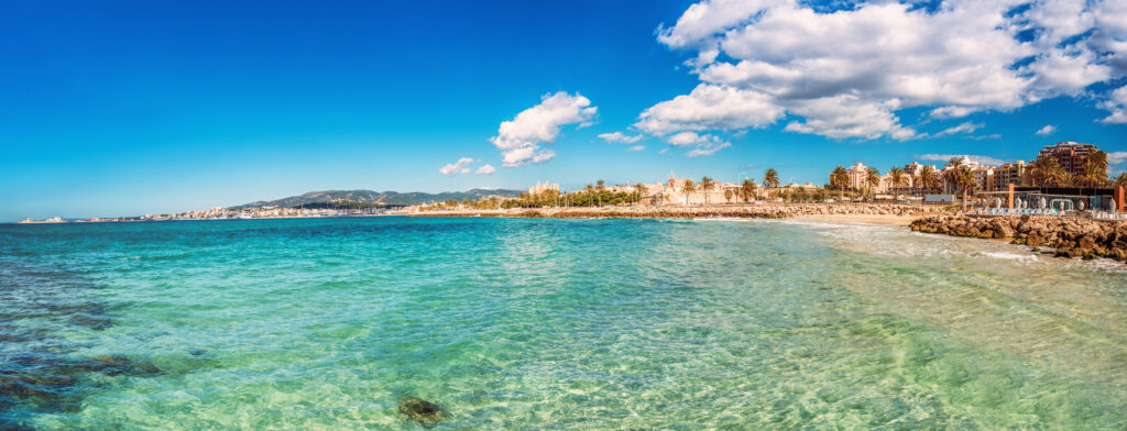
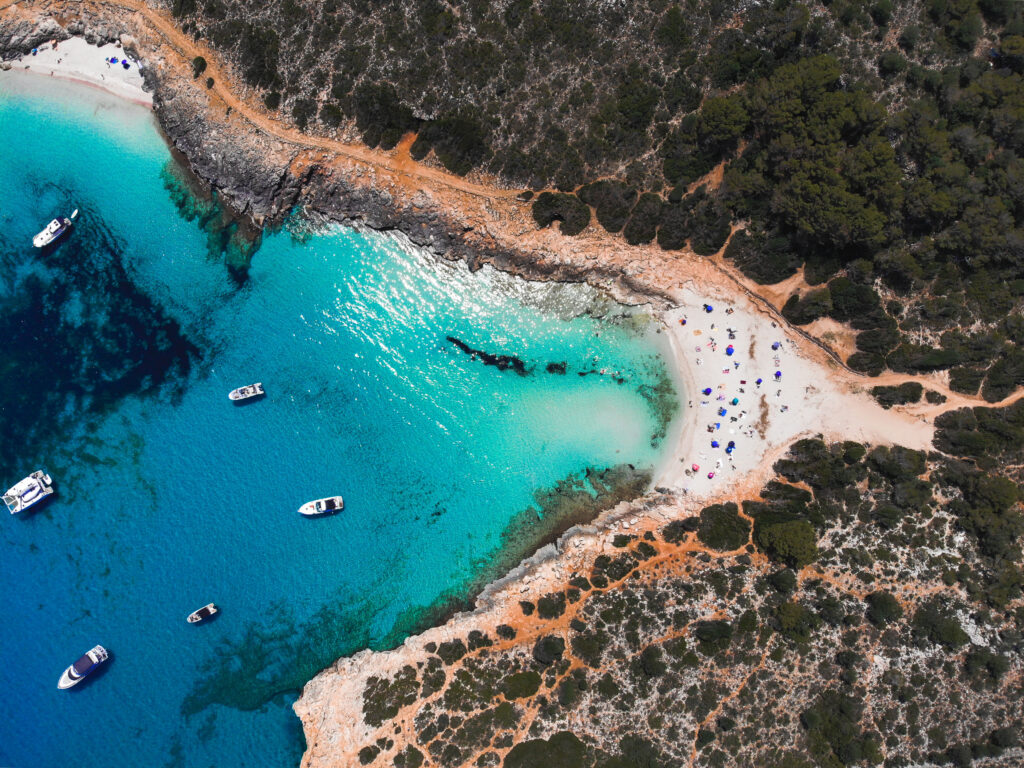
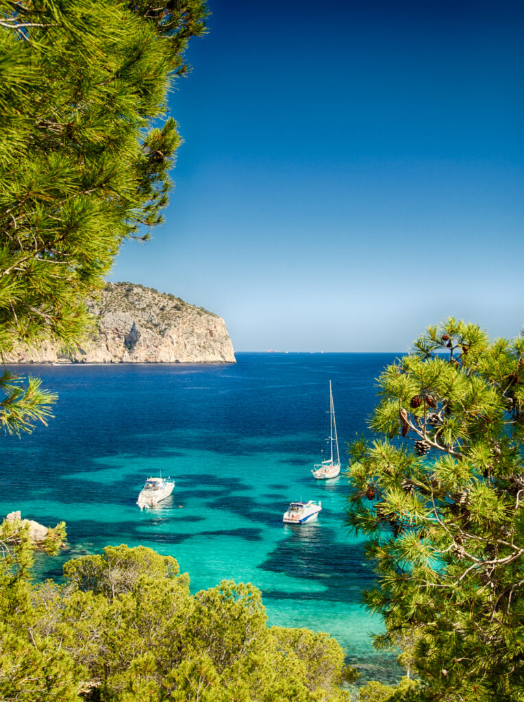
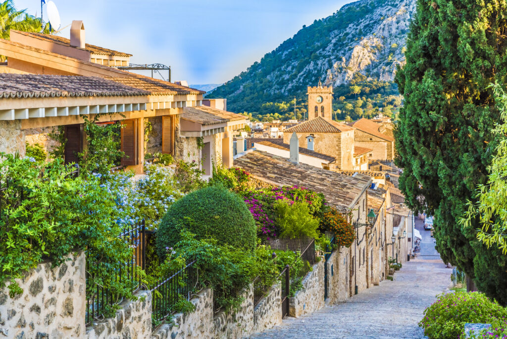
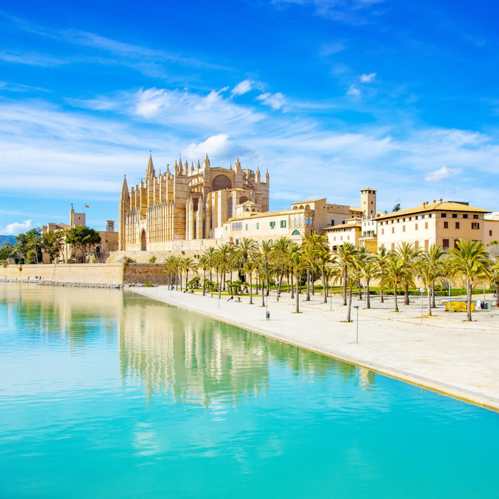
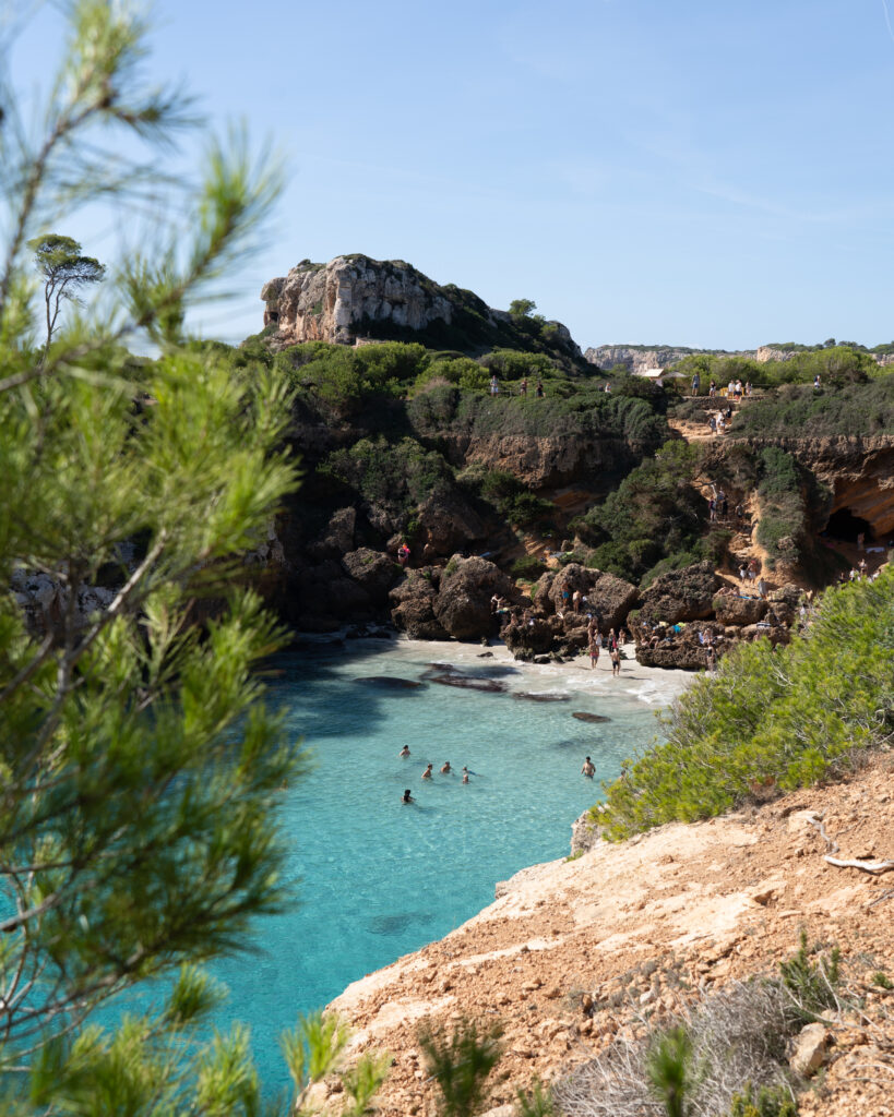
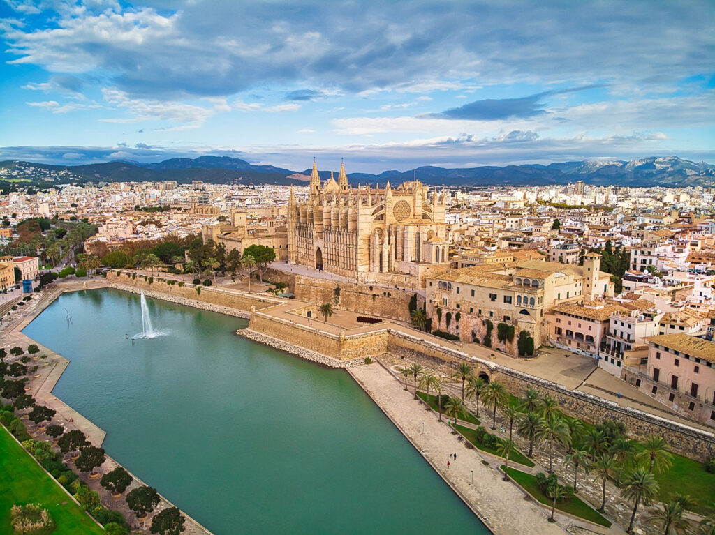
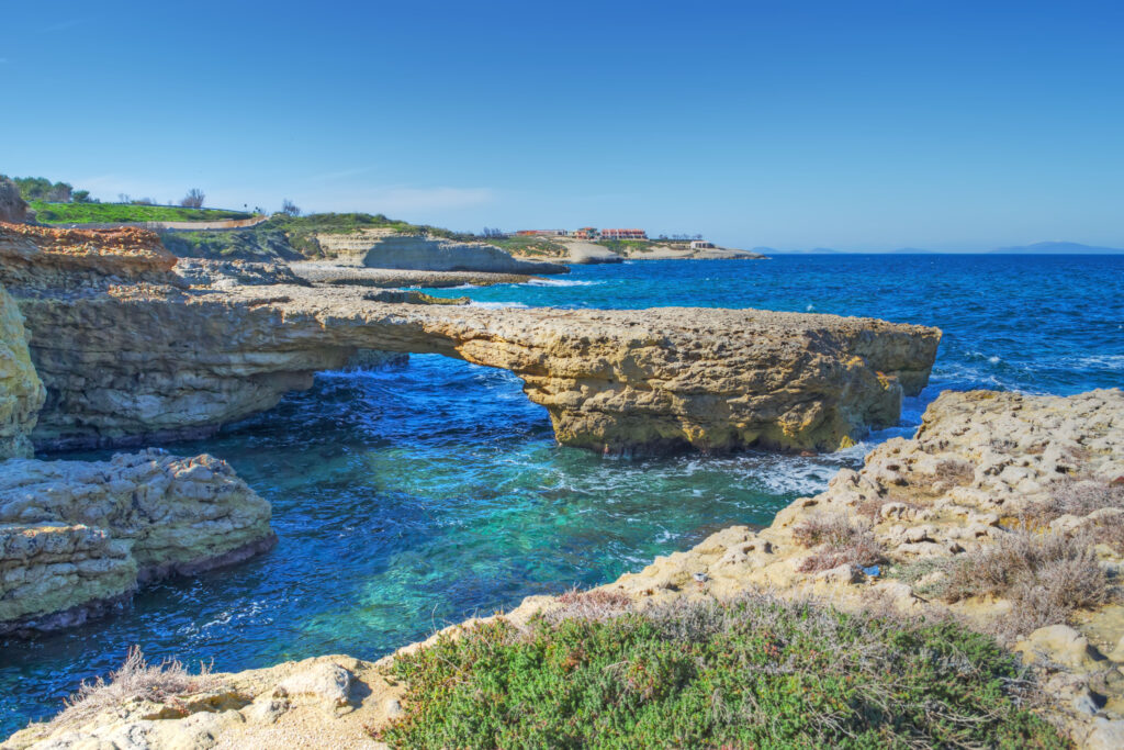
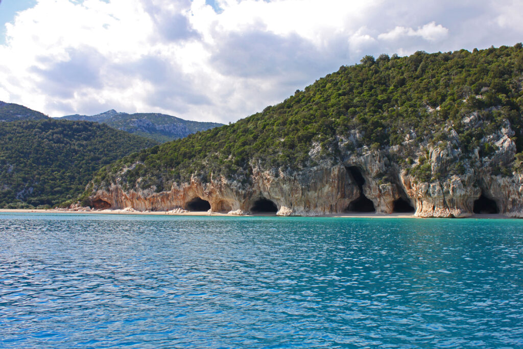
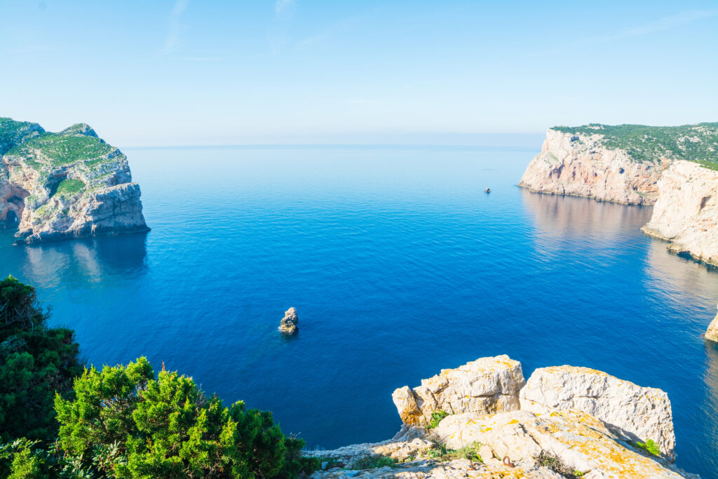
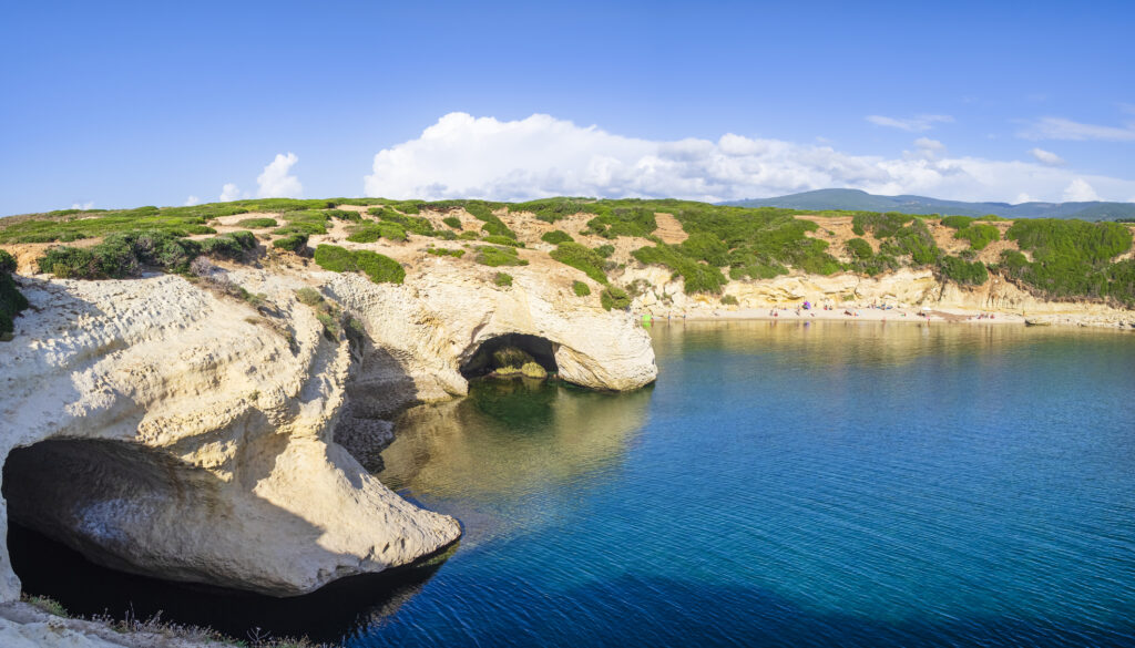
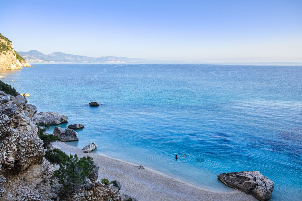
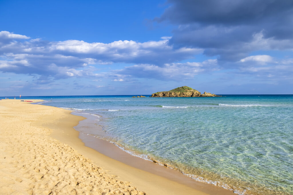
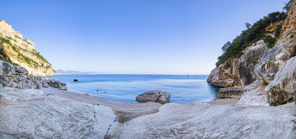
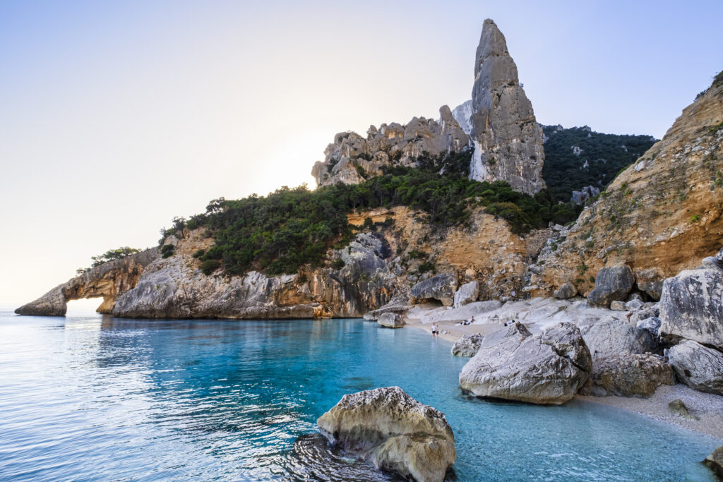
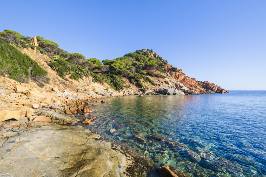
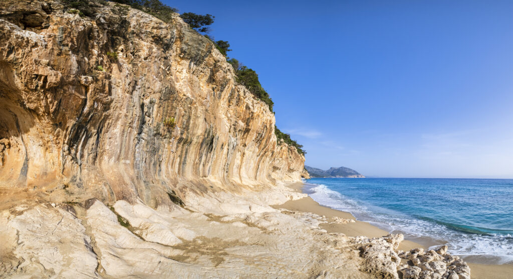
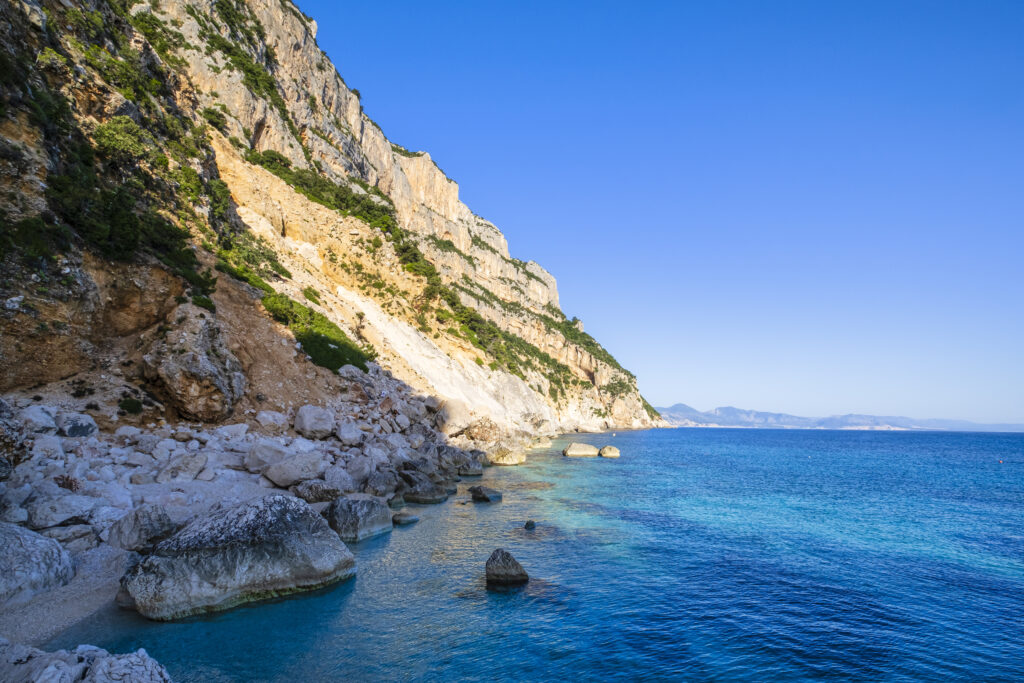
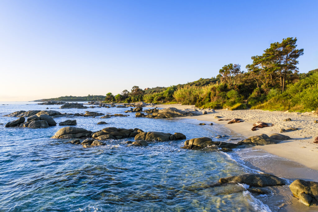
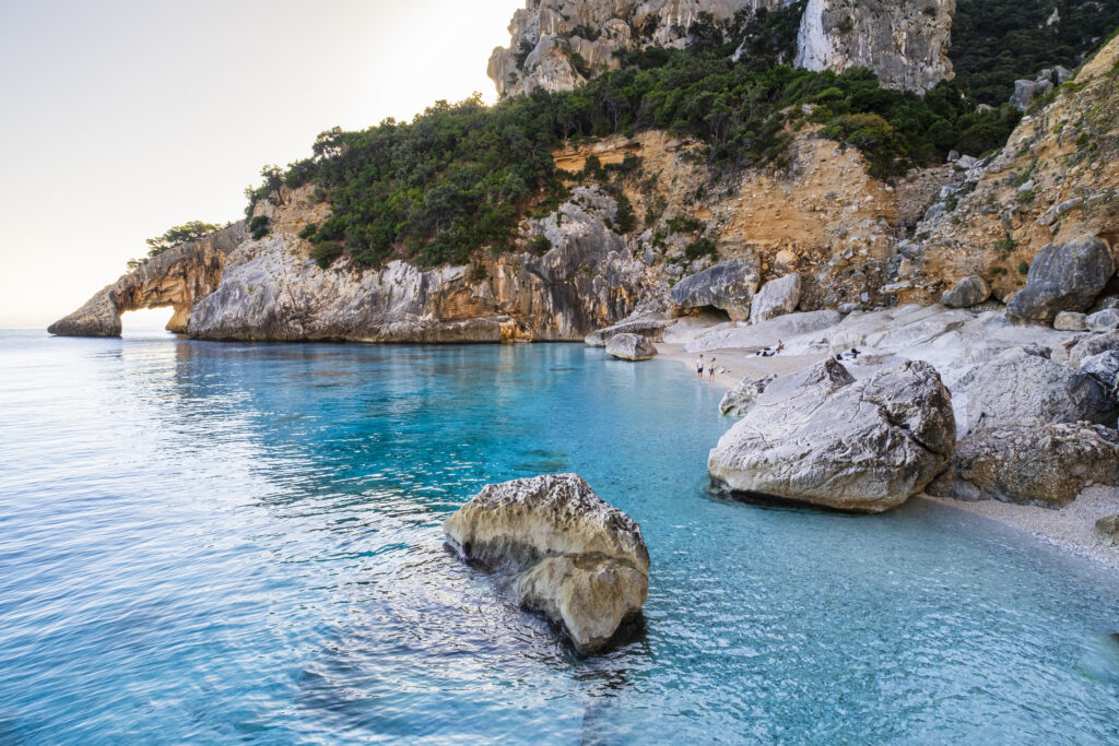
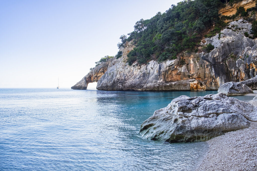
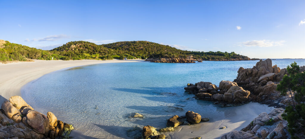
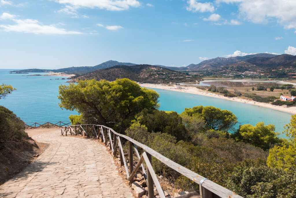
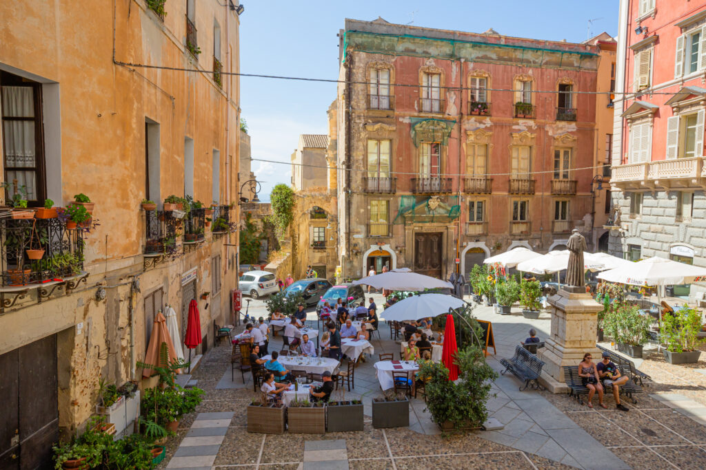
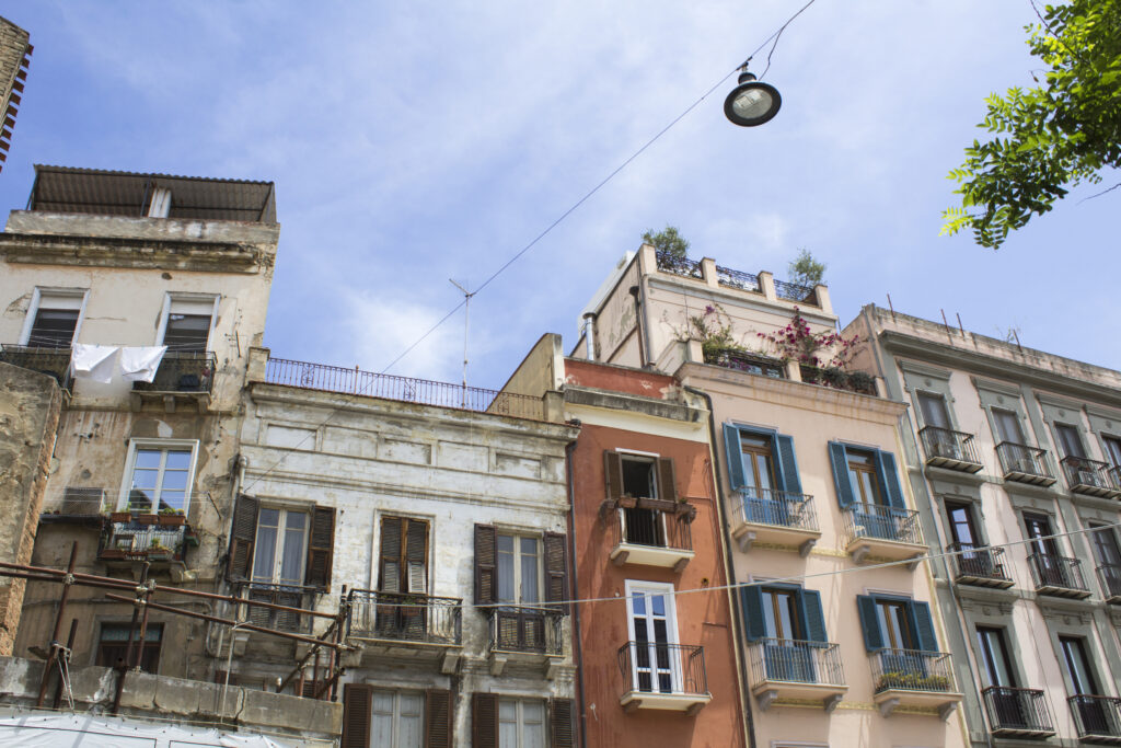
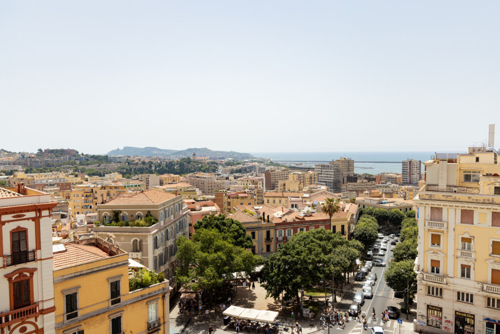
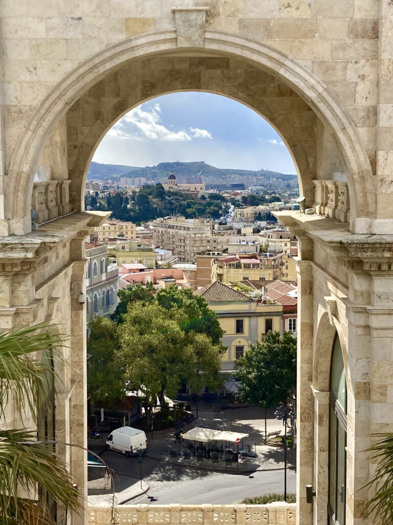
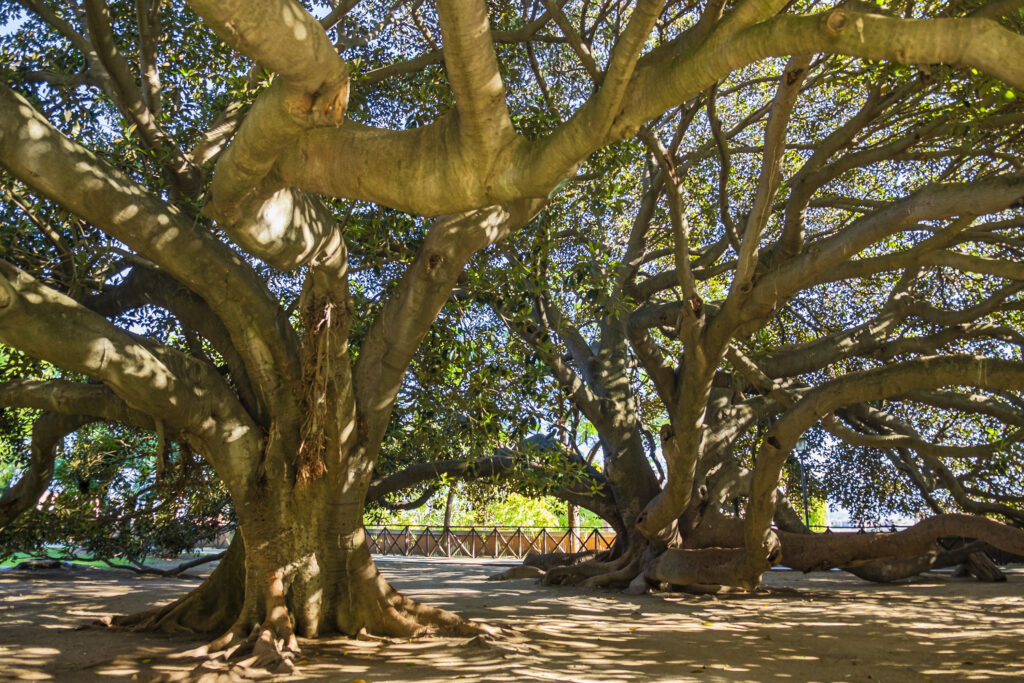
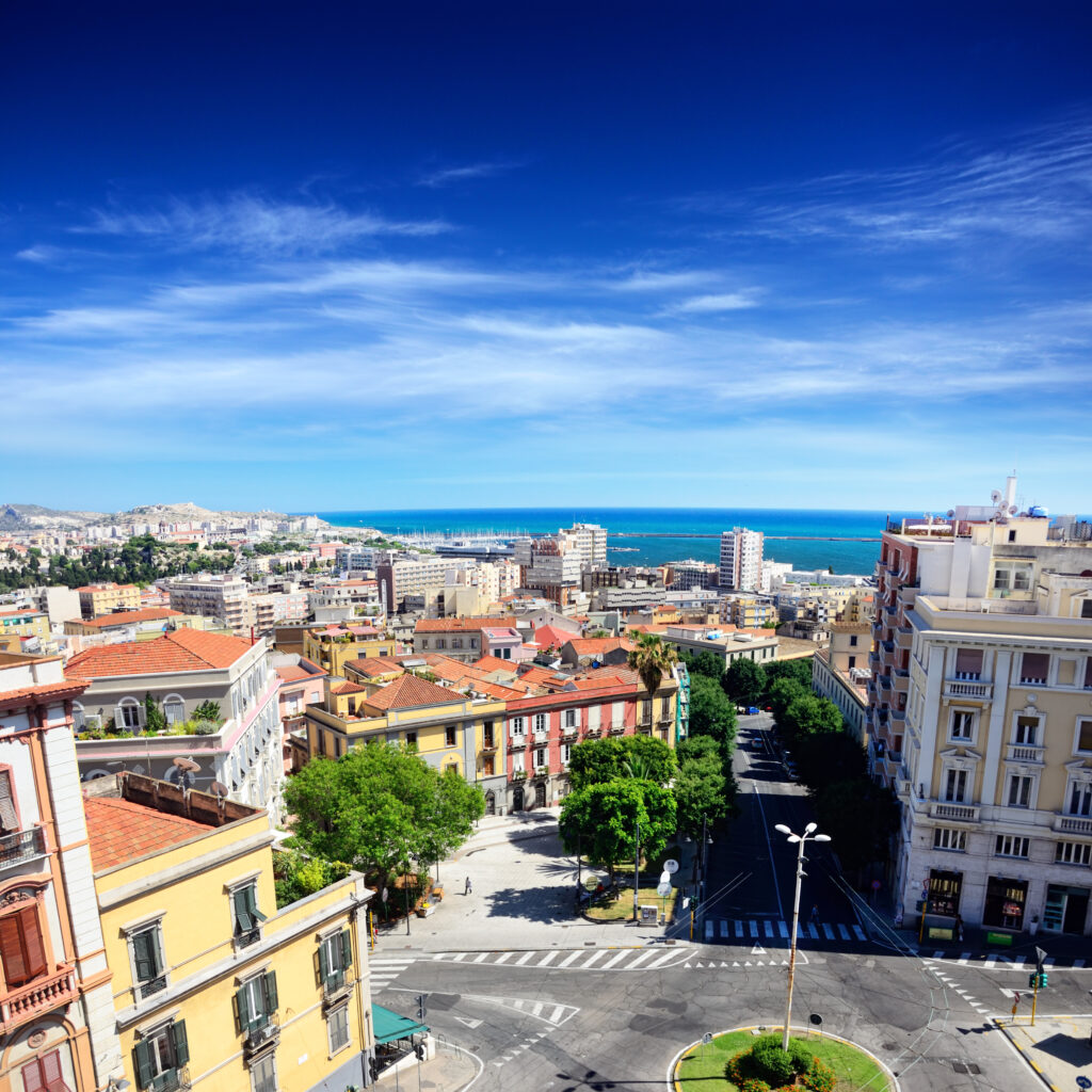
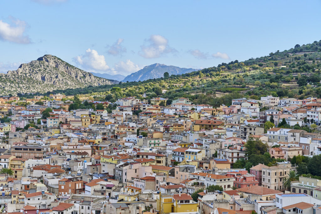
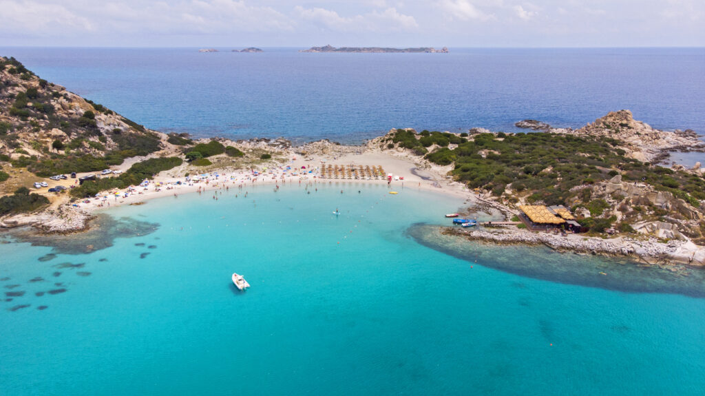
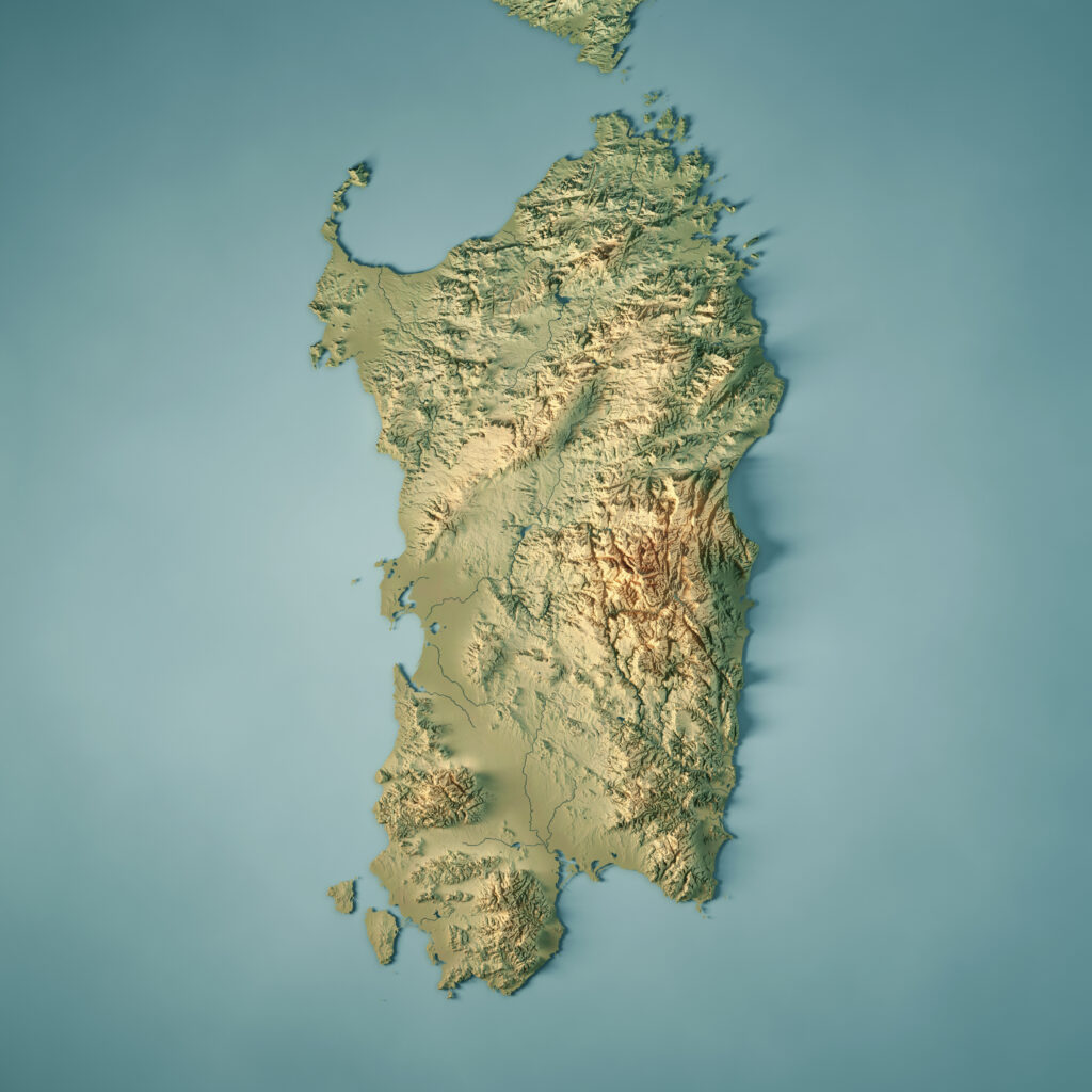
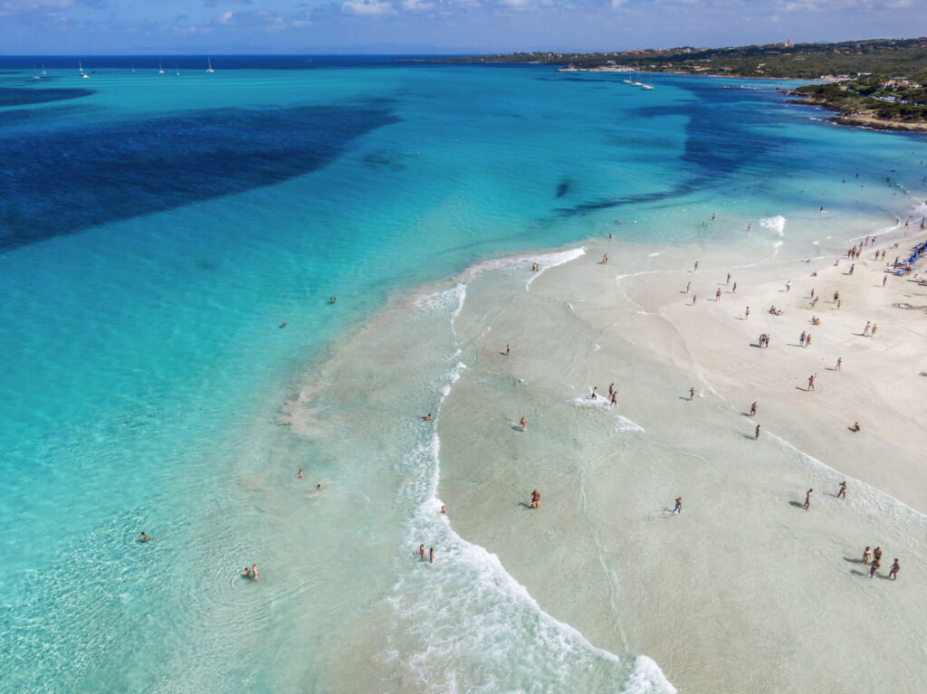
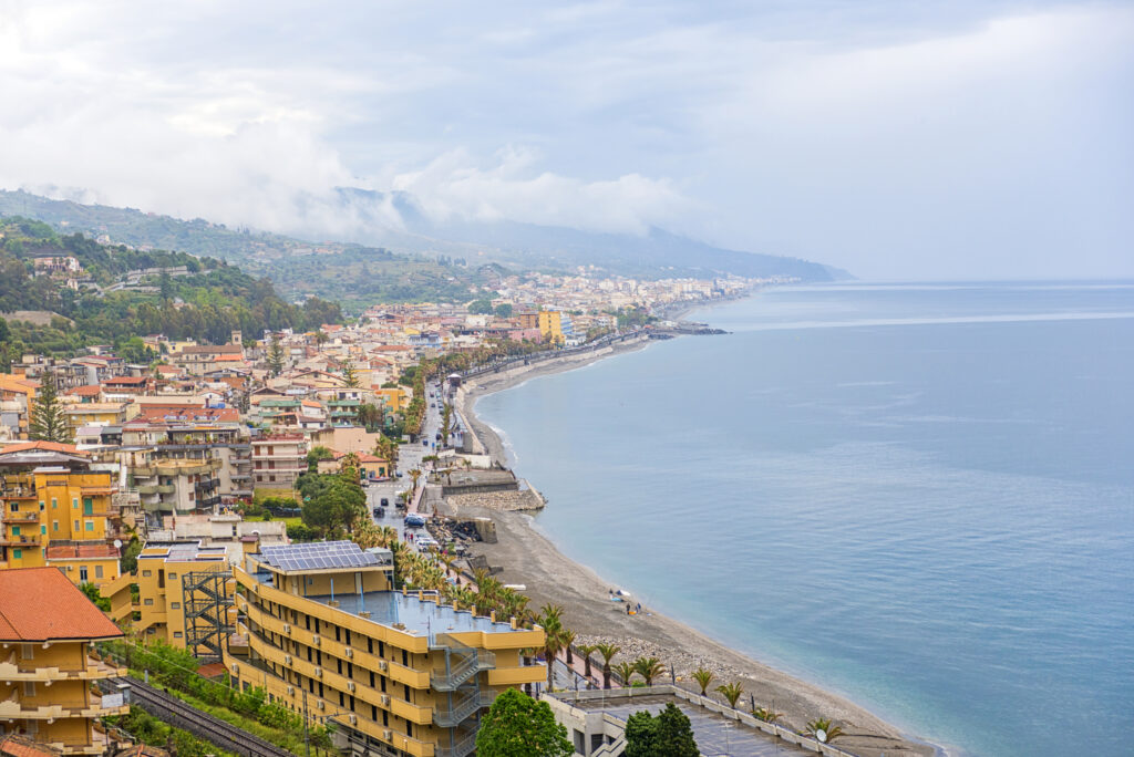
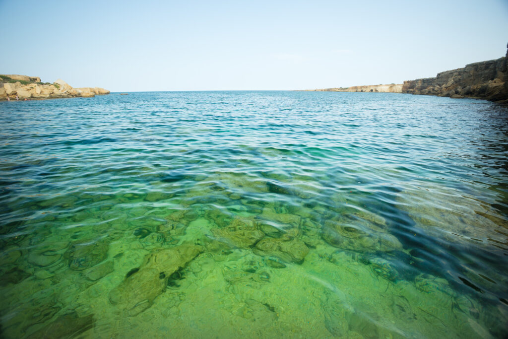
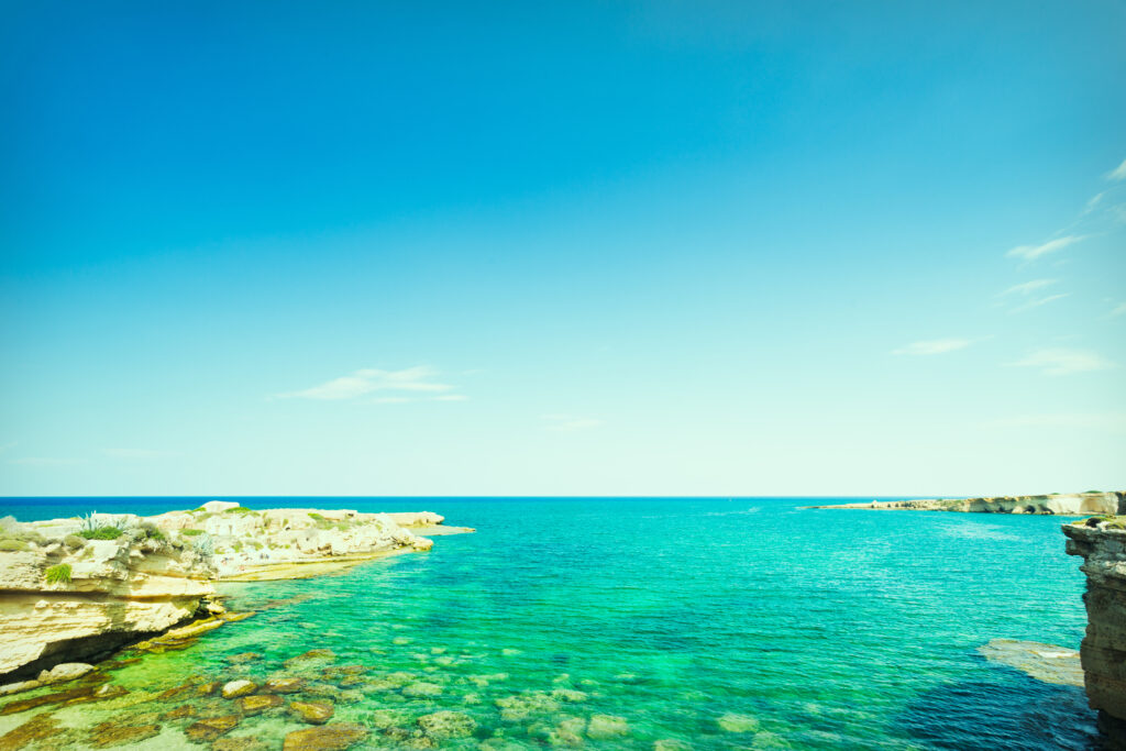
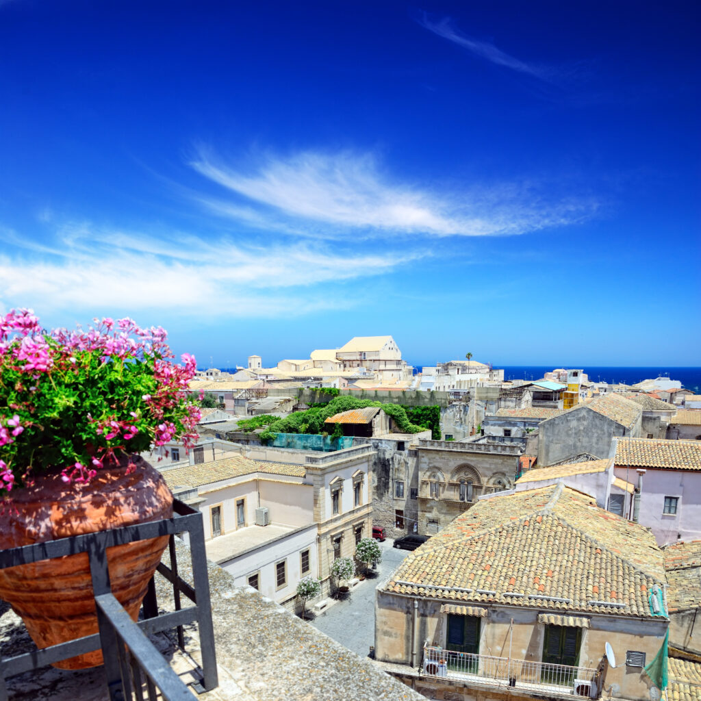
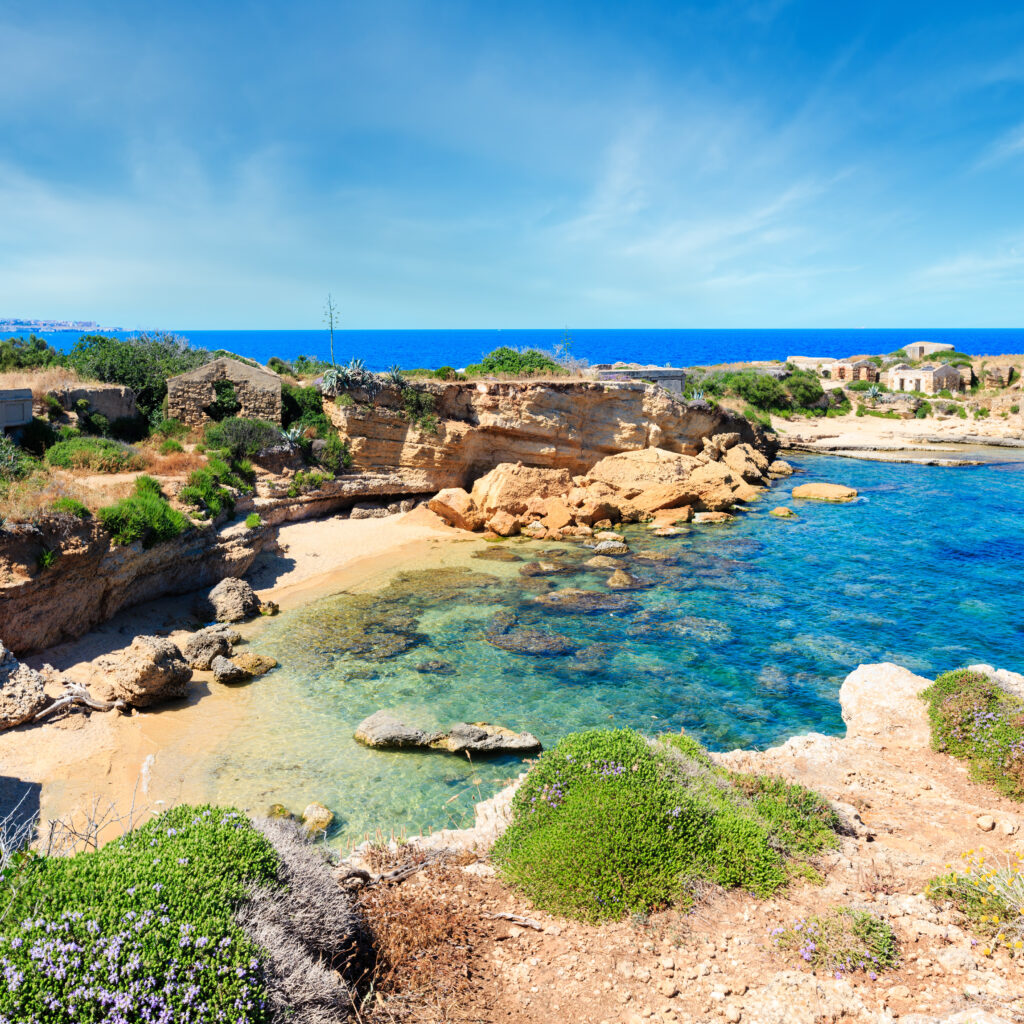
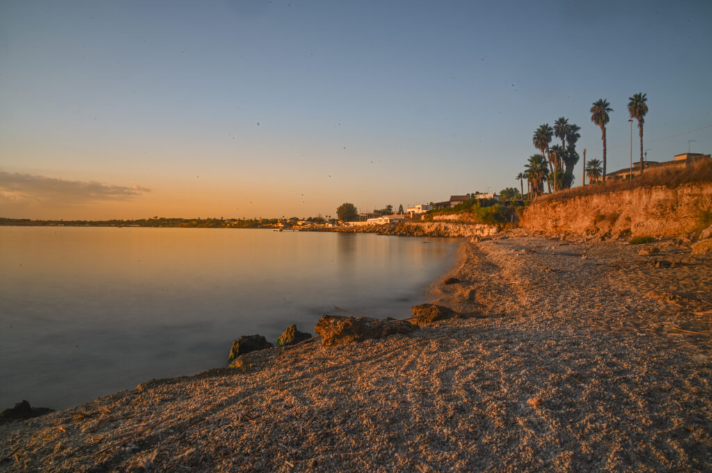
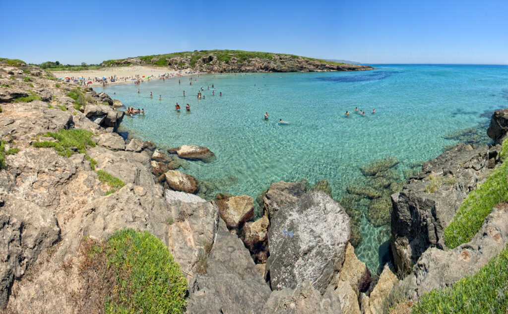
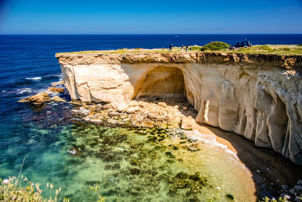
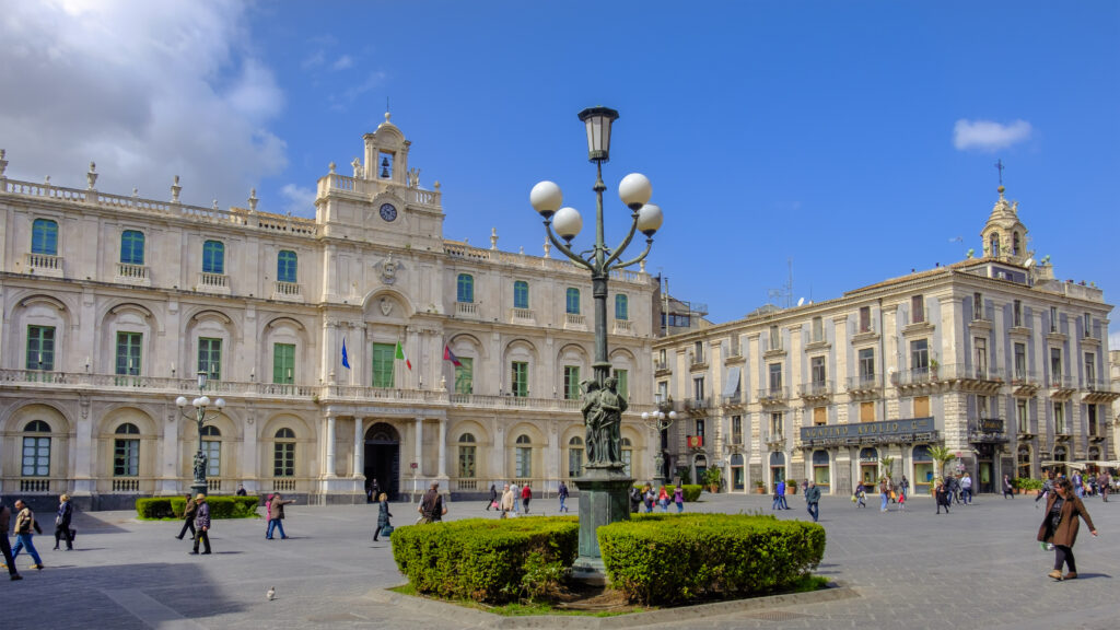
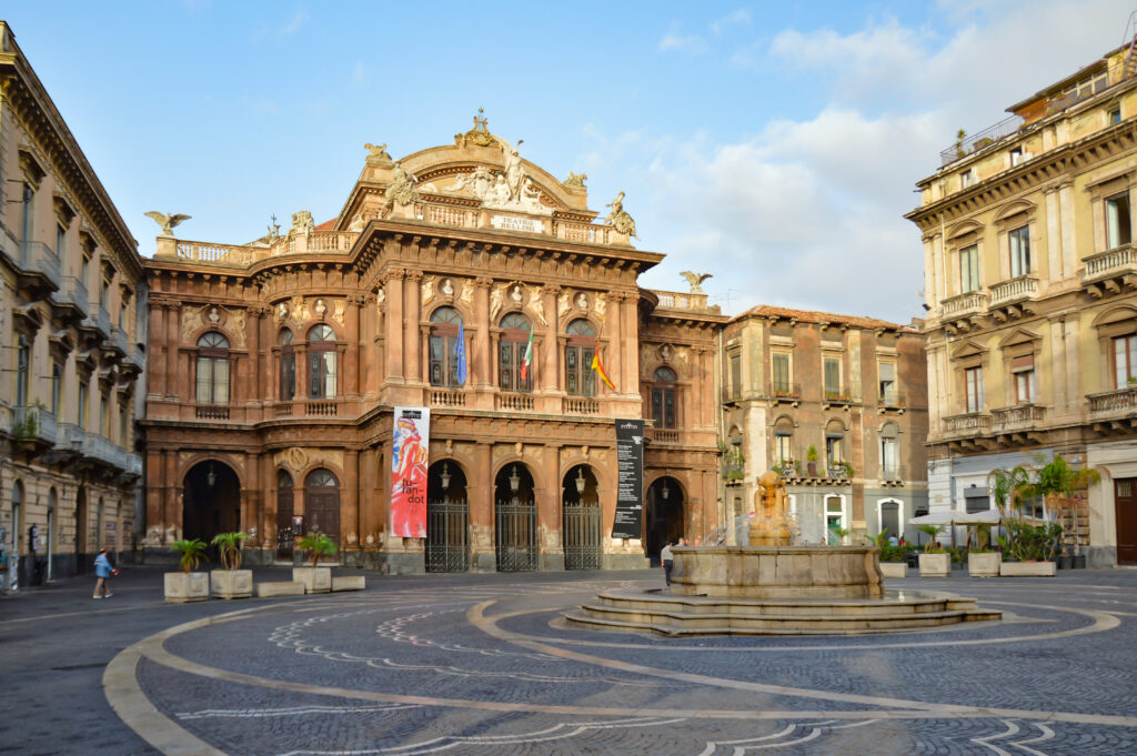
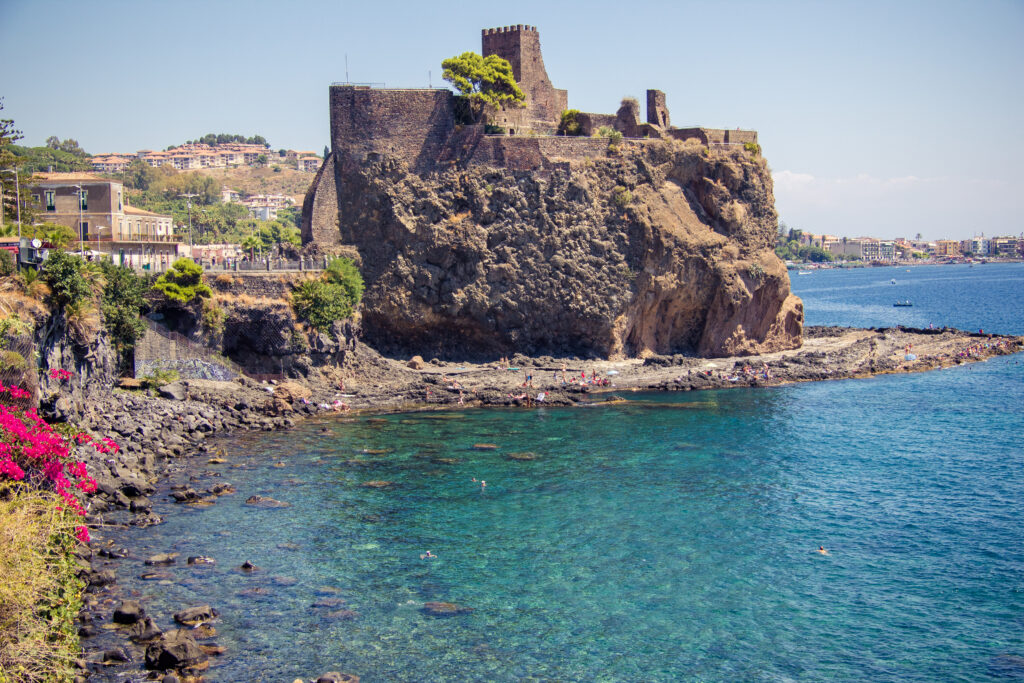
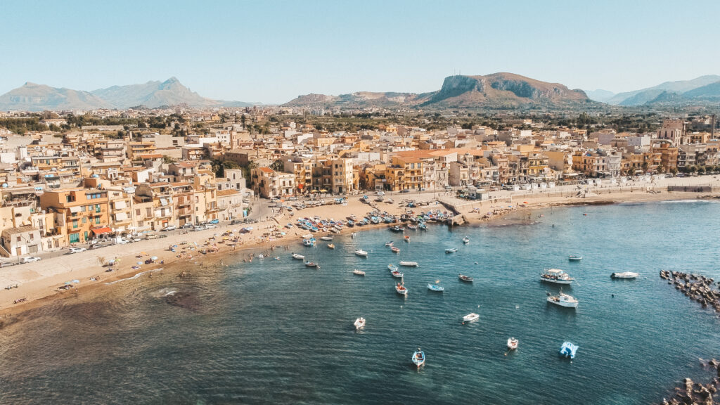
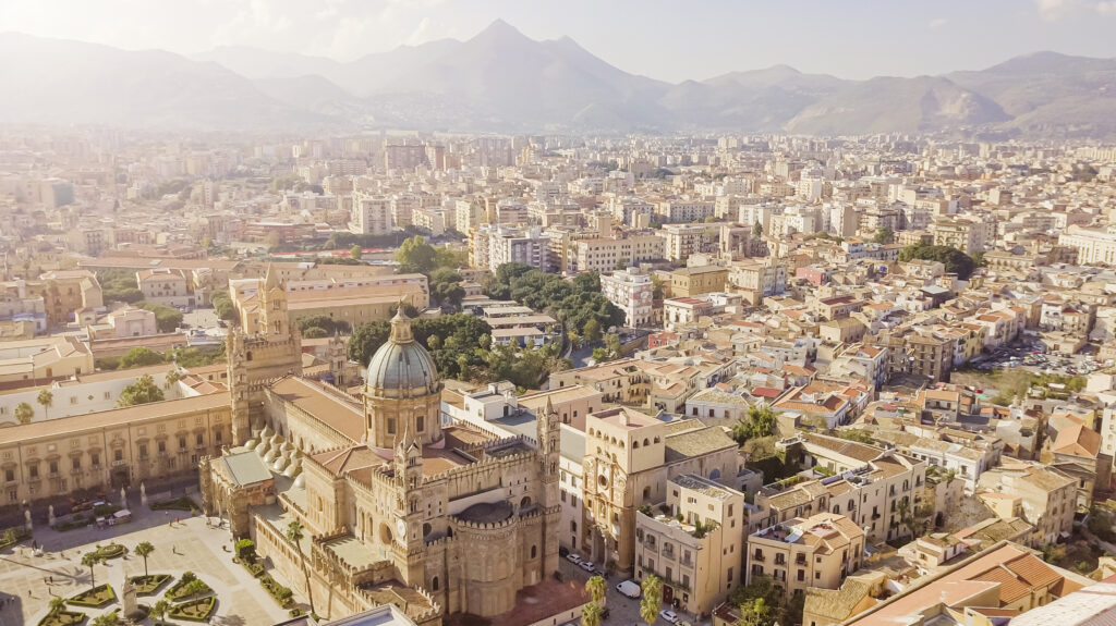
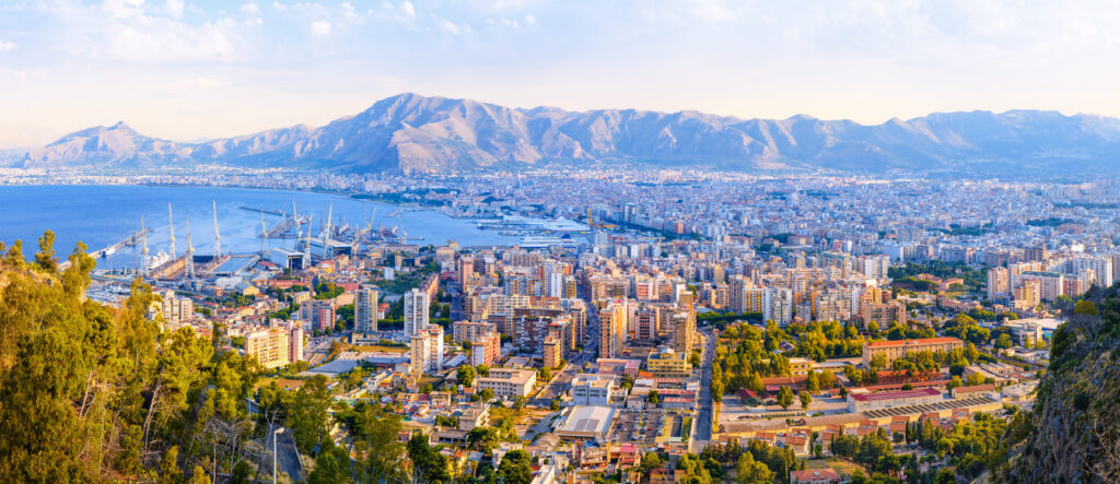
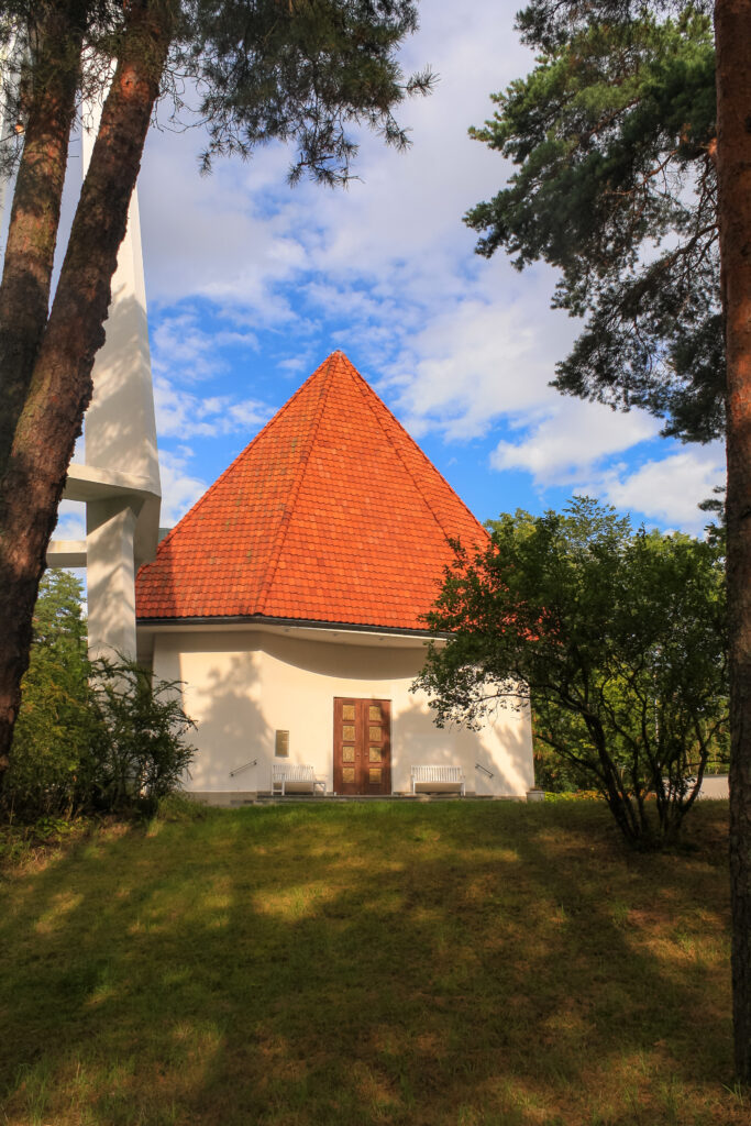
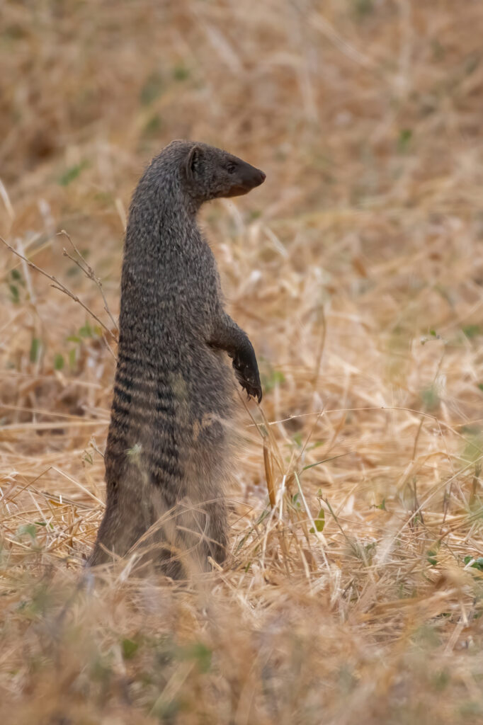
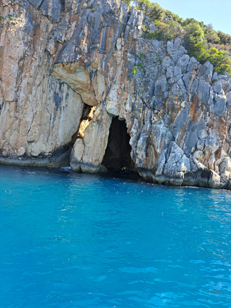
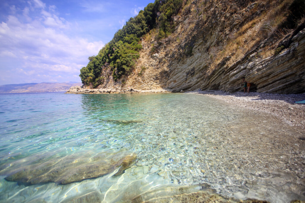
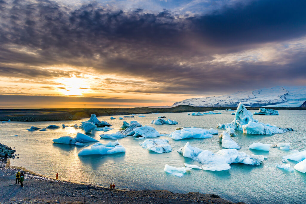
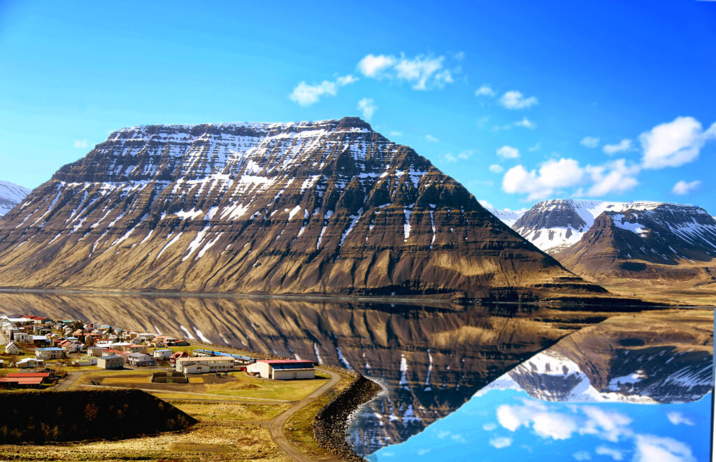
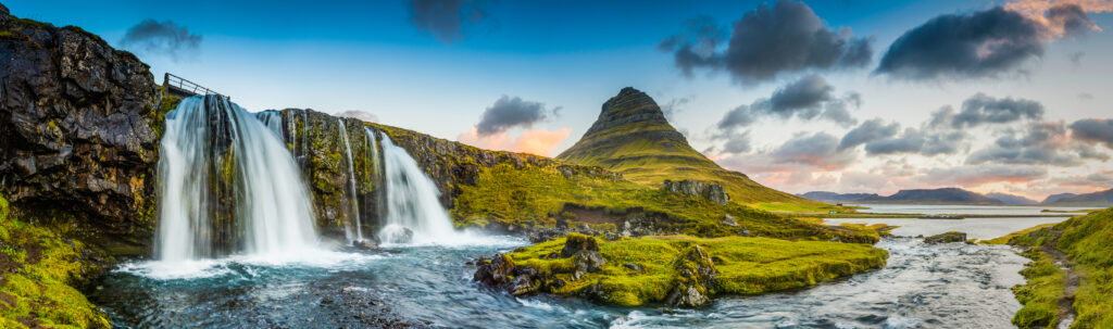
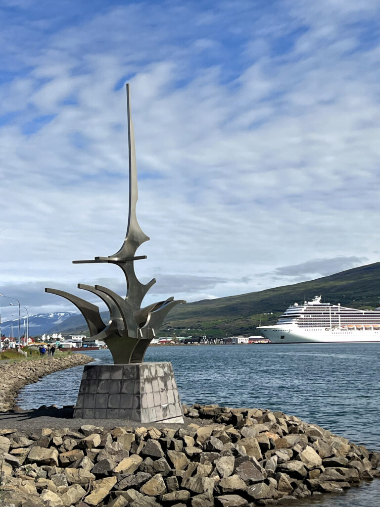
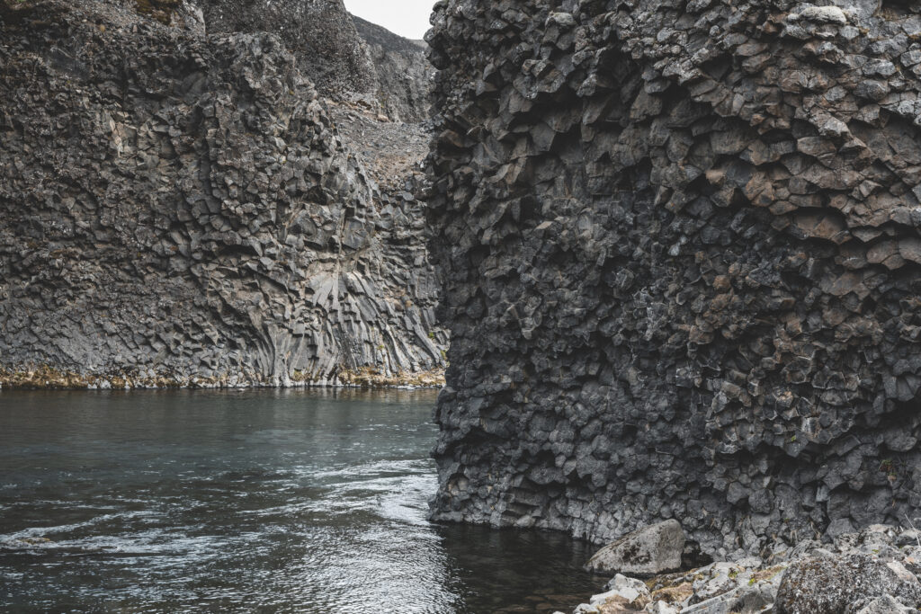
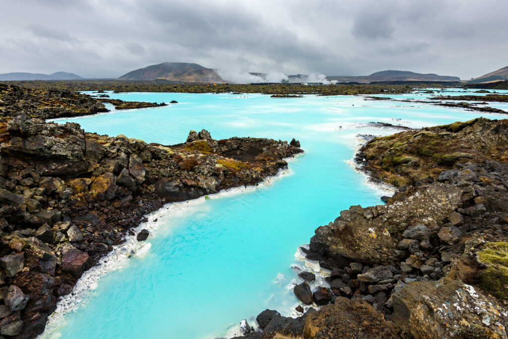
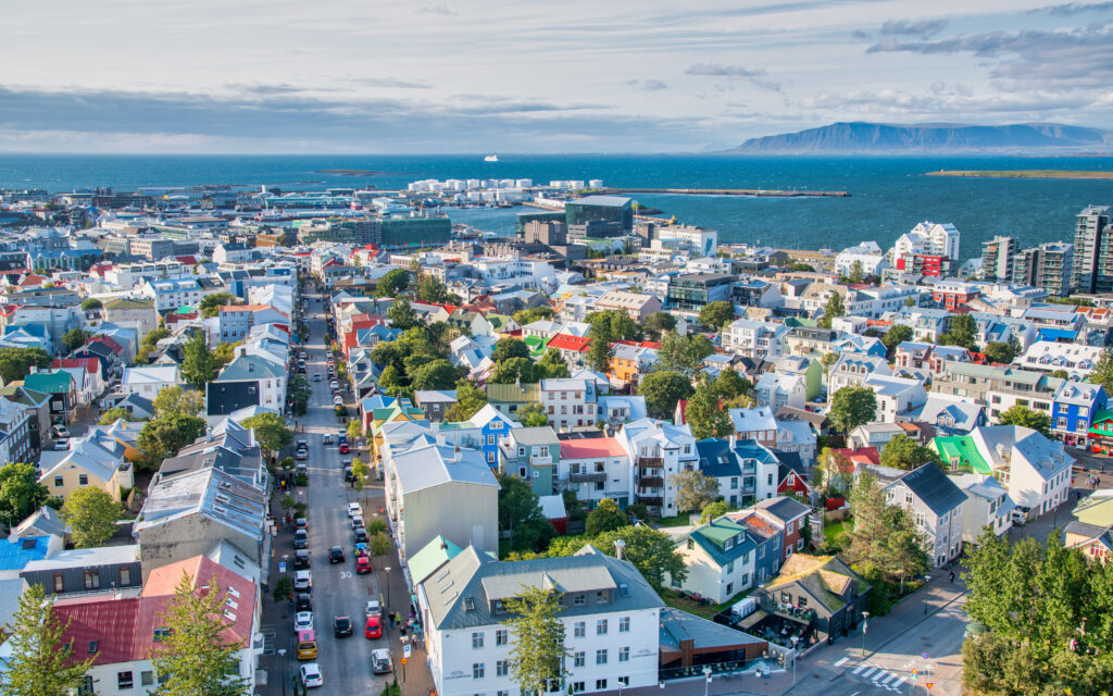
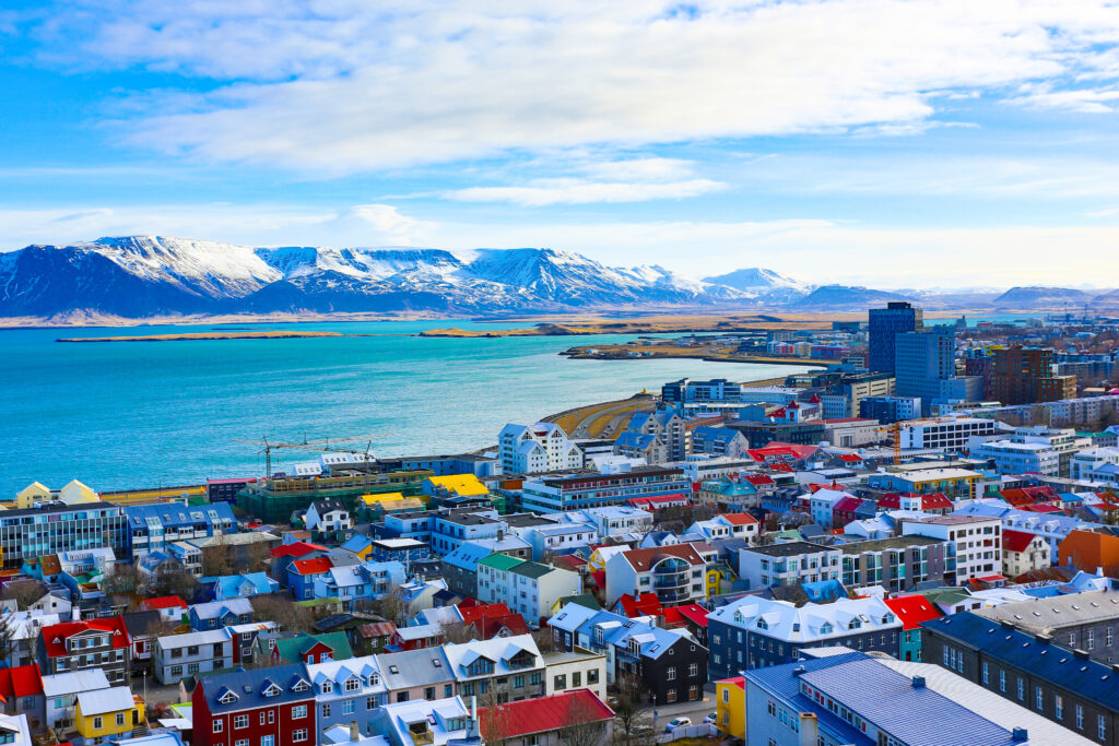
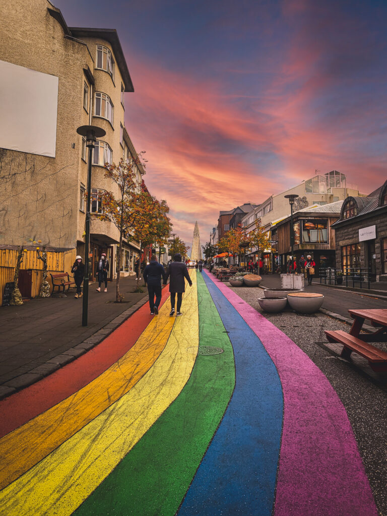
Aerial of the famous Cala Goloritze, Orosei Gulf, East Sardinia, ItalyAerial view of beautiful sandy beach, old tower on the hill, sea bays, mountains at summer sunny day. Porto Giunco in Sardinia, Italy. Top view of blue sea with clear water, white sand, mountainsCastelsardo is town and comune in northwest Sardinia, Italy,Aerial view over the old town and waterfront of Las Palmas de Gran Canaria.Acantilados de los Gigantes, giant’s cliffs in Tenerife Island. South western part of the island with amazing basalt walls that ends in the ocean. Sunny afternoon with calm waters.Cathedral Santa Ana, Las Palmas, Gran Canaria, SpainPanorama view from bell tower of Cathedral Santa Ana. On the background big industrial ships tanker waiting to enter the harbor. Downyard the historical city of Las Palmas de Gran Canaria (Canary Islands, Spain), Image made of 4 seperate image. HDR.“Columbus House(Casa de Colon), Las Palmas, Canary Islands, Spain”Artenara, Gran Canaria, Canary Islands in Spain. Most beautiful and highest mountain traditional village of Grand Canary“El Bufadero”. Rocky formation in la Garita. Telde. Gran Canariasurfers walking on Las Palmas de Gran CanariasLandscape with Cathedral Santa Ana Vegueta in Las Palmas, Gran Canaria, Canary Islands, SpainRoque Nublo on Gran Canaria, Canary Islands, Spain.Night view of the city of Las PalmasOld uptown with colorful houses in capital city of Las Palmas. Gran Canaria, Canary Islands, SpainThe colorful houses of San Juan, one of the five hills that were inhabited around Las Palmas de Gran Canaria since the 17th century.Lanzarote Papagayo turquoise beach and Ajaches in Canary IslandsWild seashore in Fuerteventura, Canary islands, SpainPanoramic view over the busy beach “Playa De Las Canteras” of Las Palmas de Gran Canaria, SpainFlight over Playa de la Barca beach, FuerteventuraChurch of the Conception in Santa Cruz de Tenerife, Canary Islands.La Orotava town view, Tenerife, Canary IslandsArch of volcanic rock known as Charco Manso; nearby you can find a fantastic bathing place. Echedo, El Hierro, Canary Islands, Spain. Canon EOS 5D Mark IIPlaya de Las Teresitas in Tenerife / Canary Islands and Santa Cruz in the background.Aerial view of people at Papagayo beach in LanzaroteCala Dor bay at Cala d’Or city, Palma Mallorca Island, SpainView from the yacht to the Balearic Islands. Beautiful landscape in the Mediterranean SeaA colorful small bay and harbor at the picturesque whitewashed village of Binibeca Vell Spain on the Balearic island of Menorca in the Mediterranean Sea. Binibeca is a coastal village on Spain’s Balearic island of Menorca. Overlooking the Mediterranean Sea, it has narrow streets and whitewashed houses. Set in a calm cove, Binibeca Nou beach is backed by sand dunes and shrubland.A picture of Mallorca taken from the sea in a sailing boat.View of Mahon in the island of Minorca, SpainCala Galdana beach, Island of Menorca, Balearic Islands, SpainBest beach in Mallorca – Balearic Islands, SpainBest beach in Mallorca – Balearic Islands, SpainThis stunning aerial photograph captures the breathtaking beauty of Menorca’s Macarella and Macarelleta bays. With the sun shining brightly and crystal-clear waters reflecting the sky, the scene exudes serenity and tranquility. The white sand beaches, surrounded by rocky cliffs and lush vegetation, provide a natural oasis for sunbathers and swimmers alike. Whether you’re an avid beach-goer or simply appreciate the stunning beauty of nature, this view of Macarella and Macarelleta bays is sure to take your breath away.Spain – Minorca – Ciutadella Ciutadella de Menorca is a port city on the west coast of Menorca, one of the Spanish Balearic Islands. It is known for its old quarter and medieval streets.Pollença, Spain, July 20, 2018; The Pollença staircase with 365 steps in the charming village in the north of the Mediterranean island of Mallorca in Spain.Sailing boat yachts in the sea, yachting, sailing, travel and active lifestyle conceptFew tourists walk through a narrow mediterranean alley with small shops and restaurants in the shadow of residential buildings in the groomed centre of Palma de Mallorca on an idyllic day in summer.Panorama and view on the skyline of Playa de Palma de Mallorca, SpainA beautiful drone view of the beach Cala Varques with boats on MallorcaIn this photo you can see the blue sea of Majorca with some recreative boats.Pollenca, old village on the island Palma Mallorca, SpainScenic view of Palma de Mallorca old town, Spain travel photoBest Mallorca beach: Calo des Moro, clearest water in Mallorca, SpainAn aerial view of the Palma de Mallorca Cathedral and other buildings in Majorca, Spainrocky coast in Porto Torres, ItalyRow of caves at the coast line at Cala luna beach on Sardinia.Rocky shore in Capo Caccia. Sardinia, ItalyLimestone rock and clear waters at S’Archittu, a very popular tourist attraction in western Sardinia (5 shots stitched)Crystal water laps Cala Goloritzé, a cove protected by a rugged cliff reachable via trekking among Mediterranean scrub in the Supramonte di BauneiBeach of the Bari Sardo and Sa Marina with tower , Sardegna, ItalyShallow and crystal clear waters in front of the golden sand beach of Su Giudeu, with an islet easy to reach on footCrystal water laps the Cala Goloritzé, a cove of white small pebbles protected by a rugged cliff with a natural arch (7 shots stitched)The pyramidal Guglia di Goloritzé watches over the Cala Goloritzé, a cove of white small pebbles lapped by crystal waterCala Moresca of Arbatax, a bay protected by red porphyry cliffs covered by Mediterranean scrub with a beach mostly made up of granite pebblesCala Luna, a remote golden beach in the Gulf of Orosei protected by sheer cliffs dotted with natural caves (7 shots stitched)Crystal water laps the Cala Goloritzé, a cove of white small pebbles protected by a rugged cliffSunrise at the Foxiglioni Beach on the coast of Tortolì, in eastern SardiniaCrystal water laps the Cala Goloritzé, a cove of white small pebbles protected by a rugged cliff with a natural archCrystal clear water laps the Cala Goloritzé, a cove of white small pebbles protected by a rugged cliff with a natural archShallow, clear waters at the Spiaggia del Principe, one of the most beautiful beaches in Costa Smeralda in the northeast coast of Sardinia (7 shots stitched)View from torre di Chia, SardiniaCagliari,Sardinia,Italy 09 September 2021:Carlo Alberto square in the historic center also occupied by some restaurant.View of the old town on the summer day. Cagliari. Sardinia. Italy.Cagliari is an Italian municipality and the capital and largest city of the island of Sardinia, an autonomous region of Italy. It has about 155,000 inhabitants, while its metropolitan city has about 420,000 inhabitants. According to Eurostat, the population of the functional urban area, the commuting zone of Cagliari, rises to 476,975. Cagliari is the 26th largest city in Italy and the largest city on the island of SardiniaItaly – Sardaigne- Cagliari – view from bastionTwo centenary Moreton Bay figs (Ficus macrophylla) in the public gardens of Cagliari, the capital of SardiniaPanorama of Cagliari, Sardinia, Italy. Composite photoAerial view of Dorgali, a mountain town in Province of Nuoro. Sardinia. Italy.Aerial view of Punta Molentis beach, Villasimius, Sardegna,Italy3D Render of a Topographic Map of Sardinia Island, Italy.
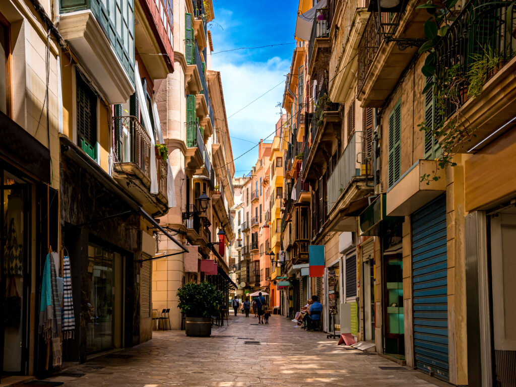
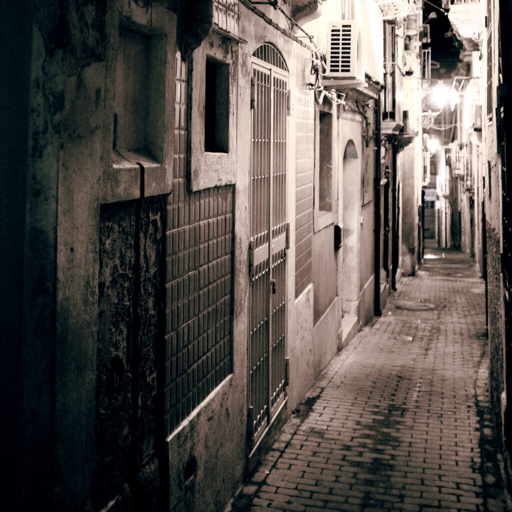
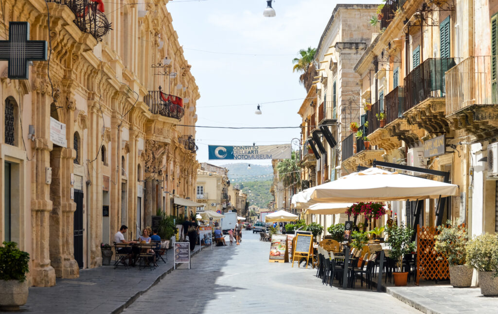
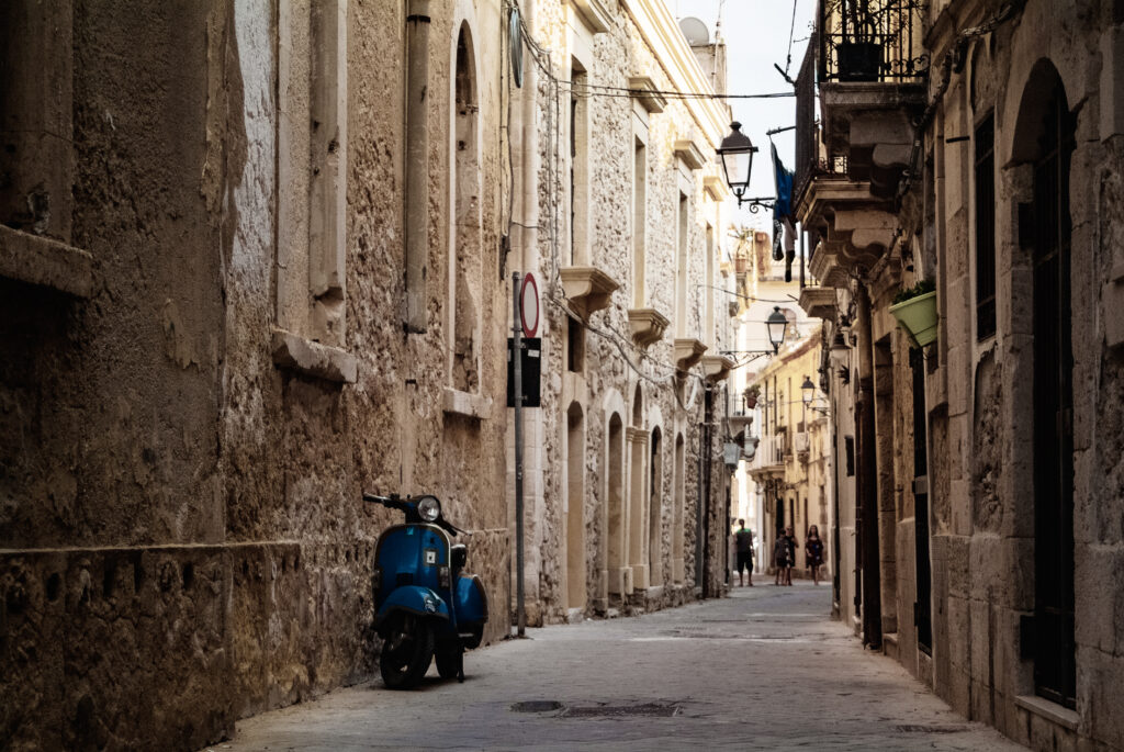
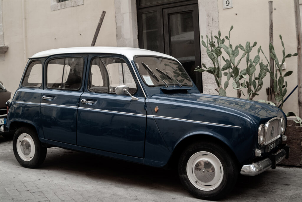
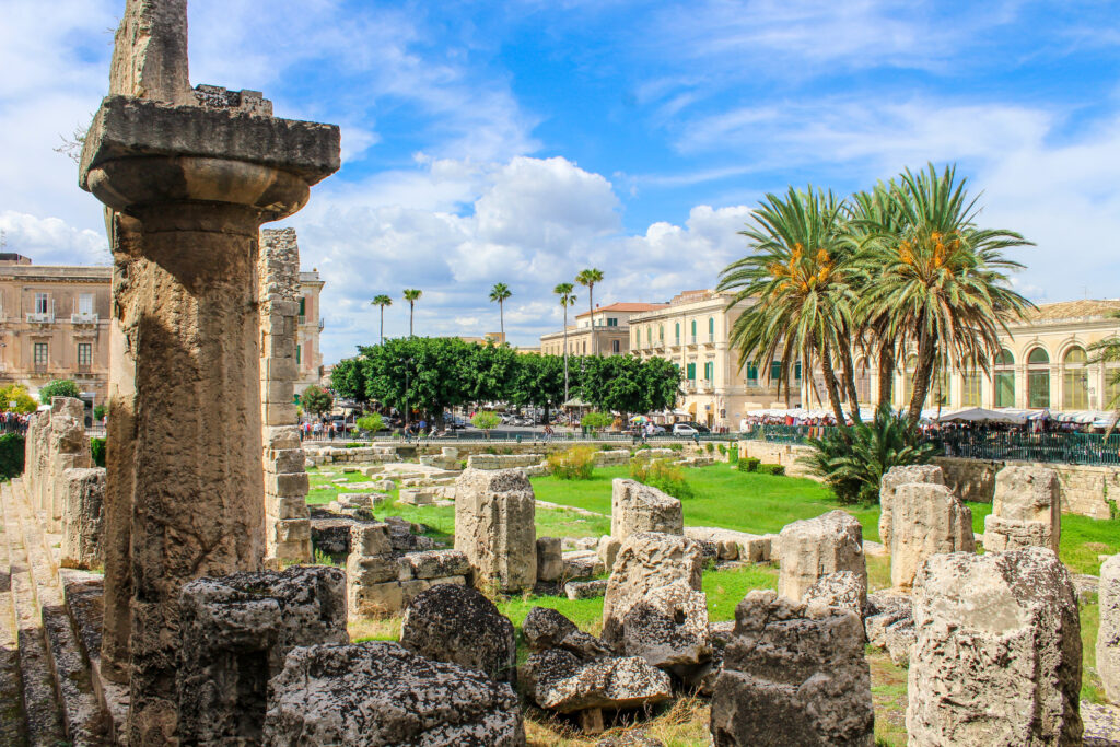
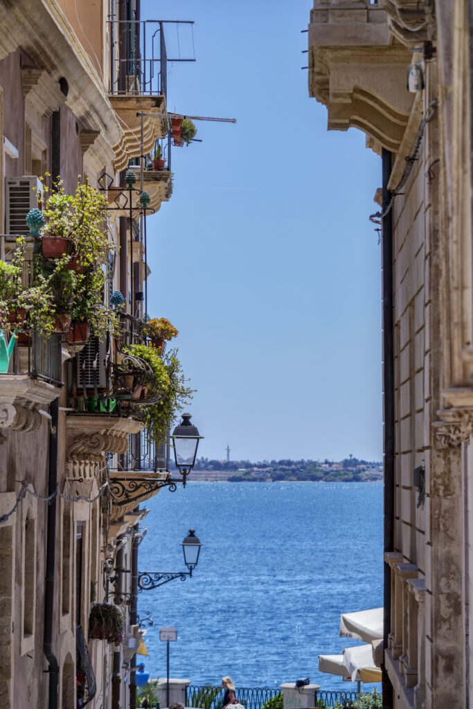
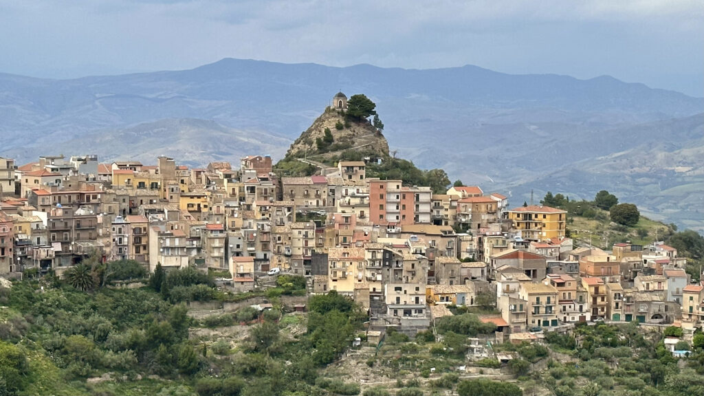
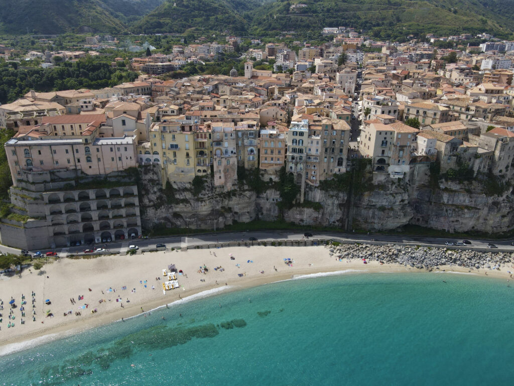
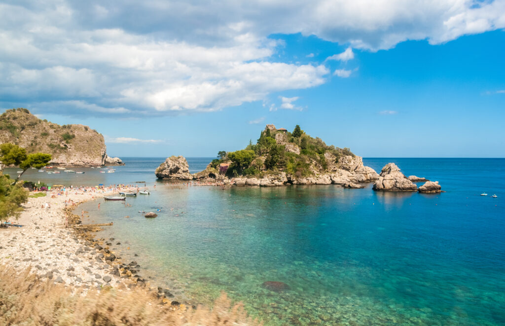
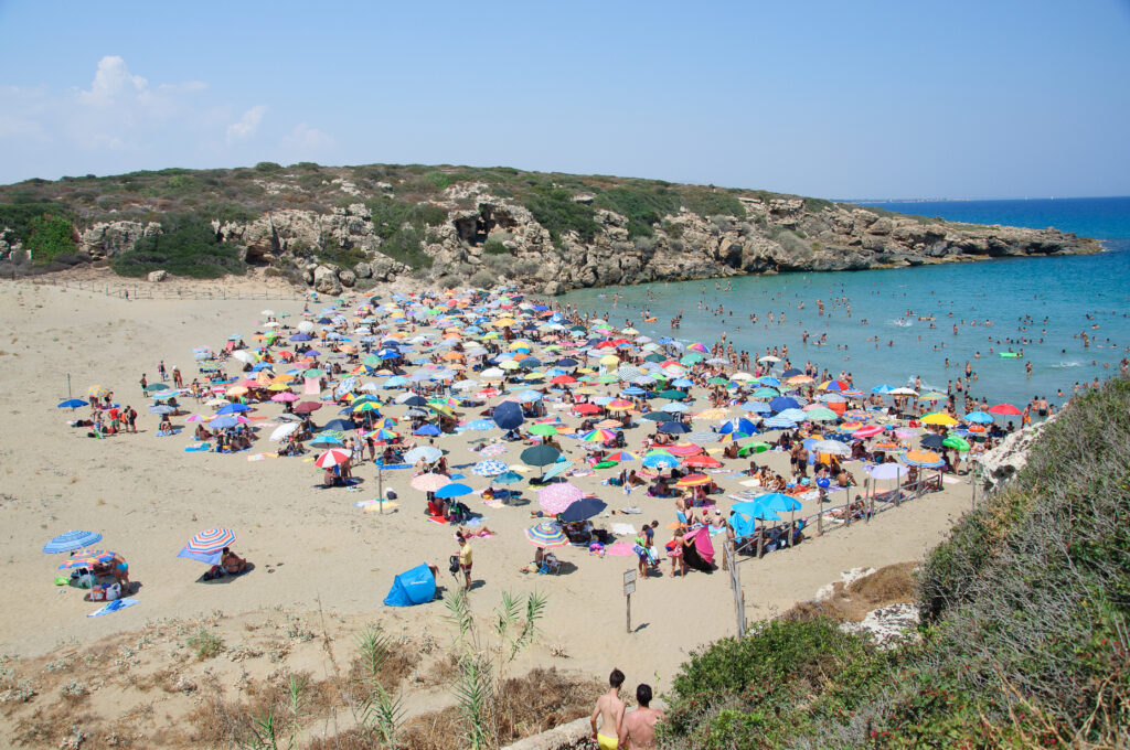
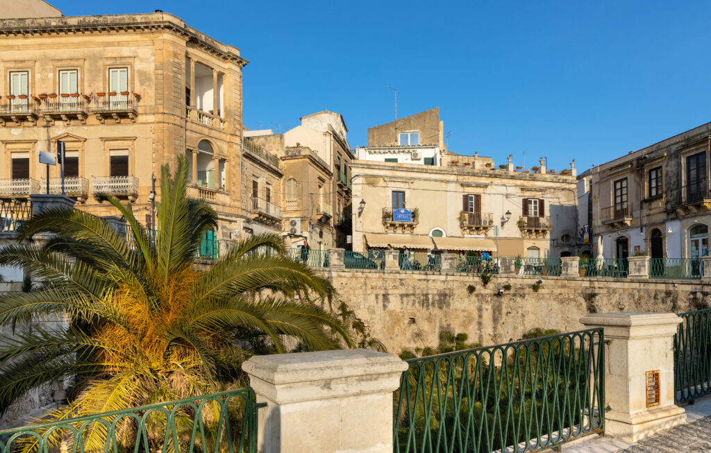
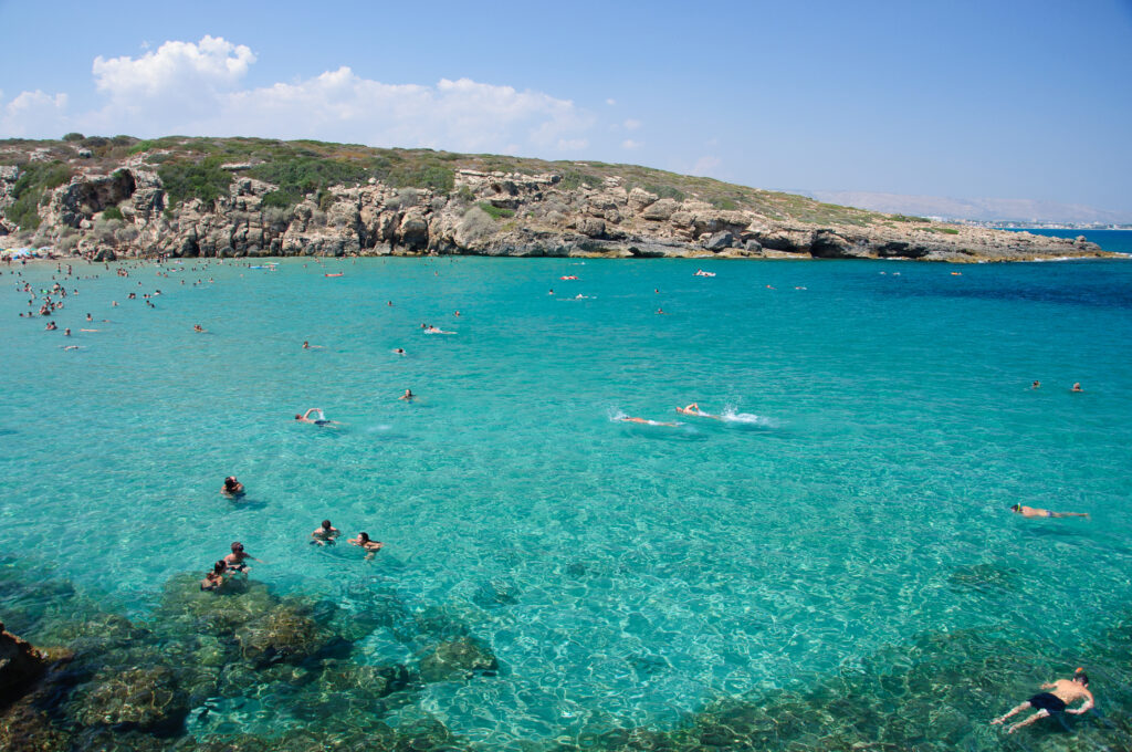
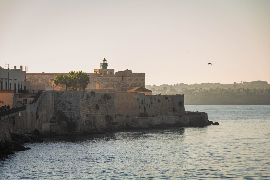
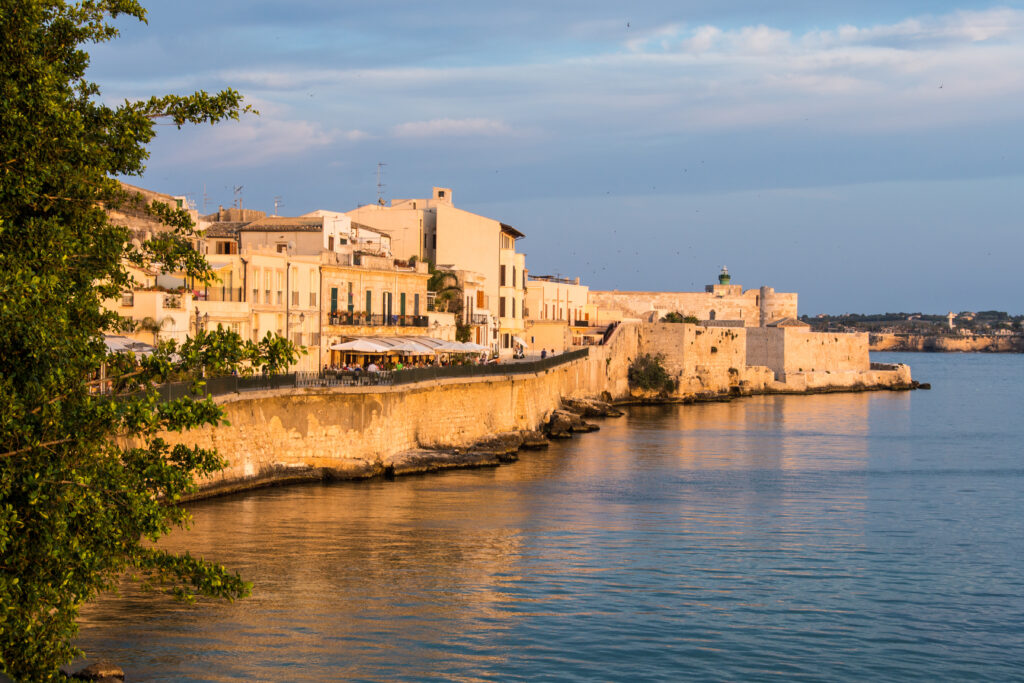
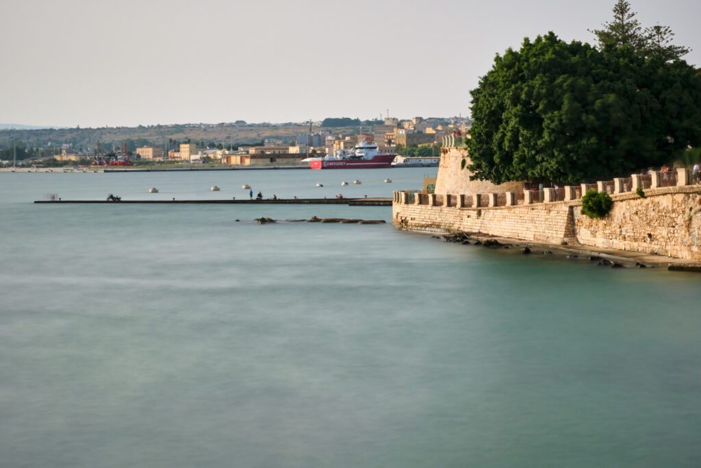
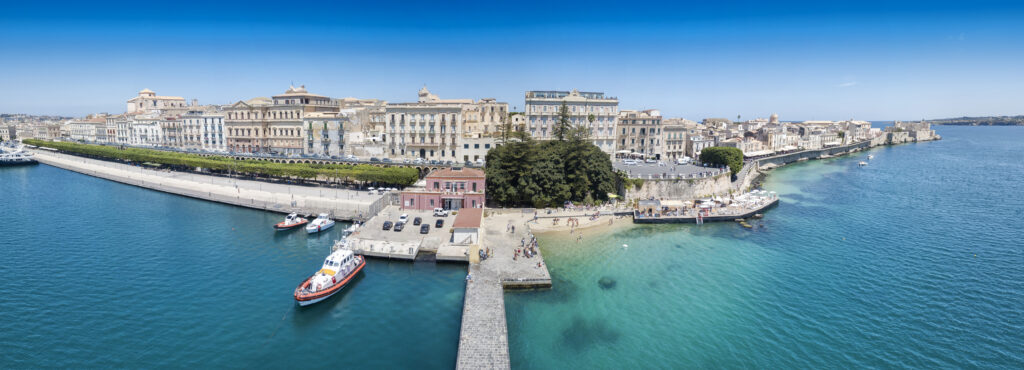
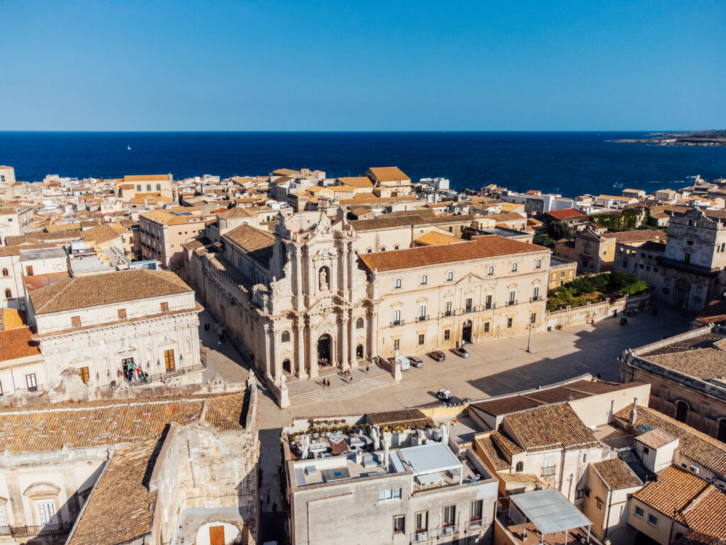
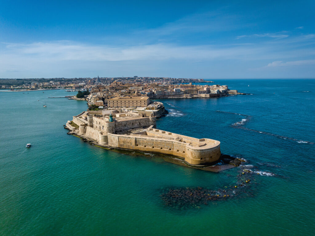
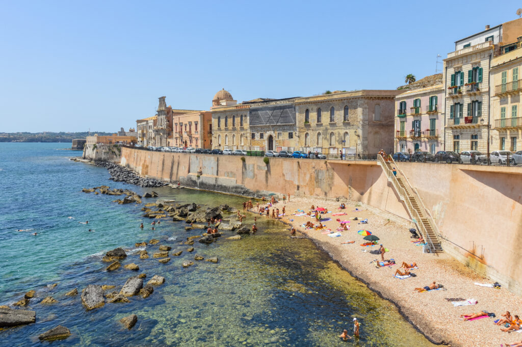
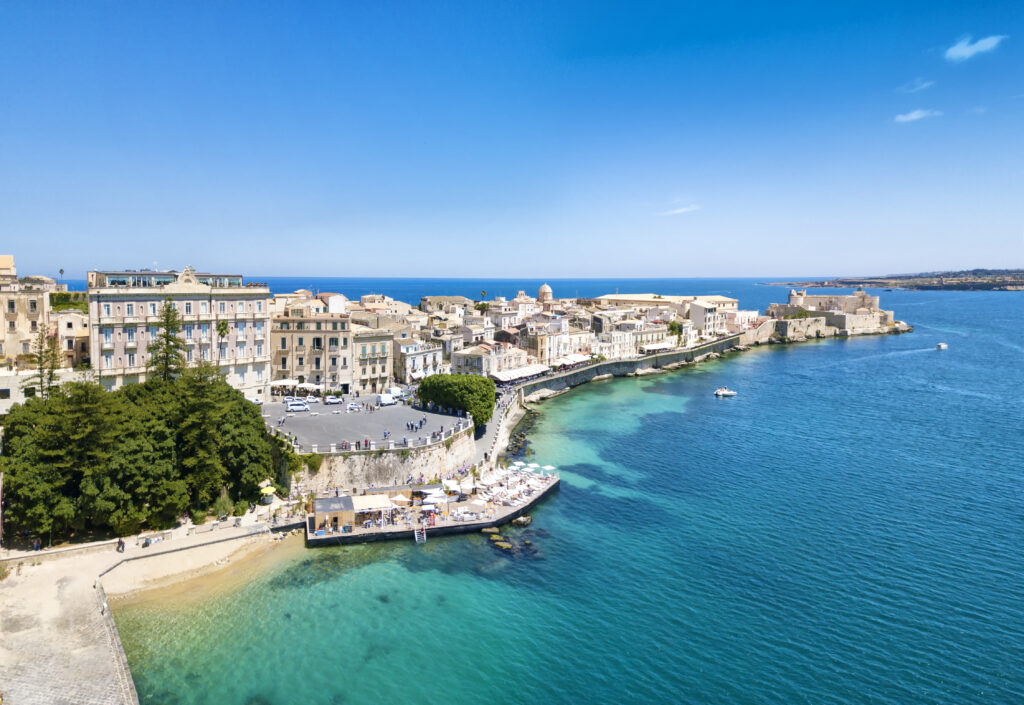
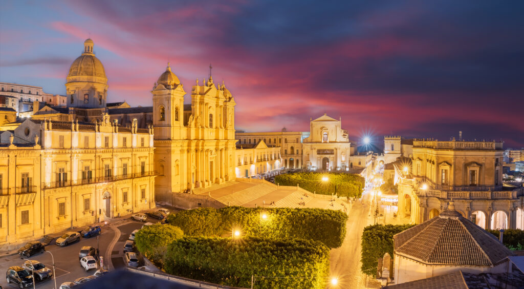
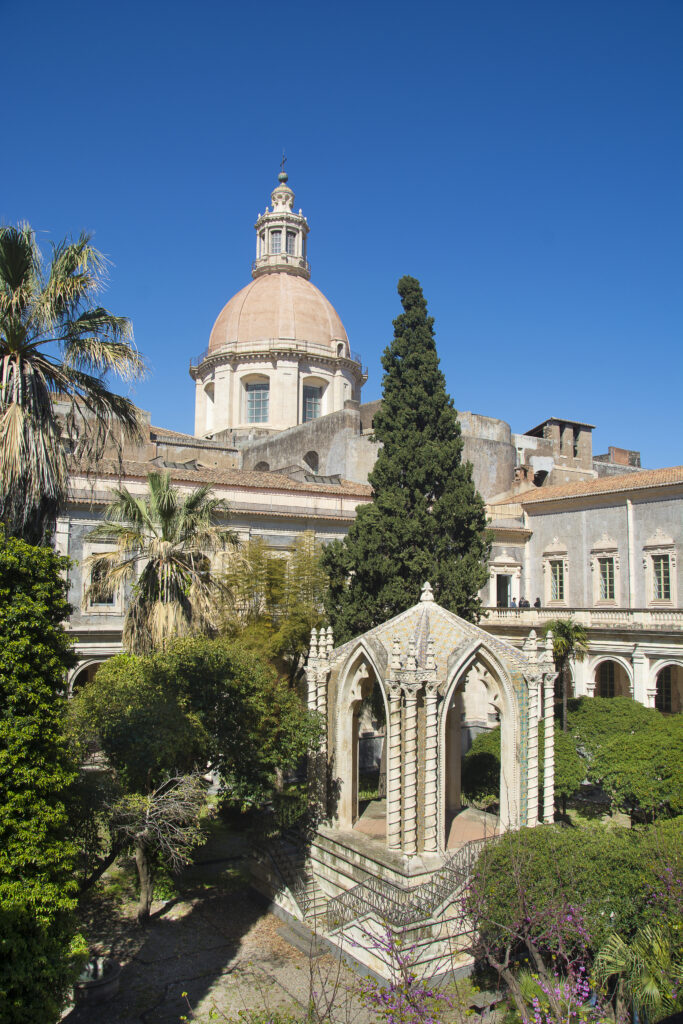
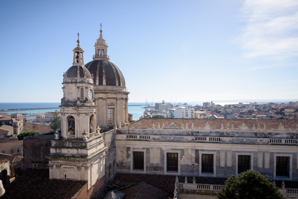
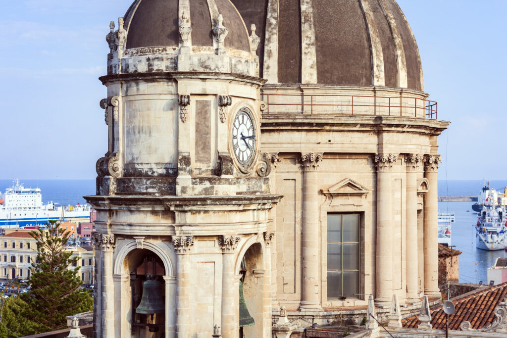
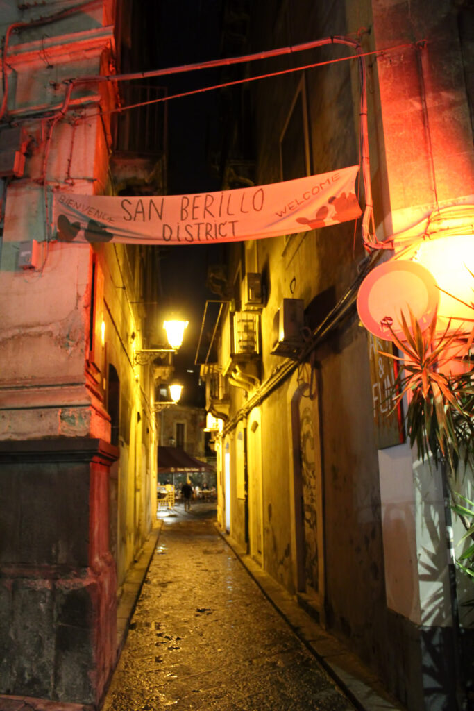
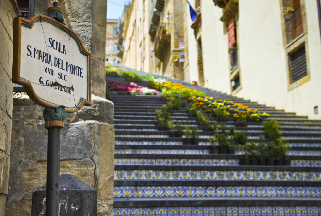
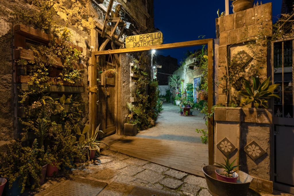
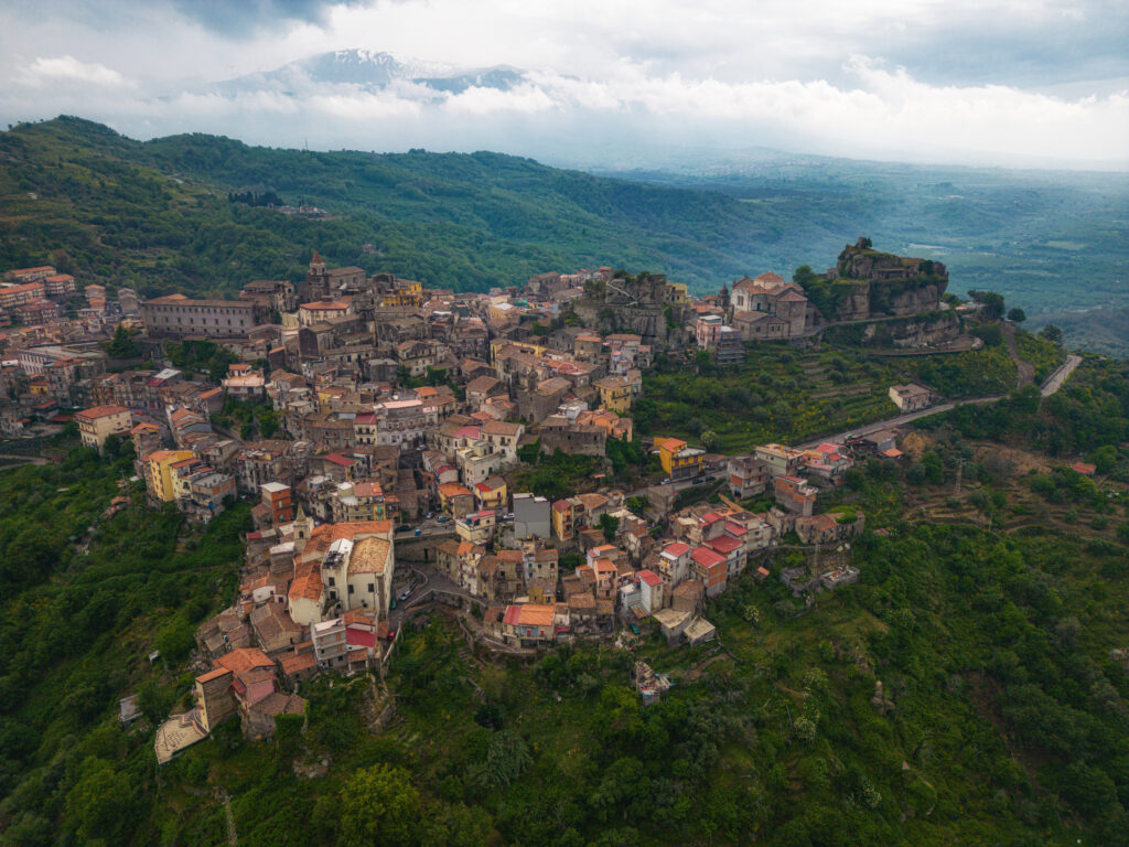
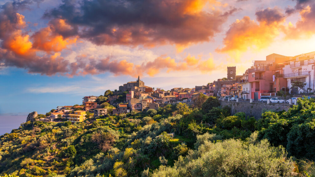
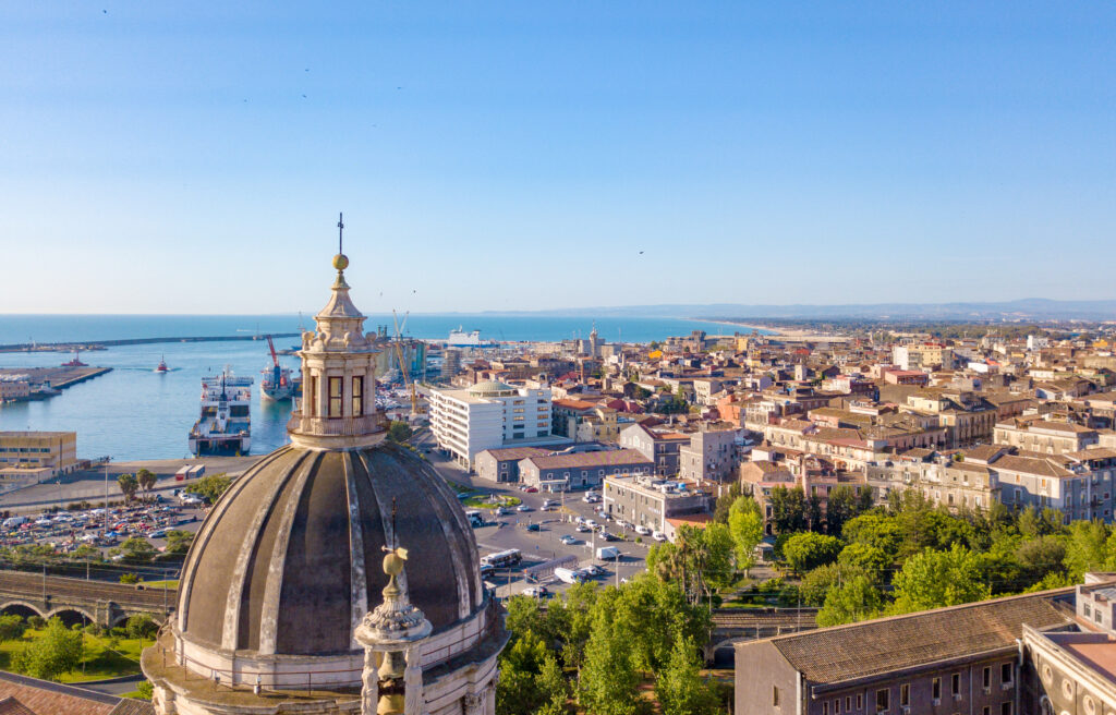
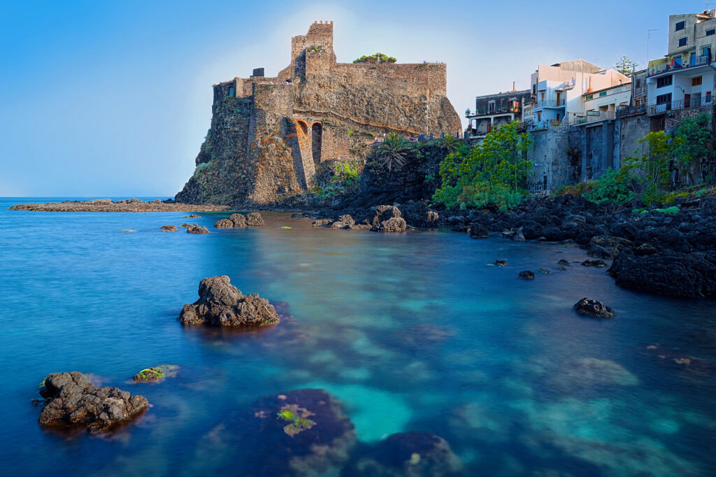
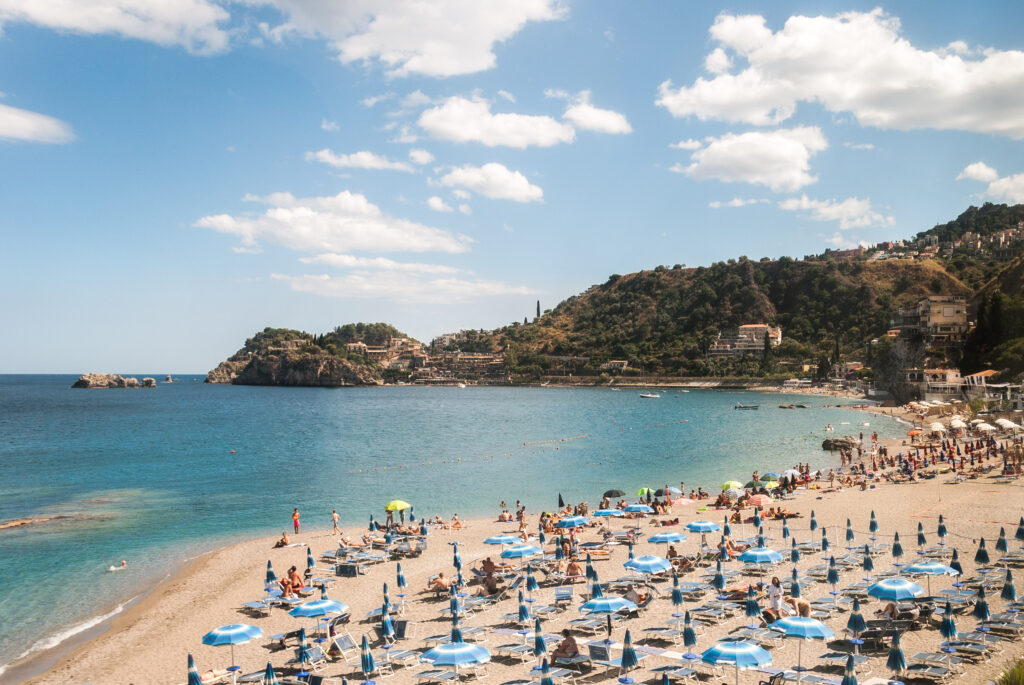
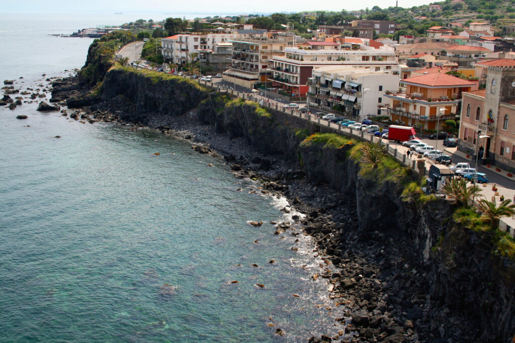
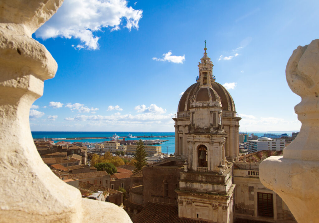
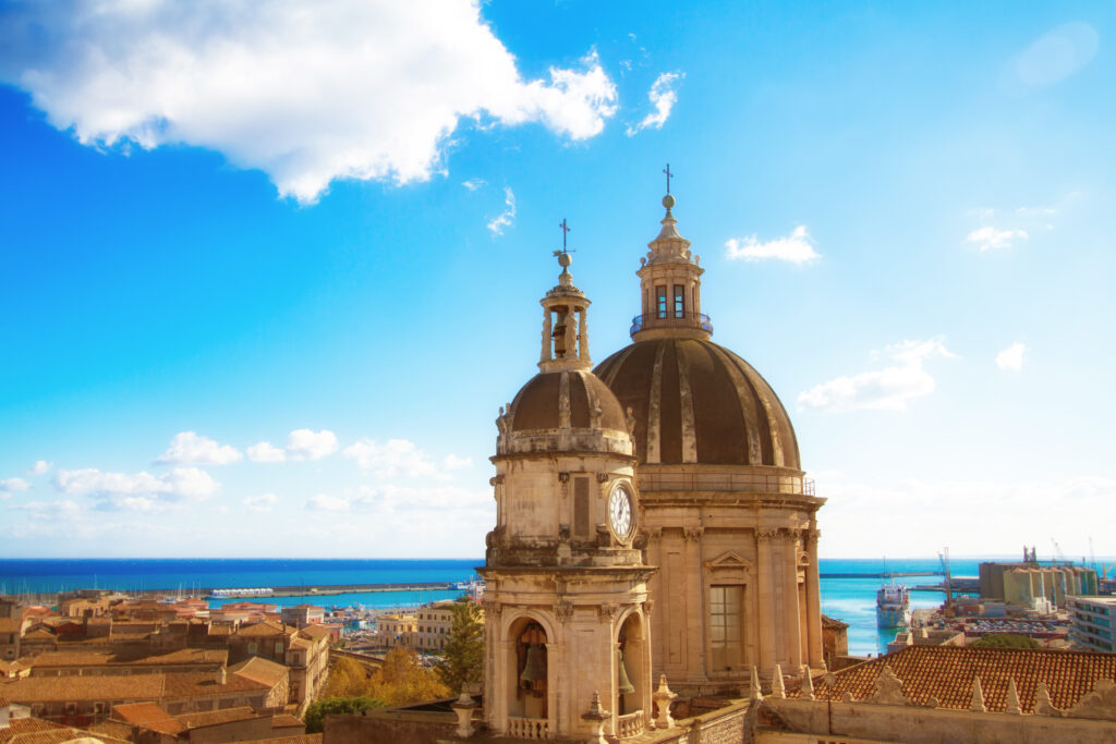
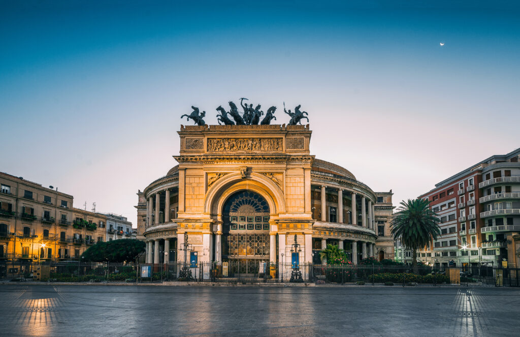
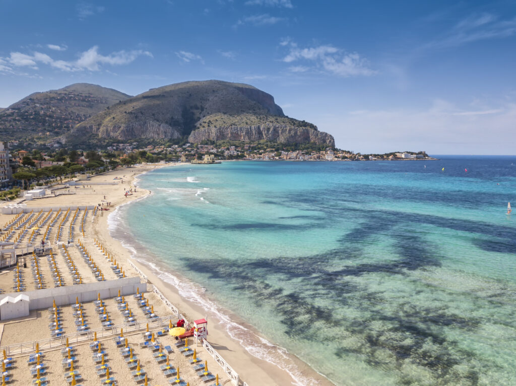
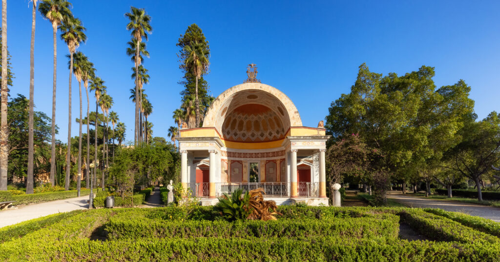
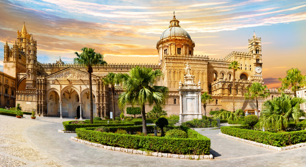
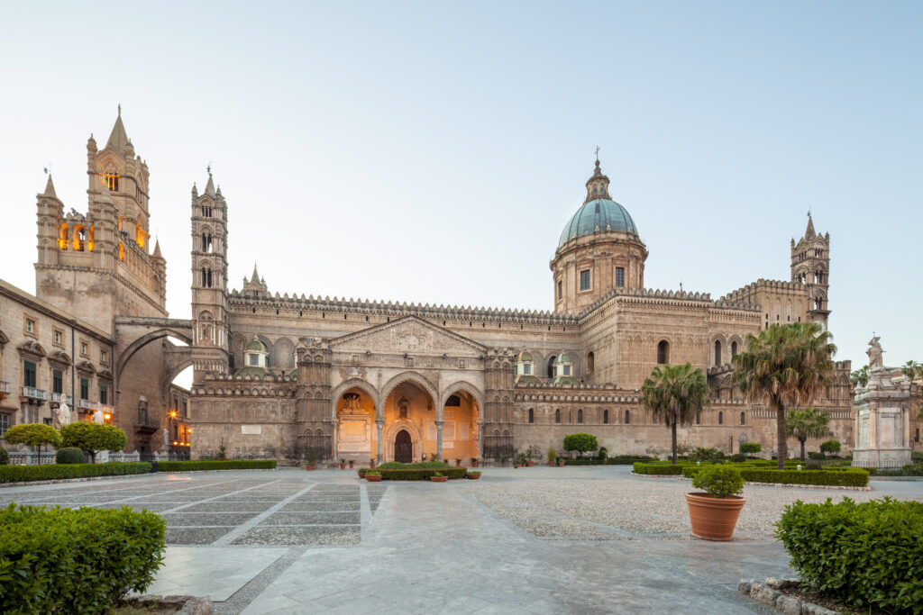
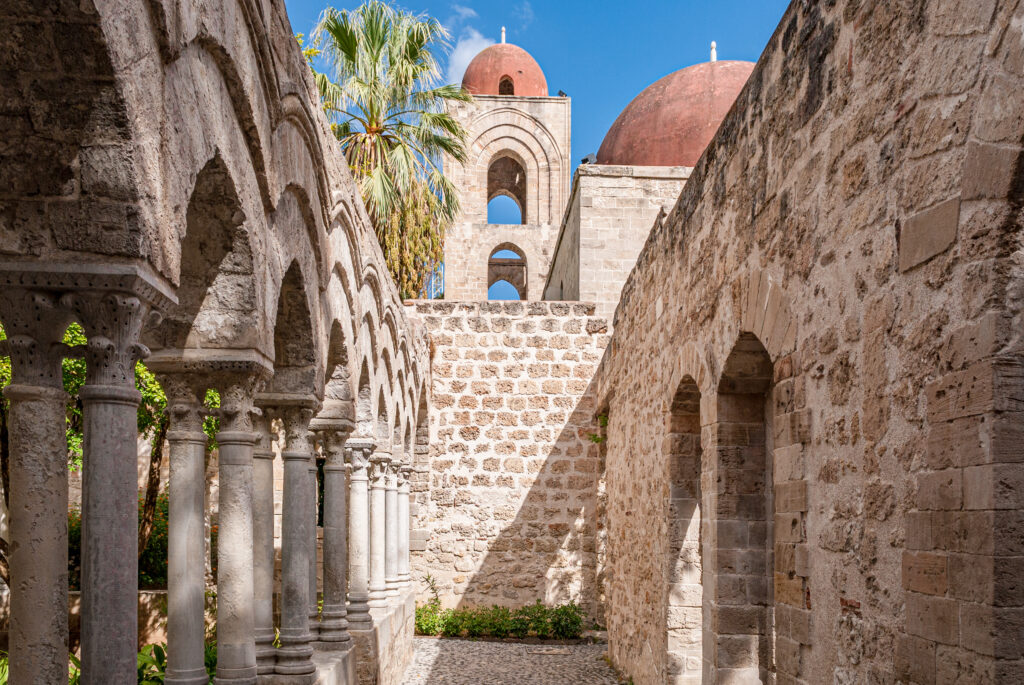
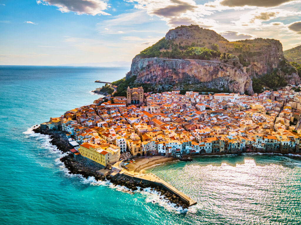
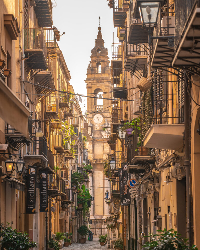
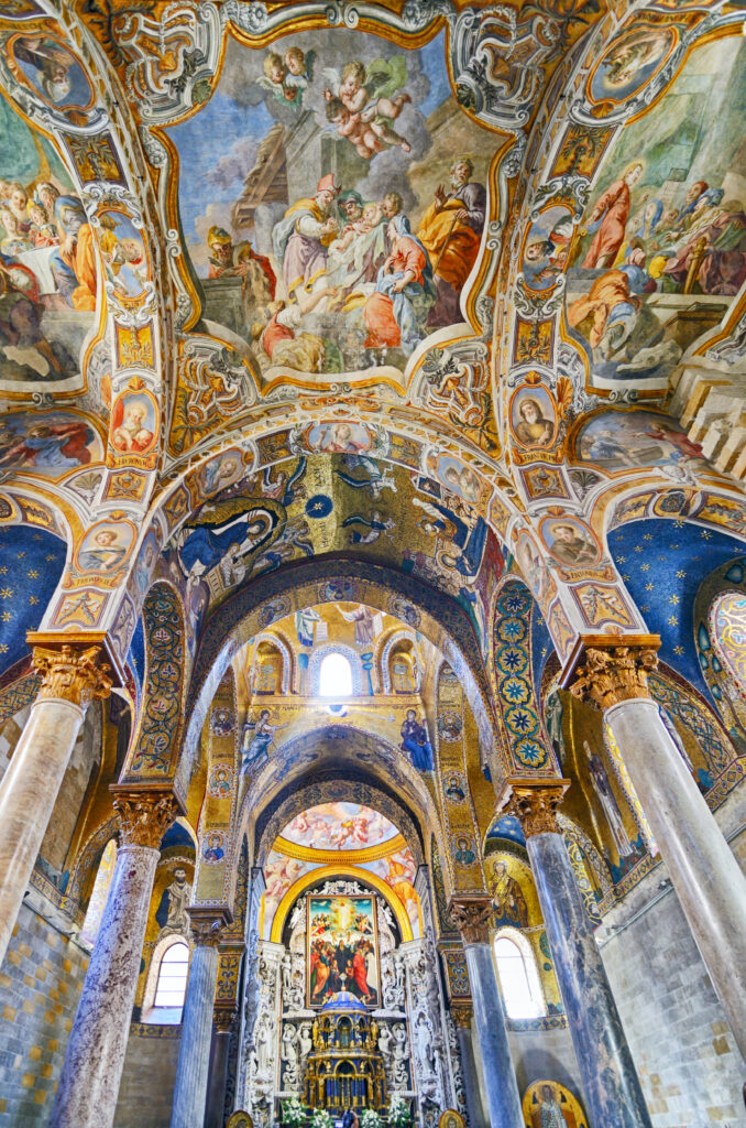
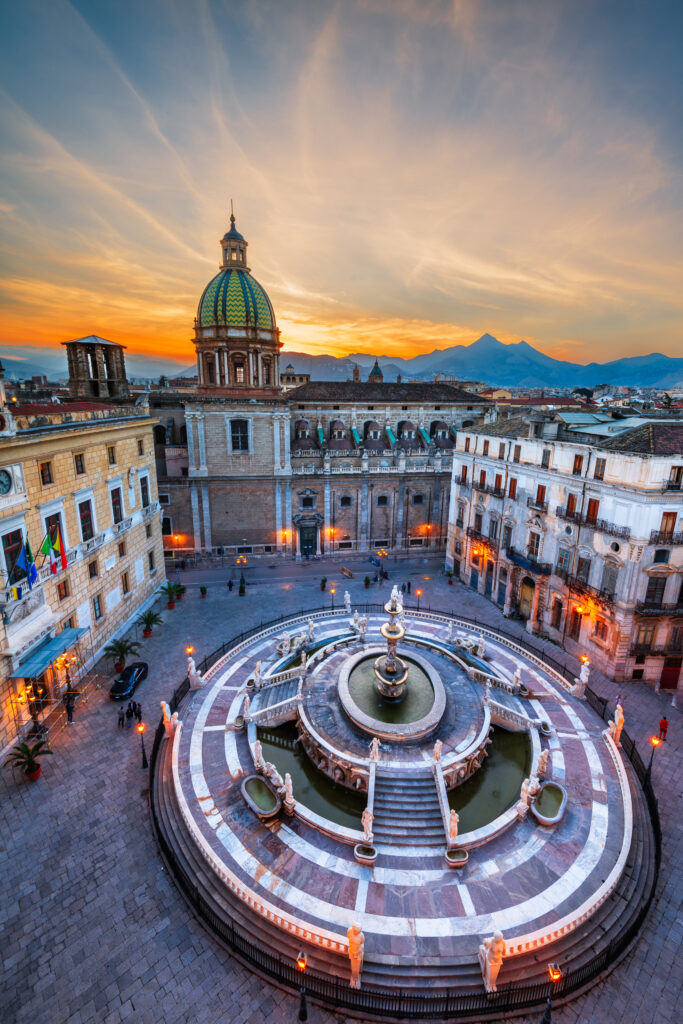
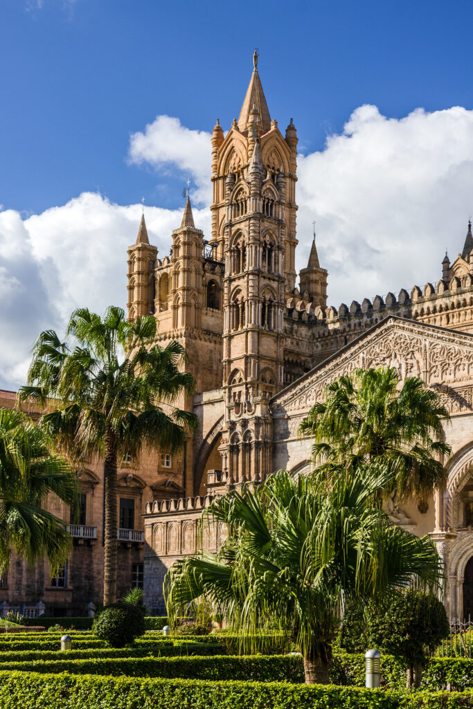
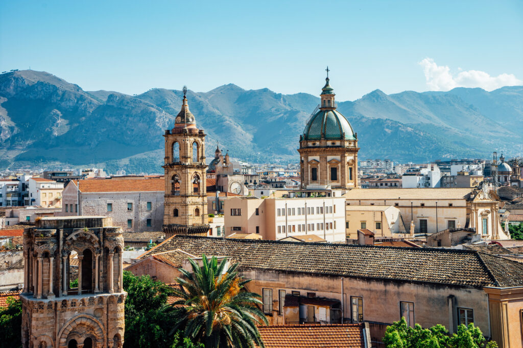
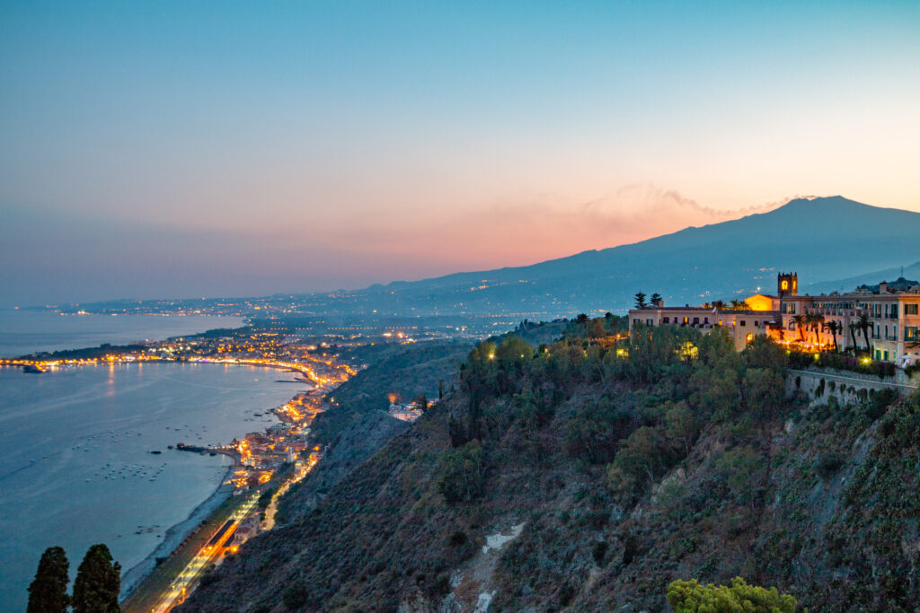
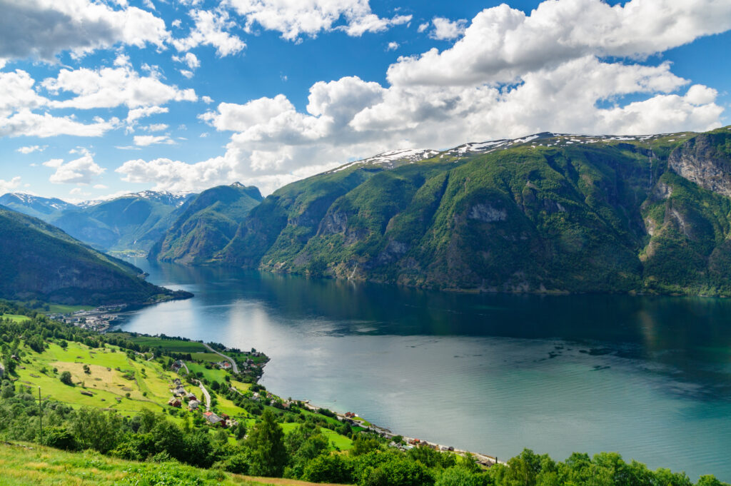
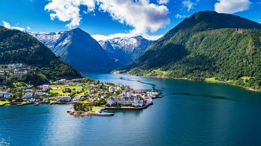
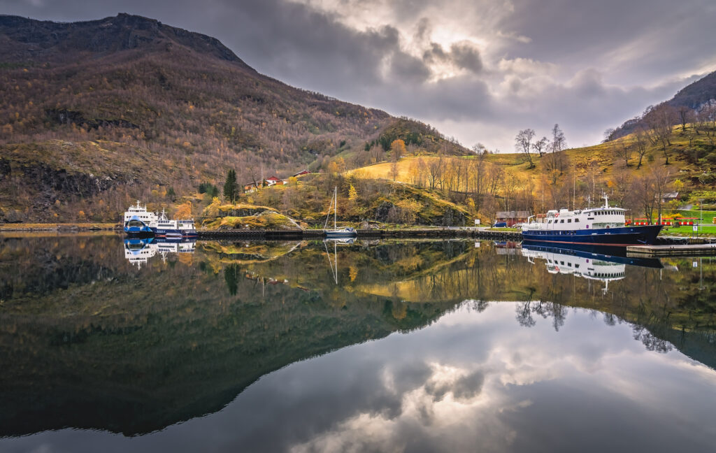
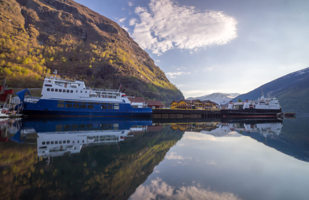
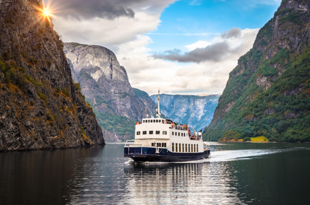
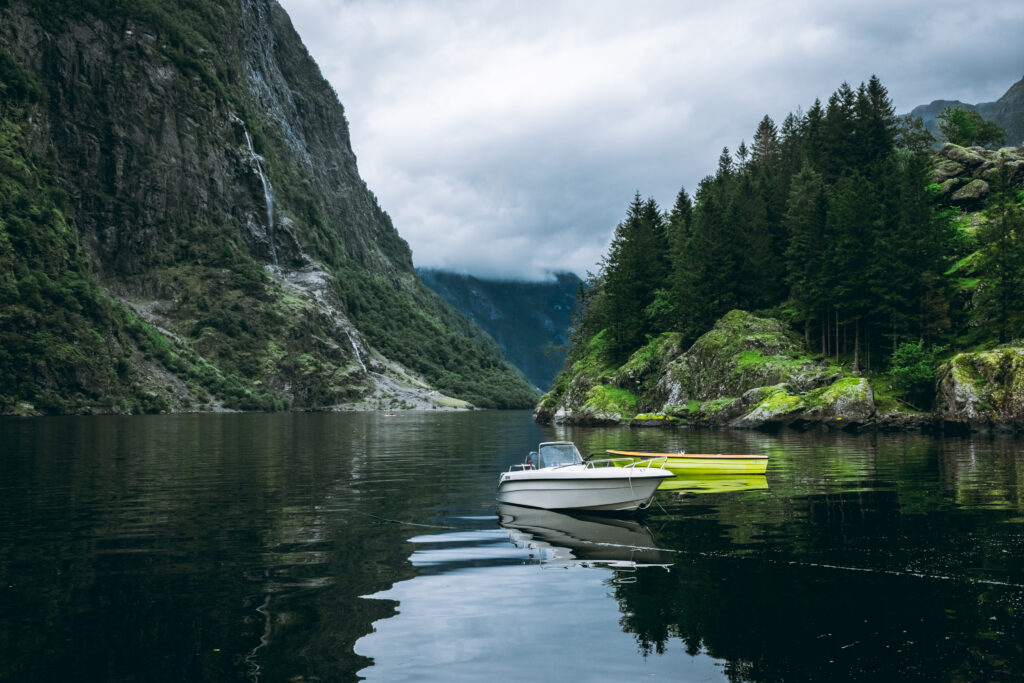
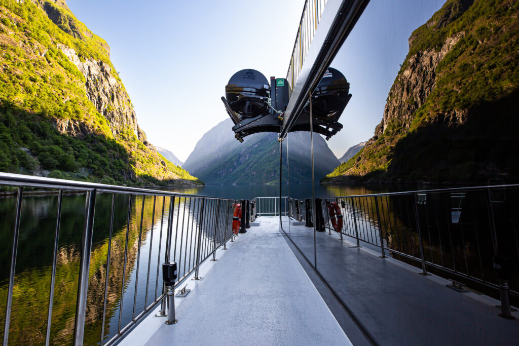
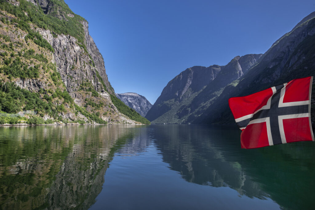
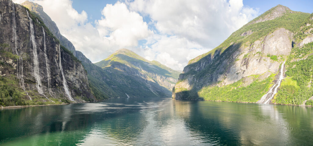
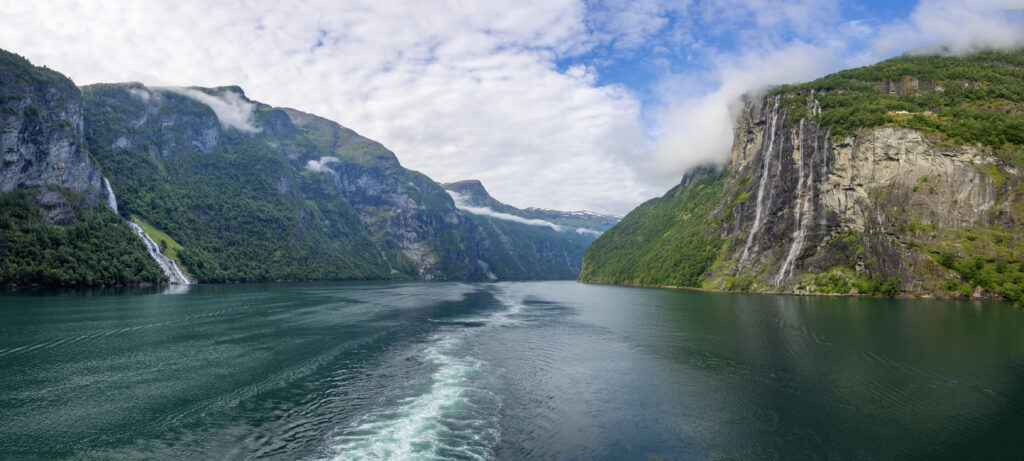
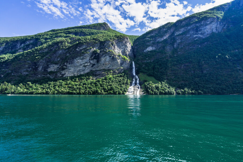
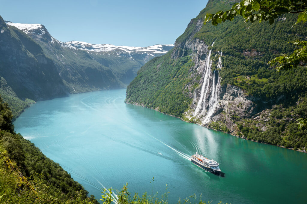
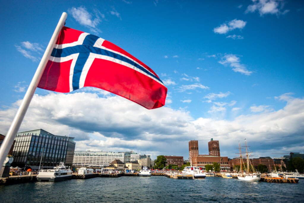
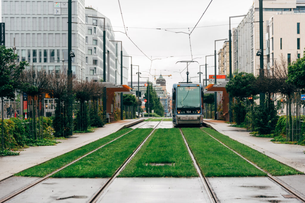
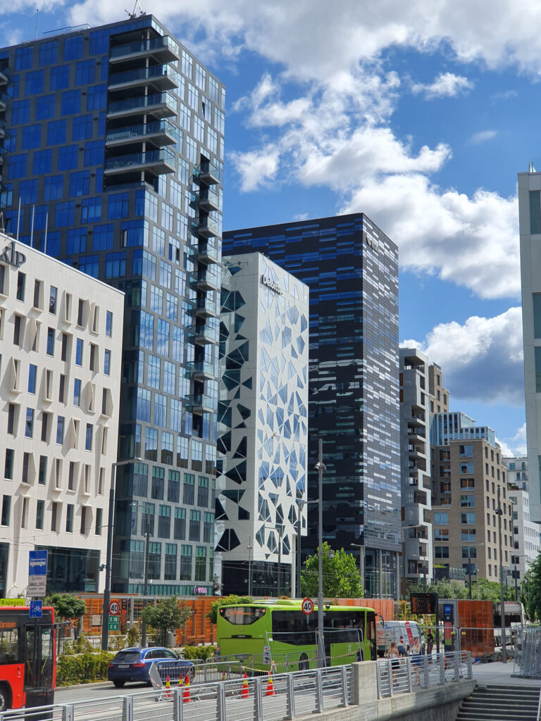
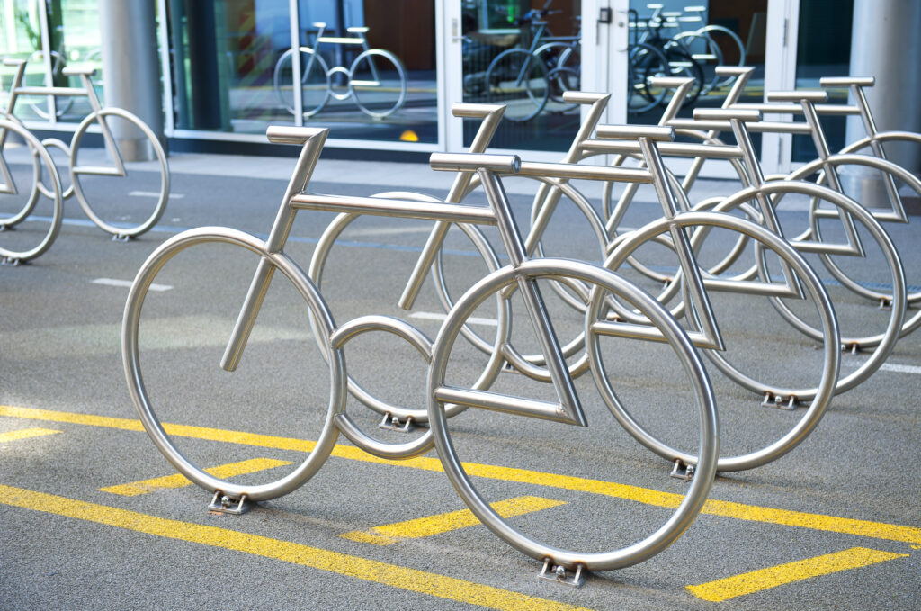
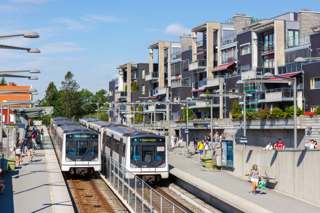
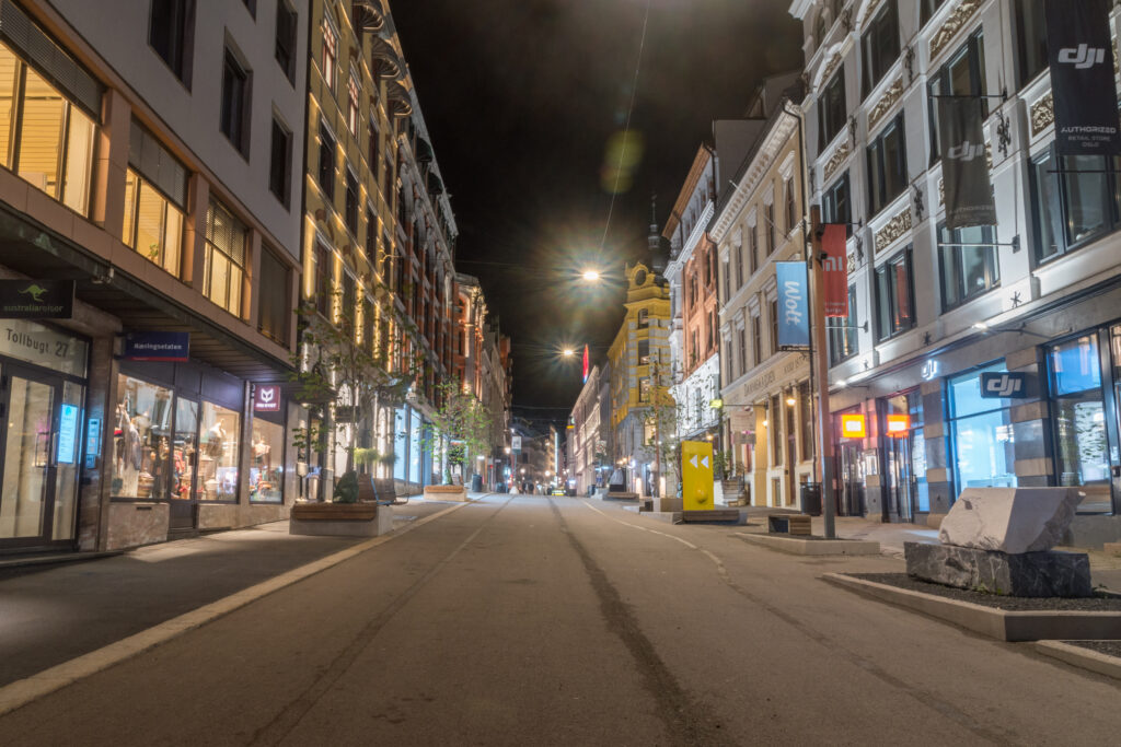
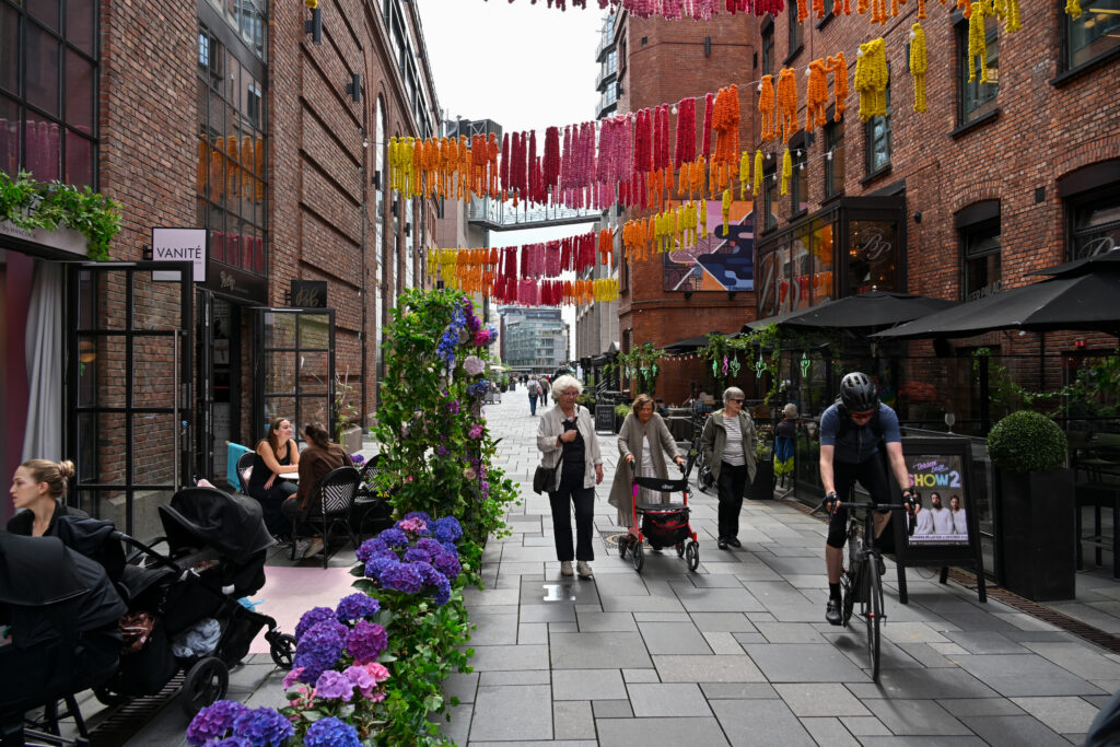
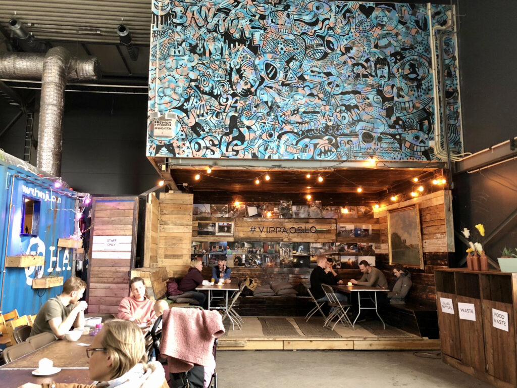
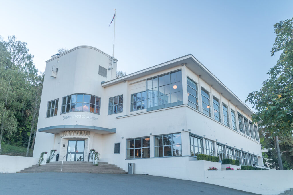
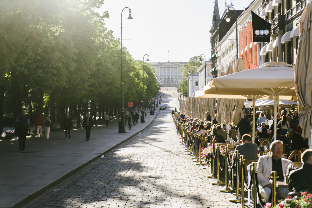
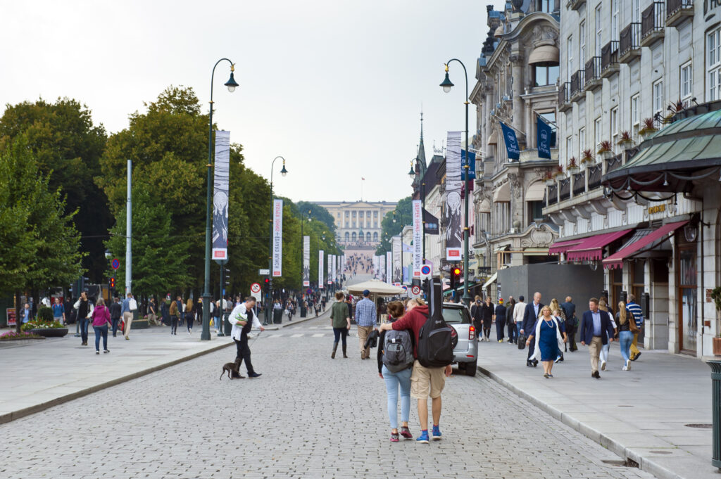
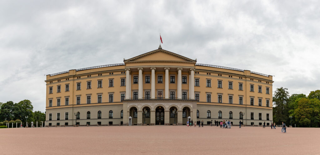
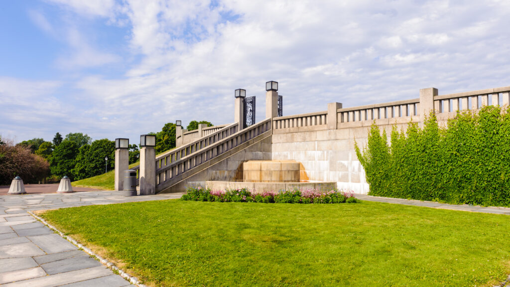
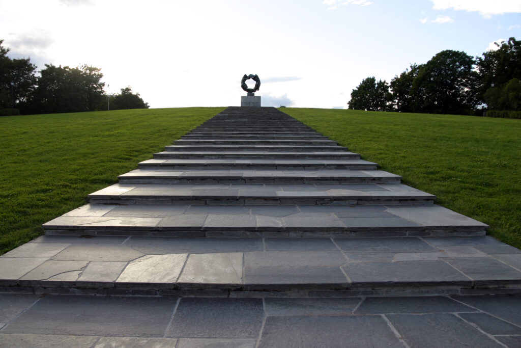
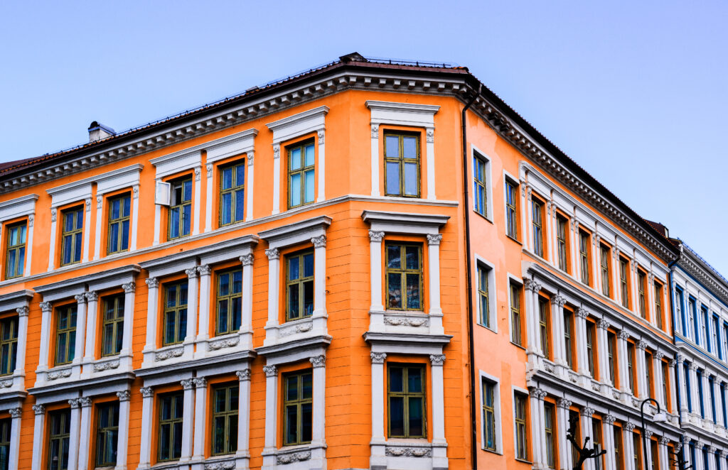
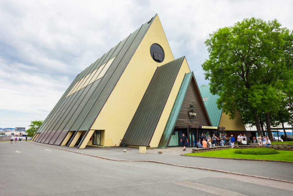
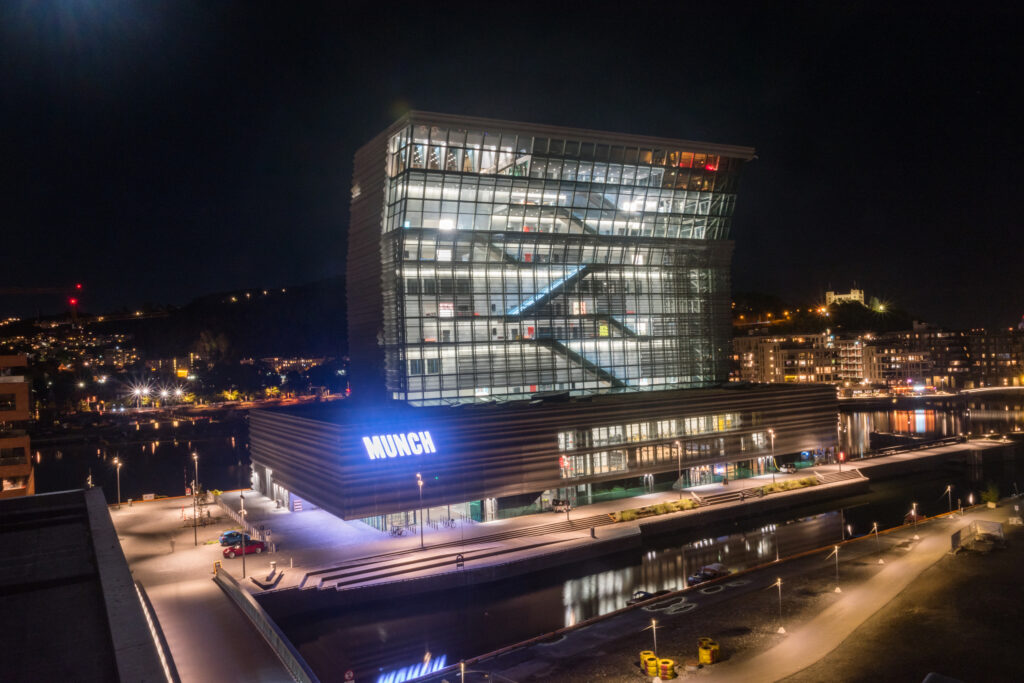
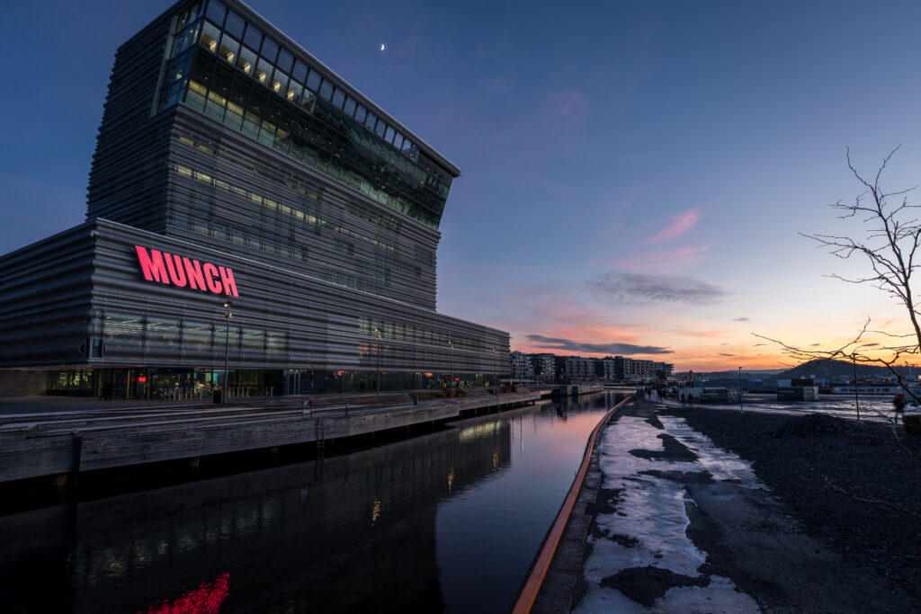
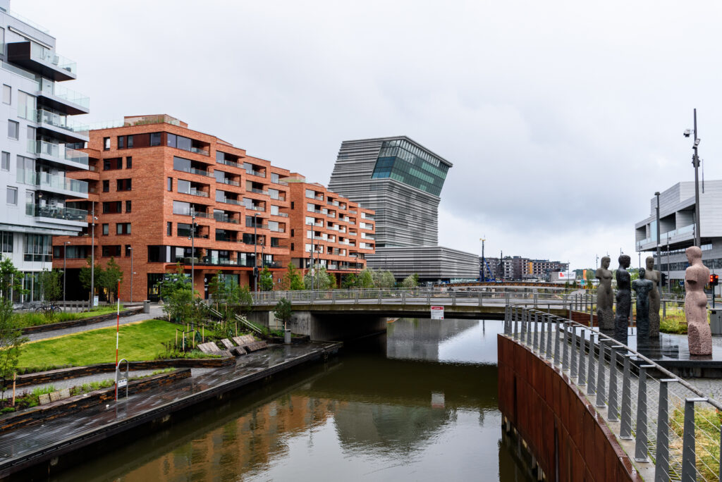
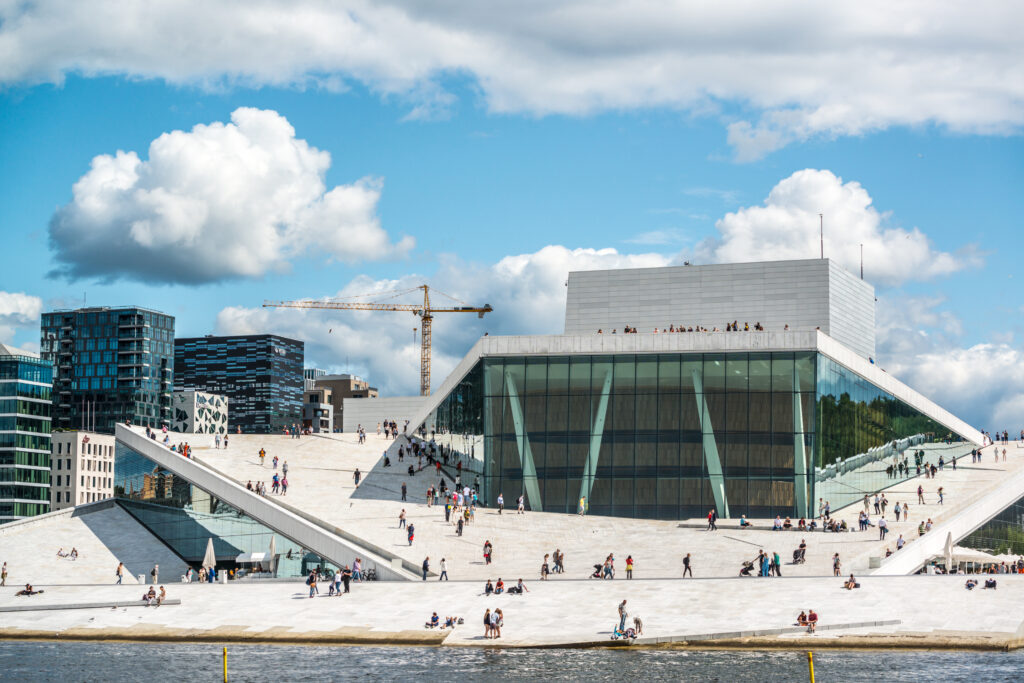
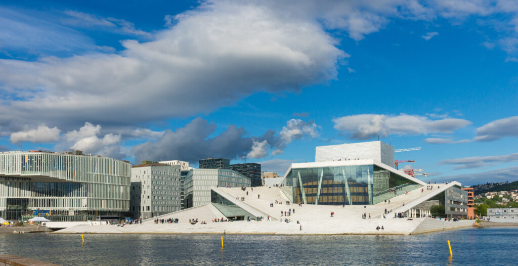
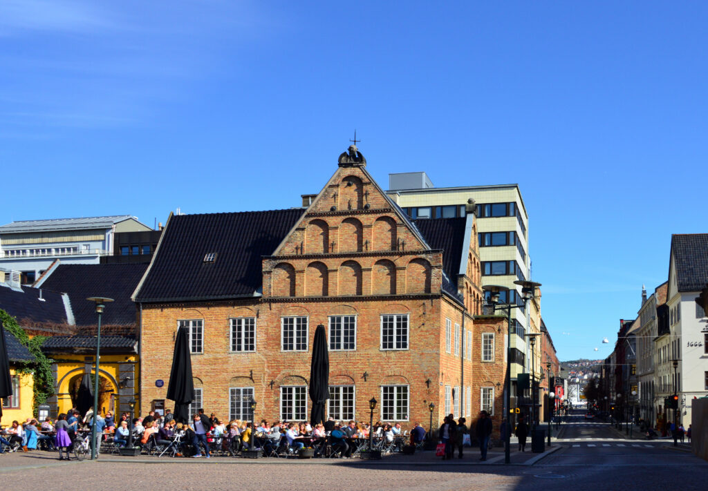
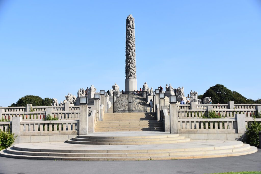
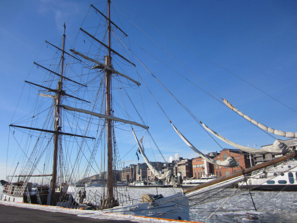
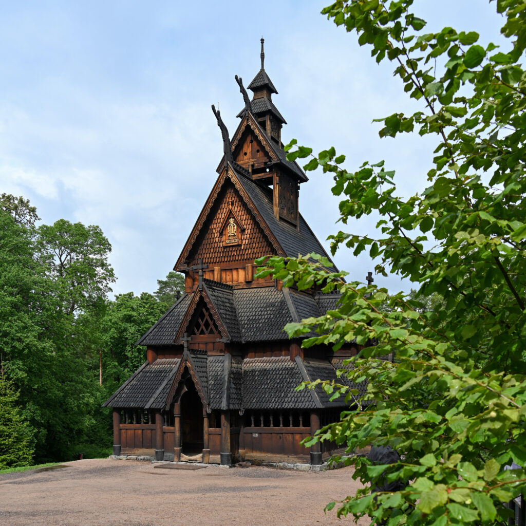
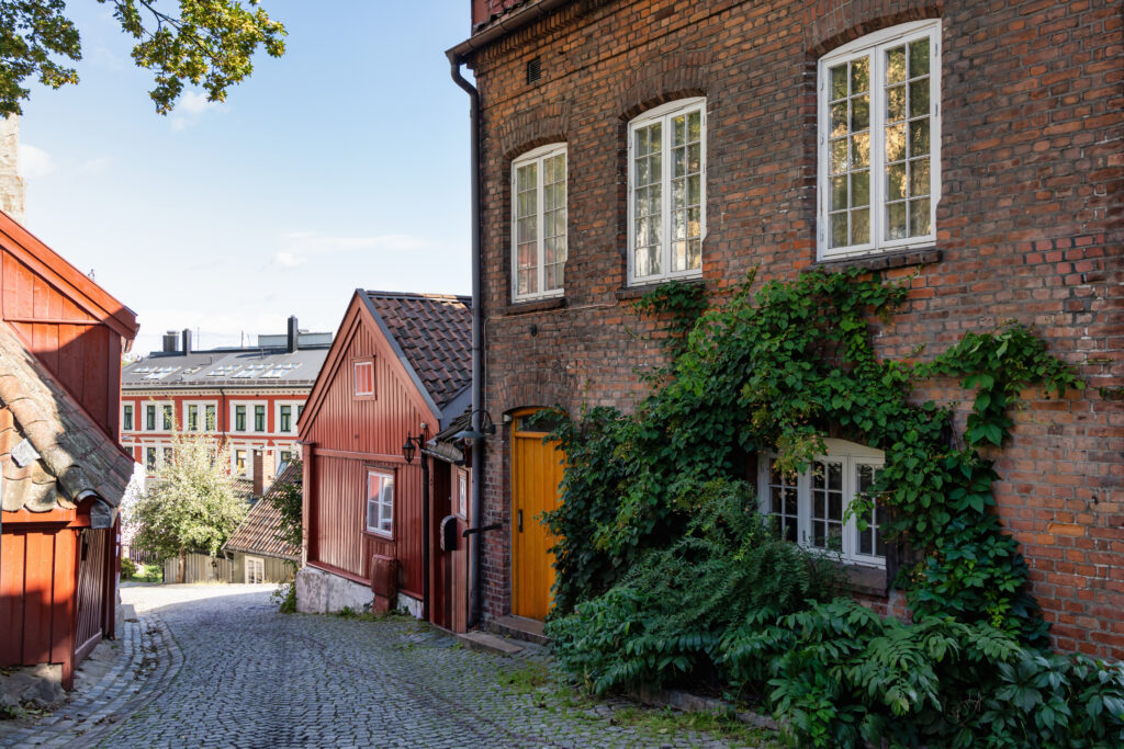
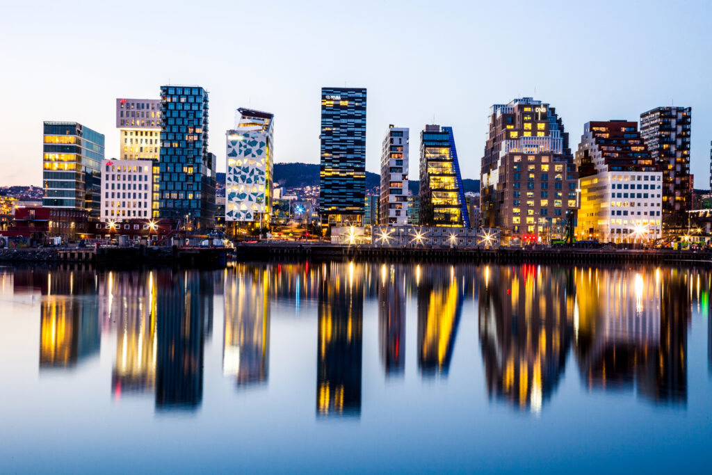
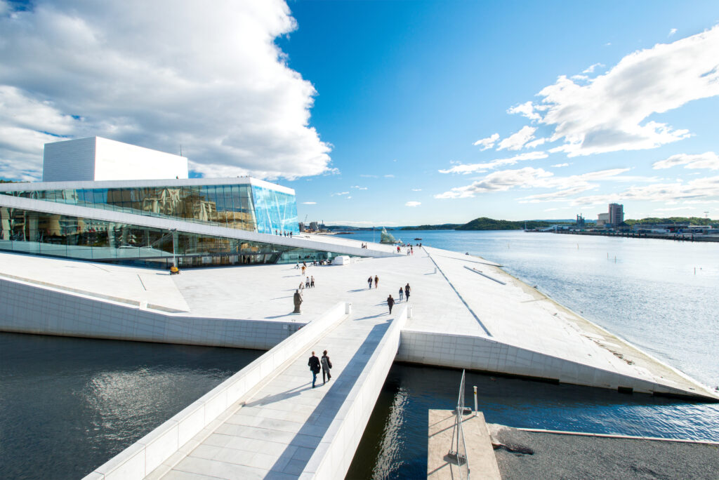
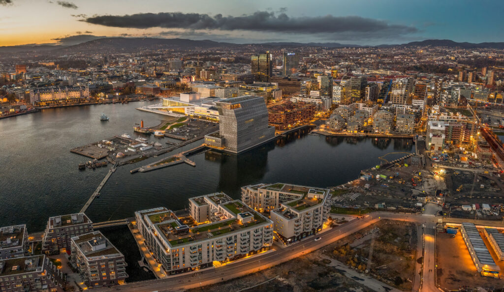
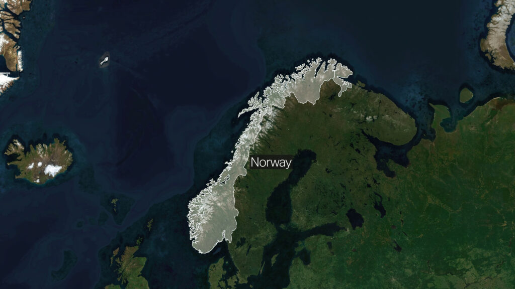
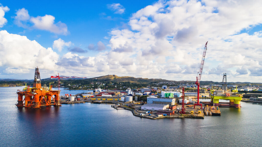
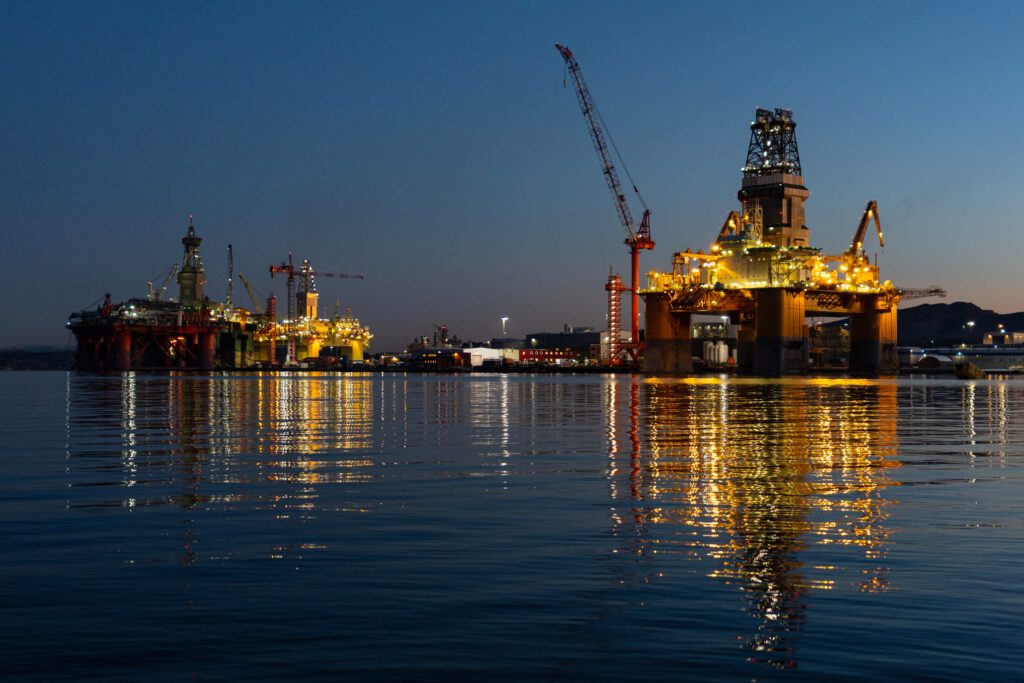
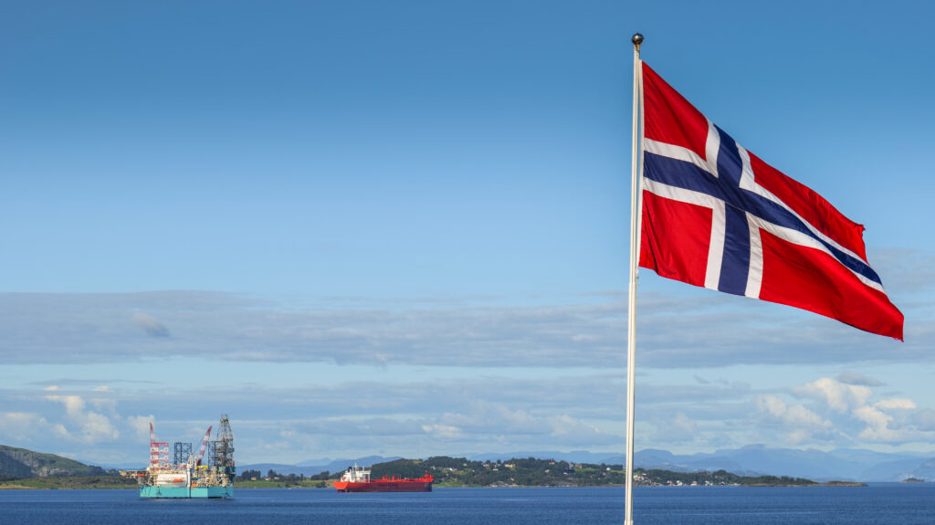
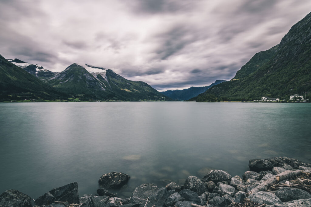
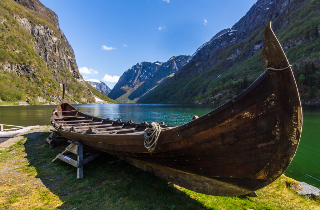
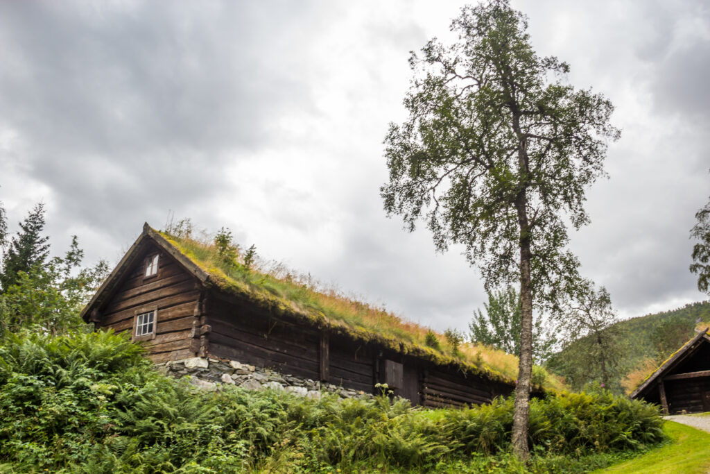
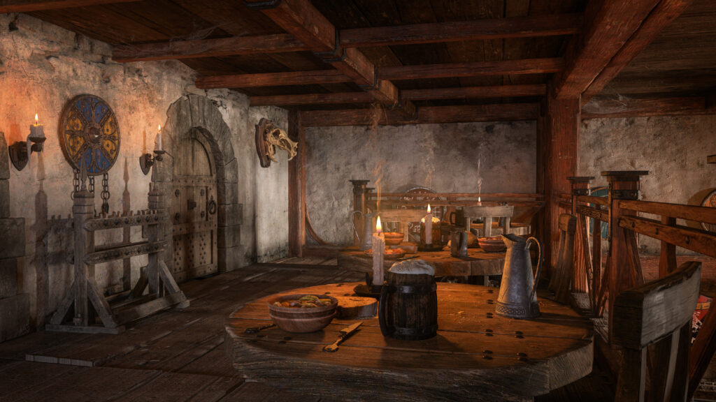
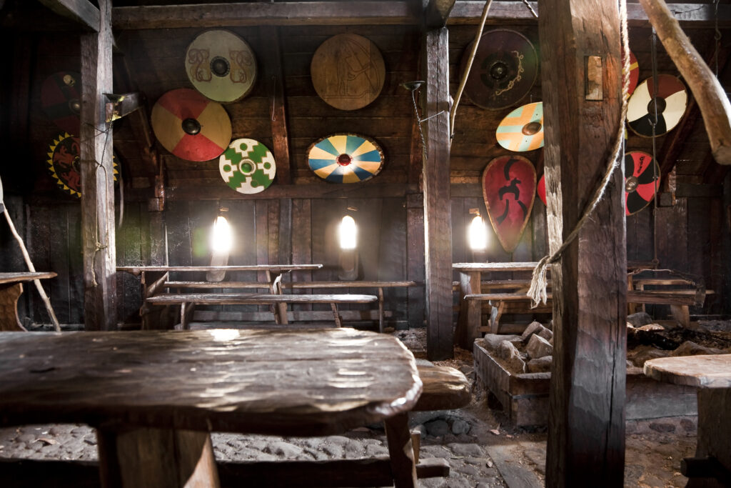
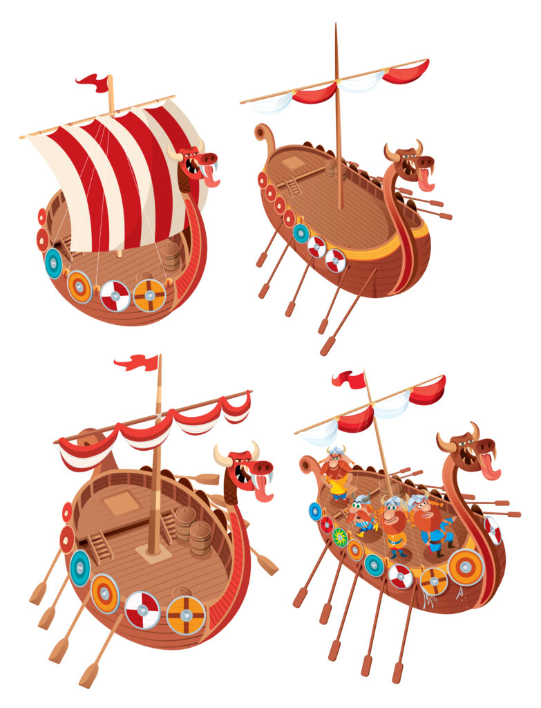
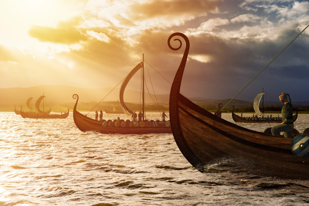
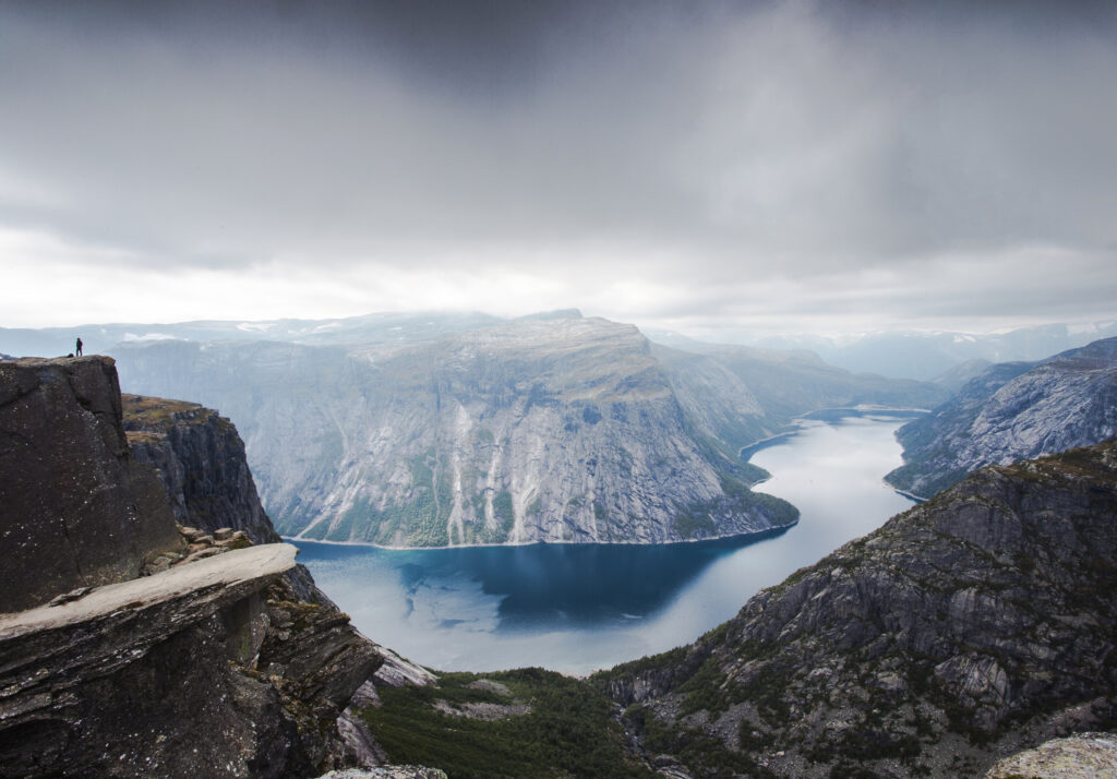
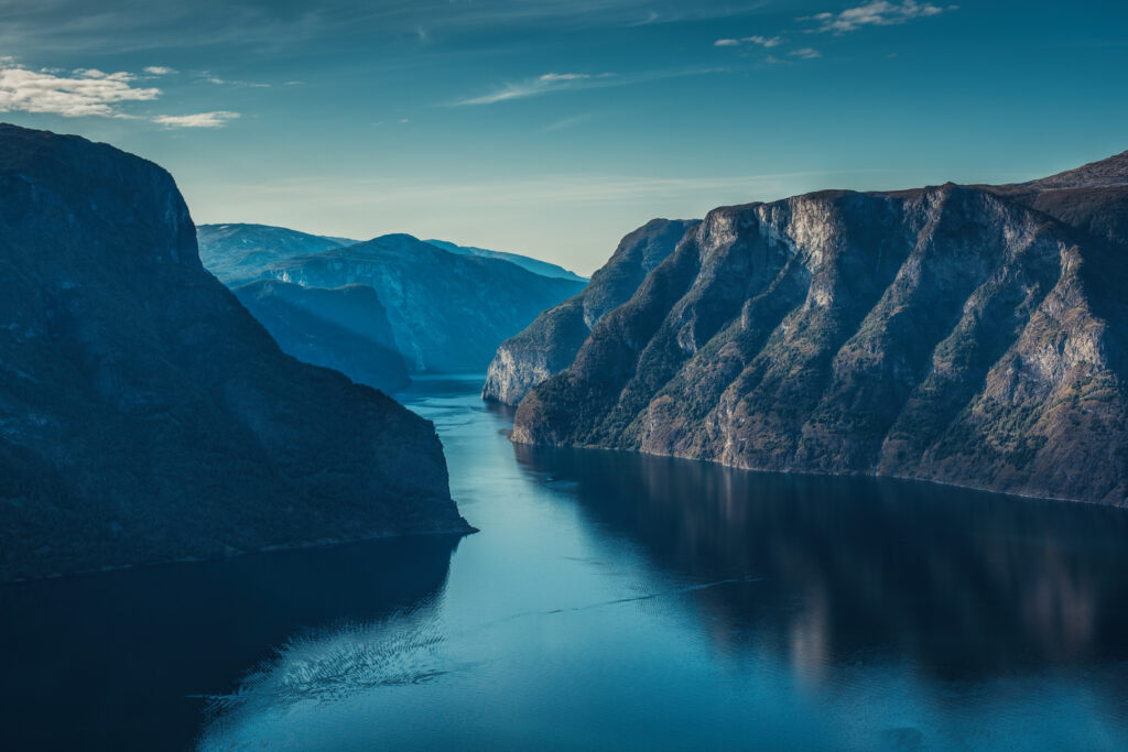
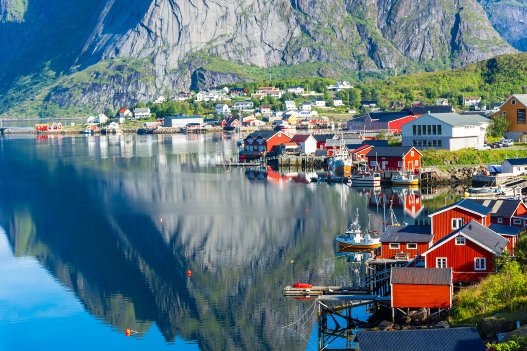
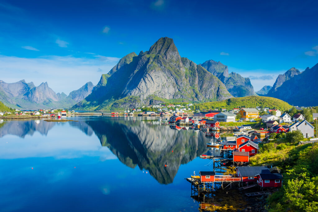
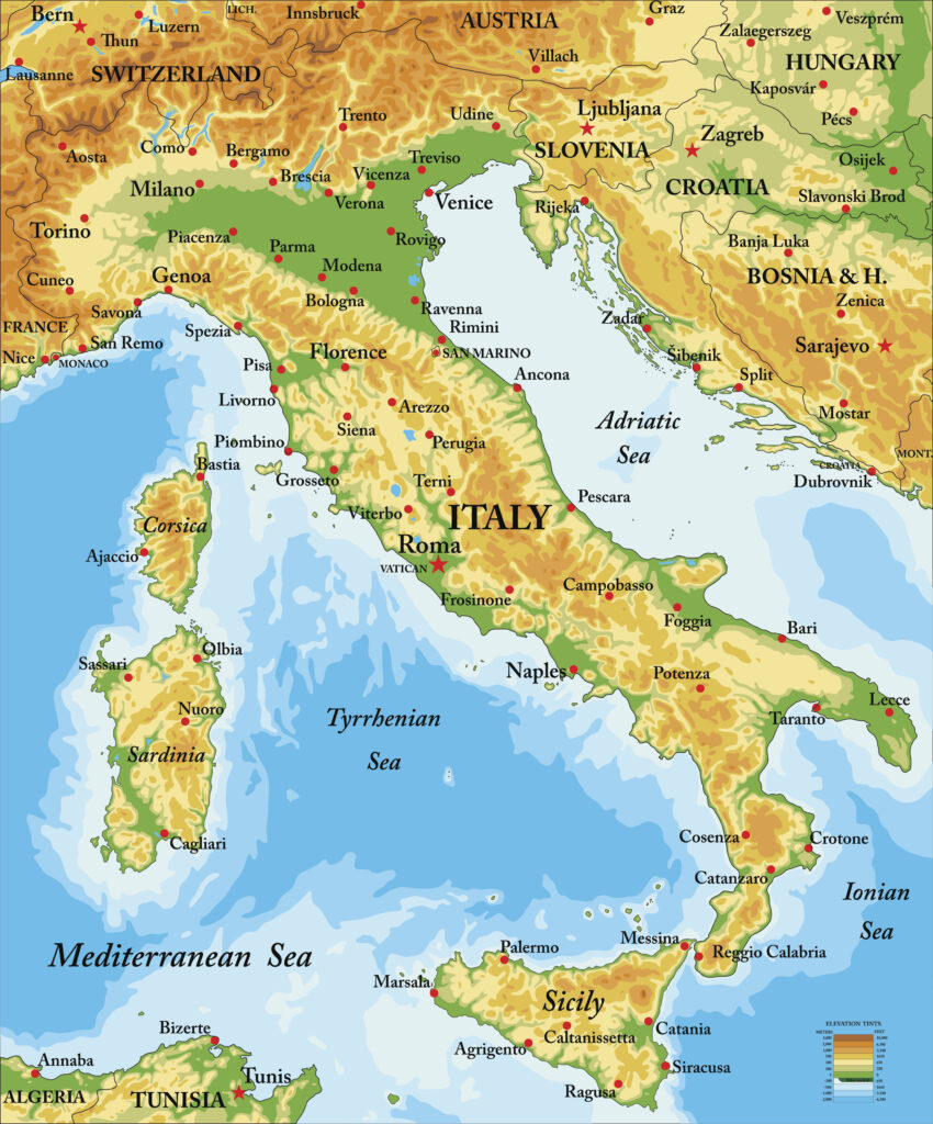
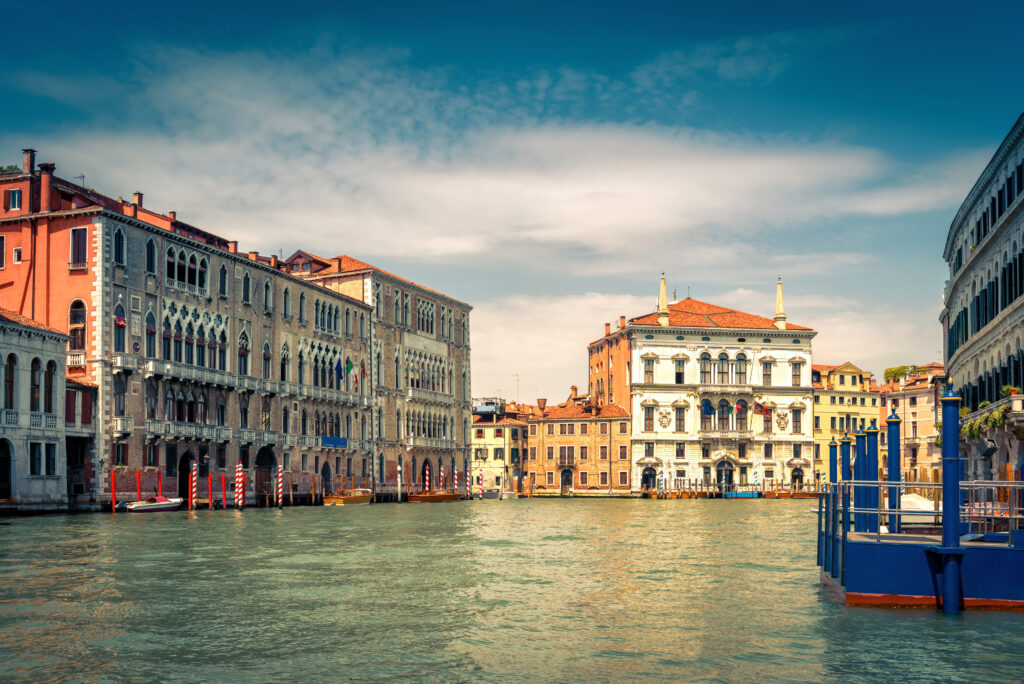
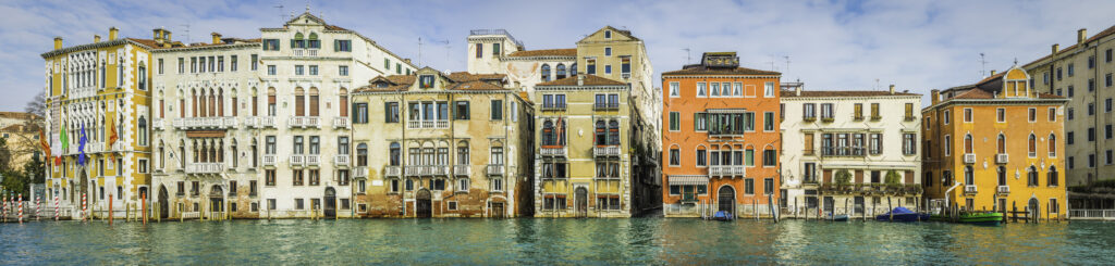
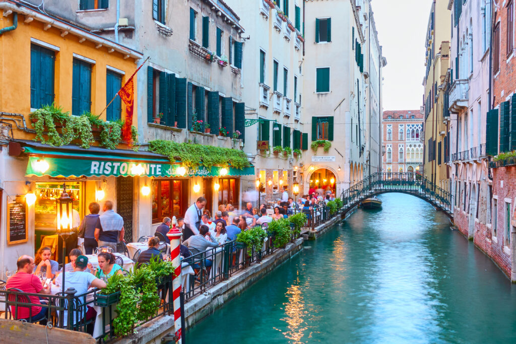
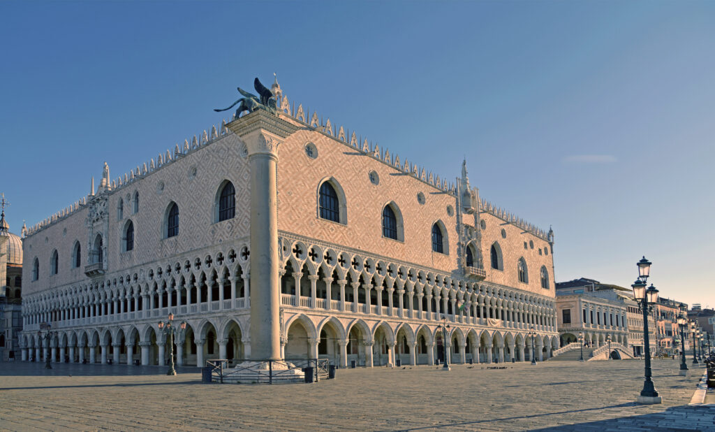
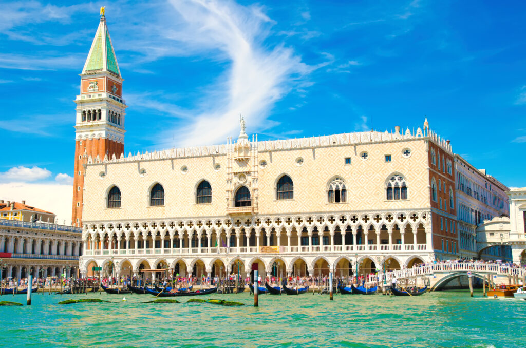
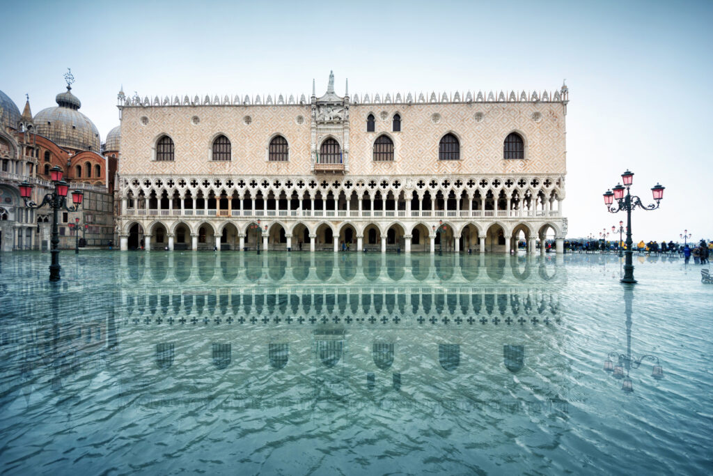
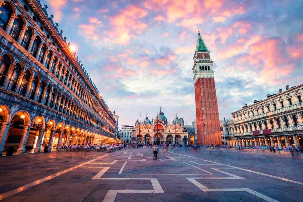
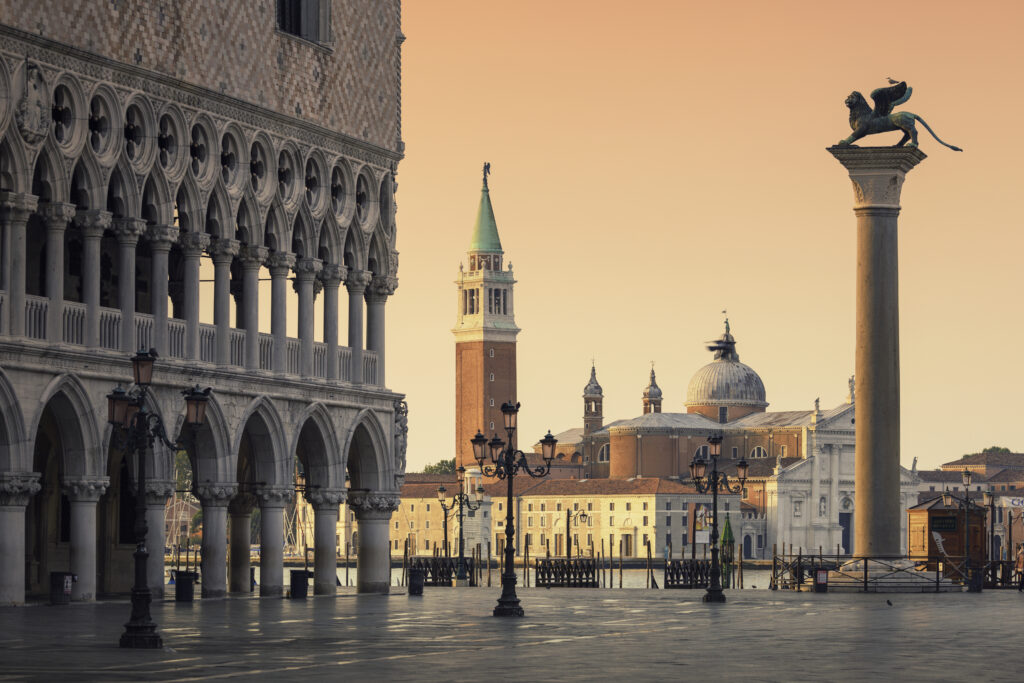
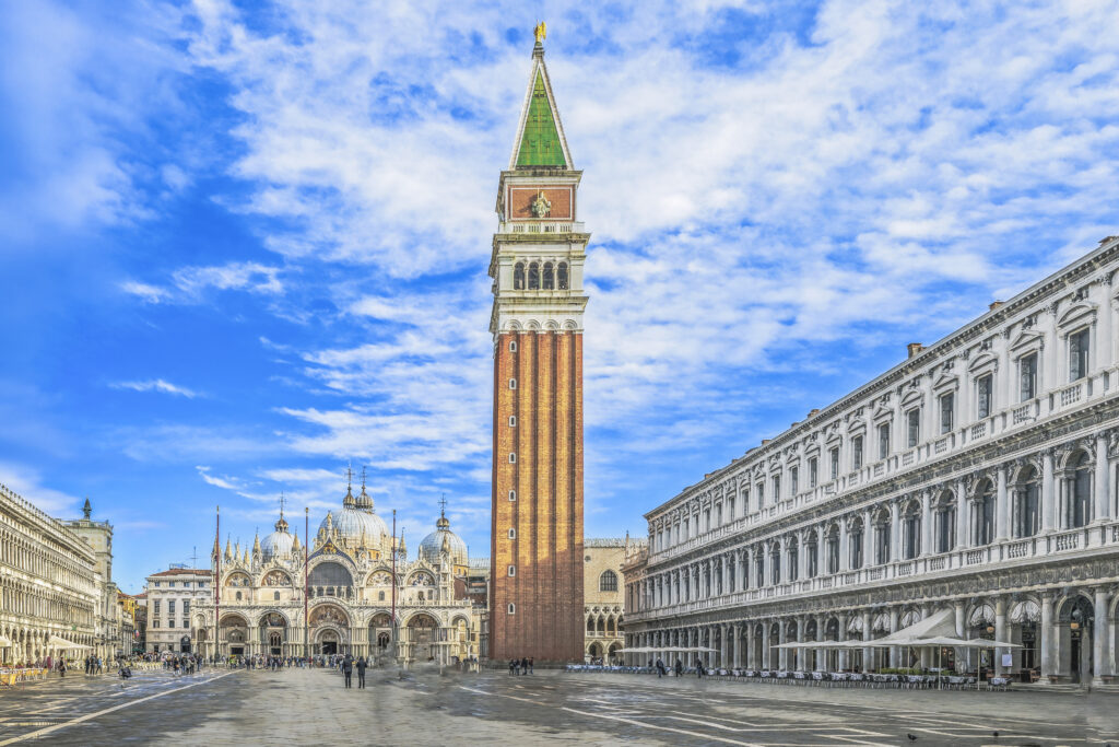
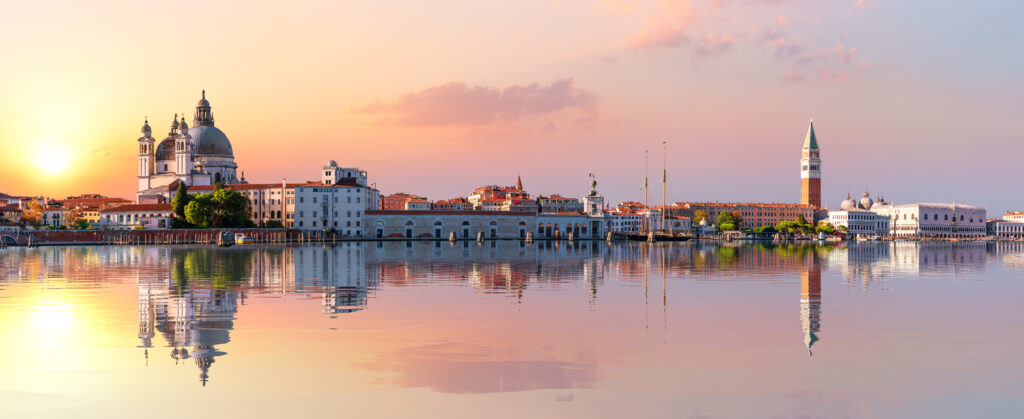
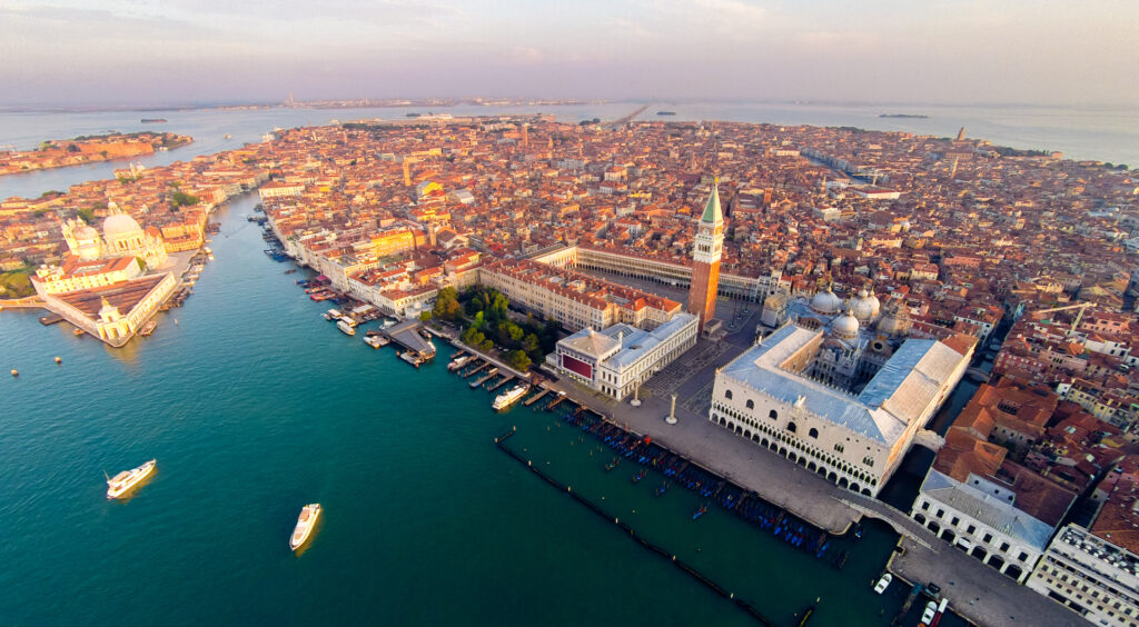
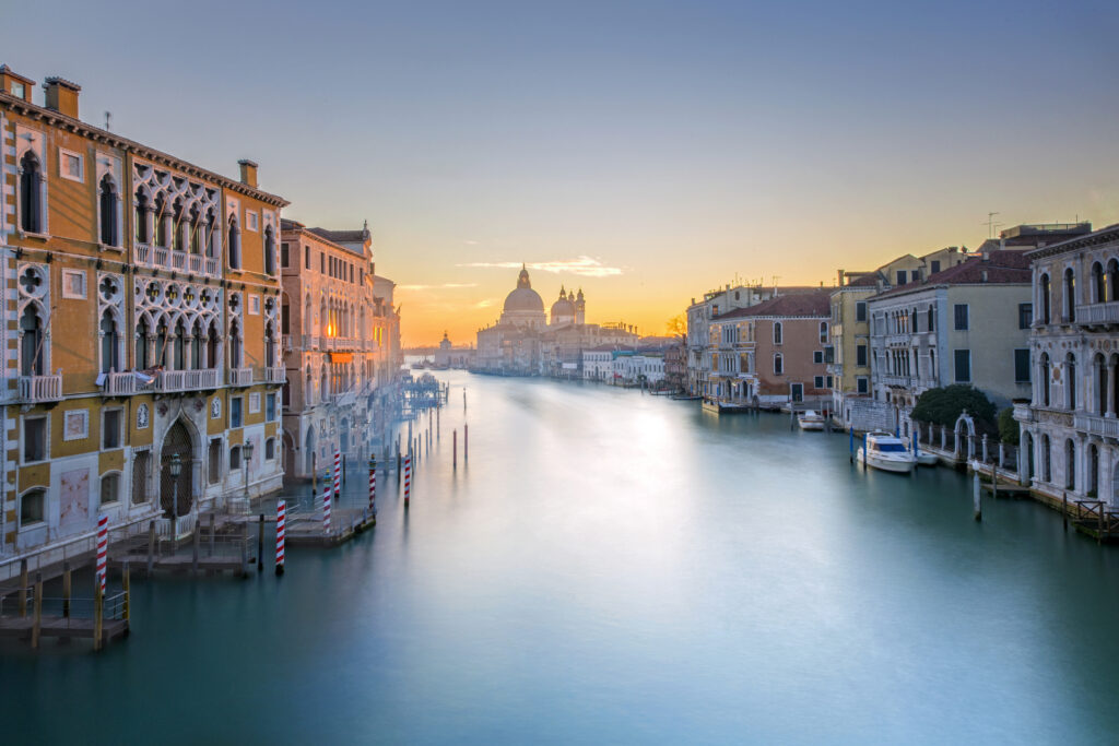
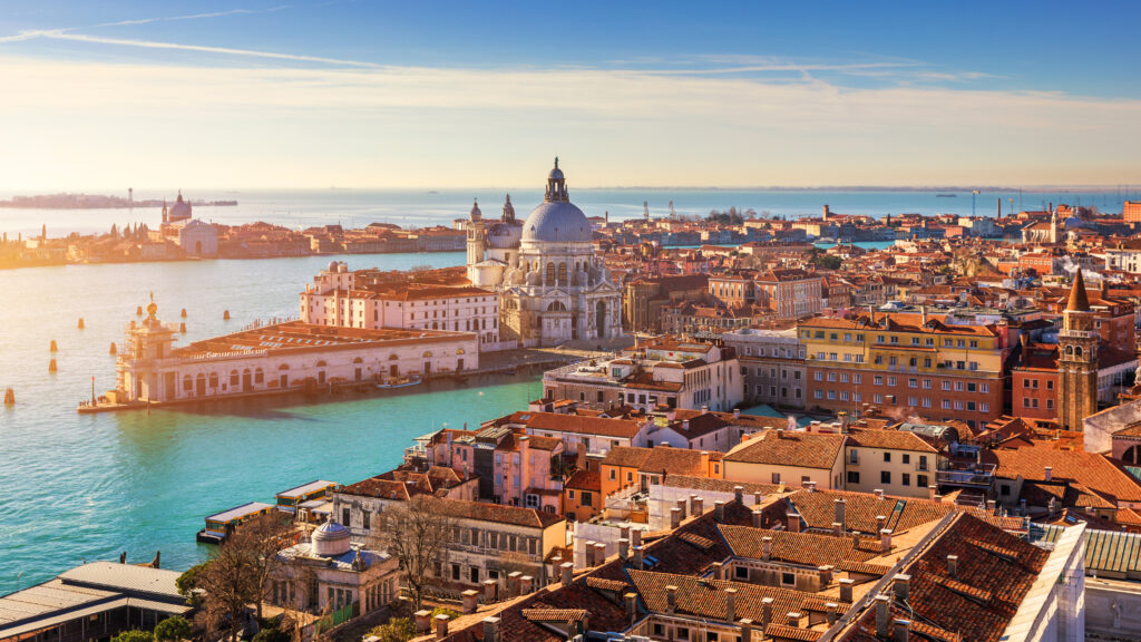
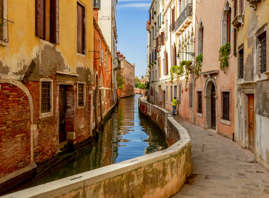
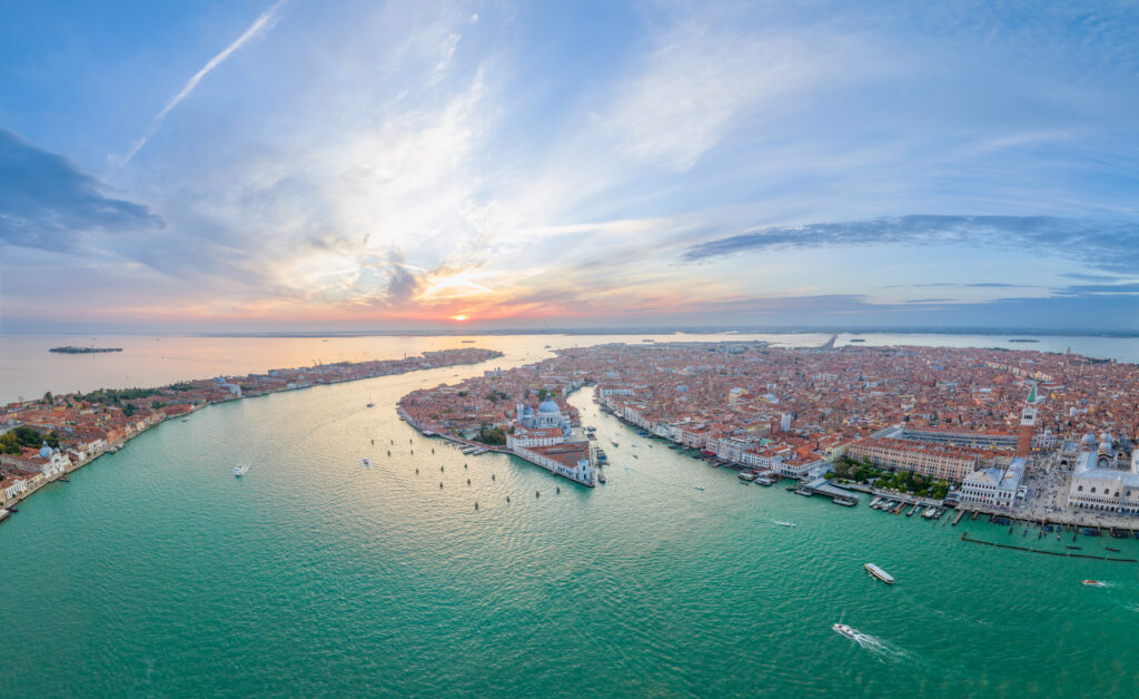
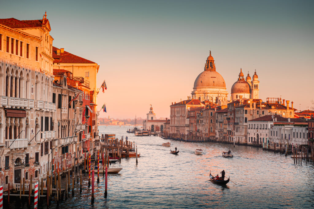
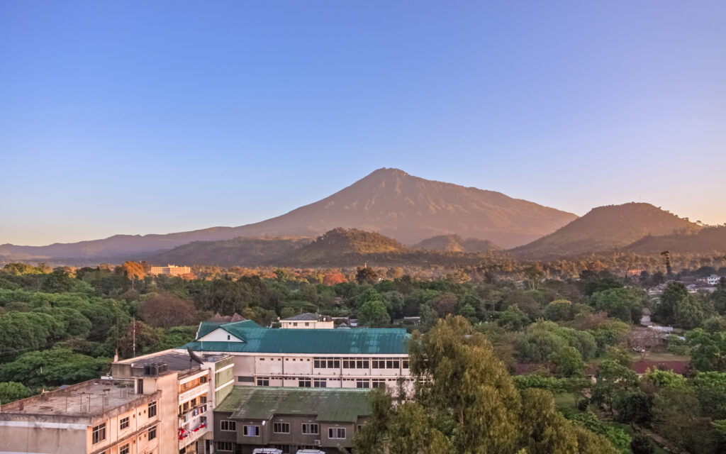
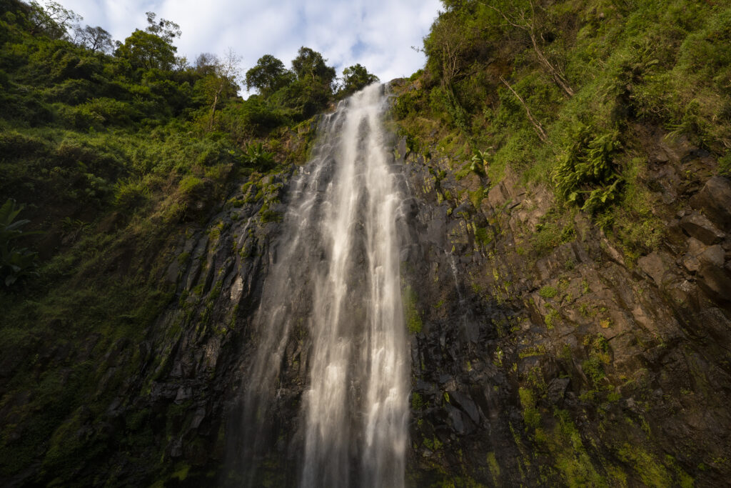
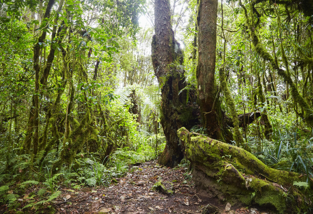
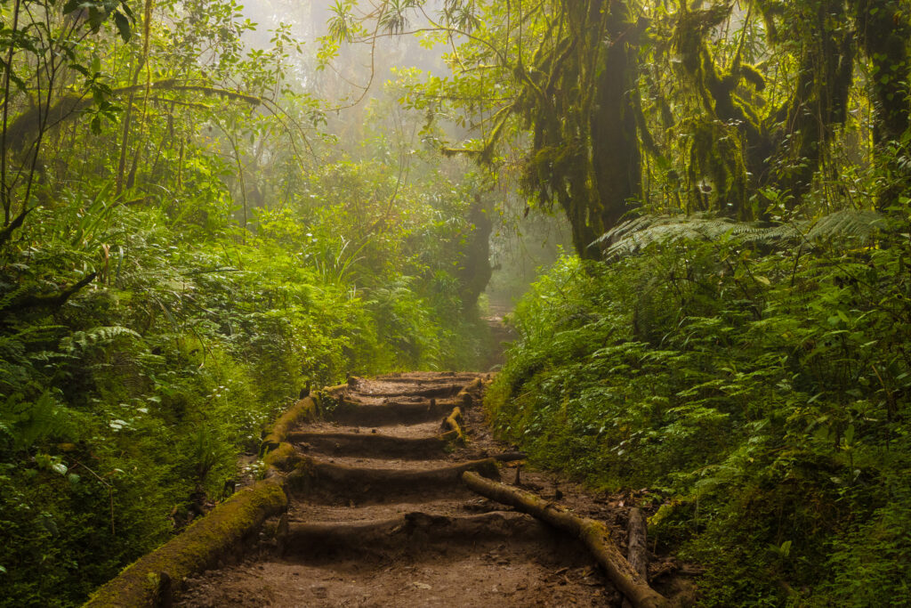
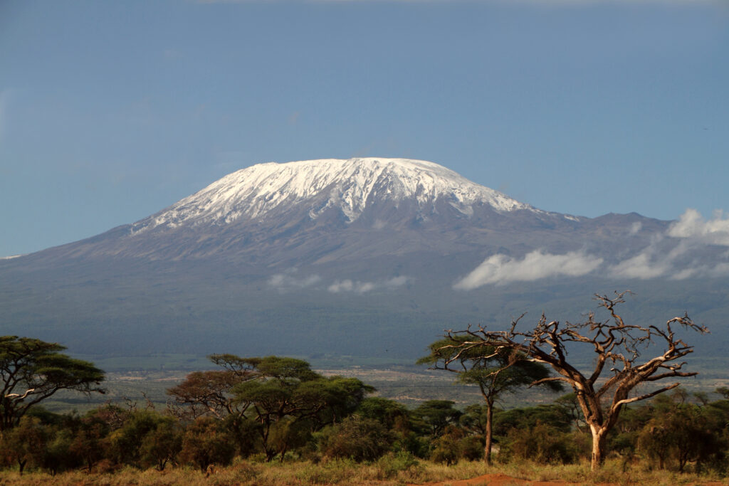
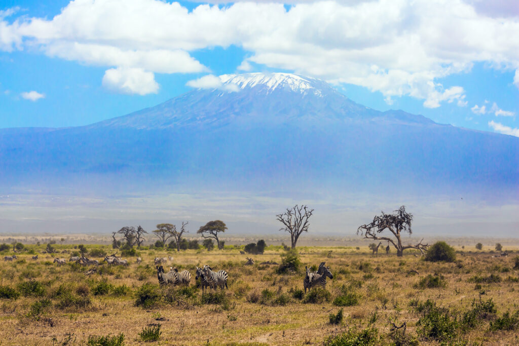
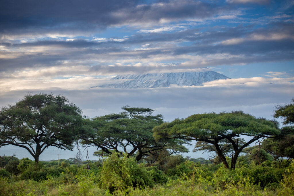
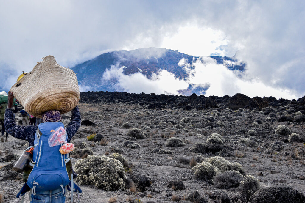
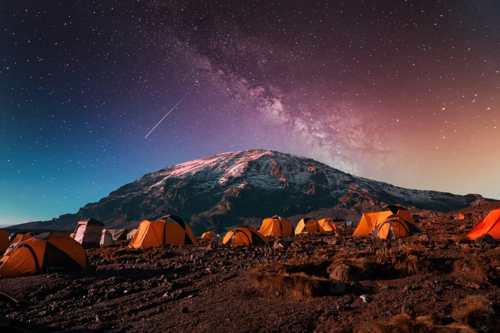
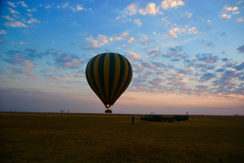
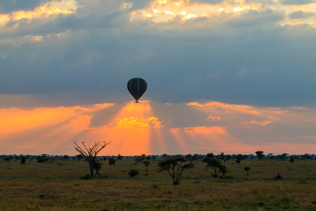
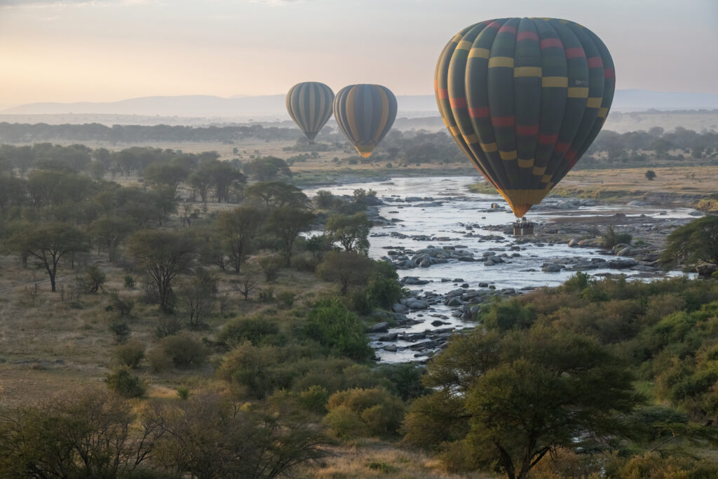
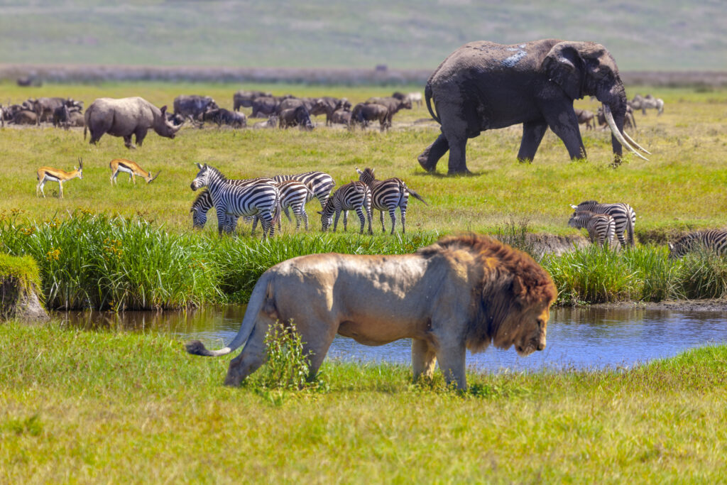
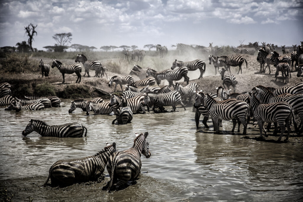
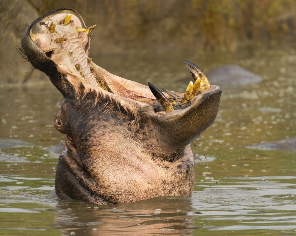
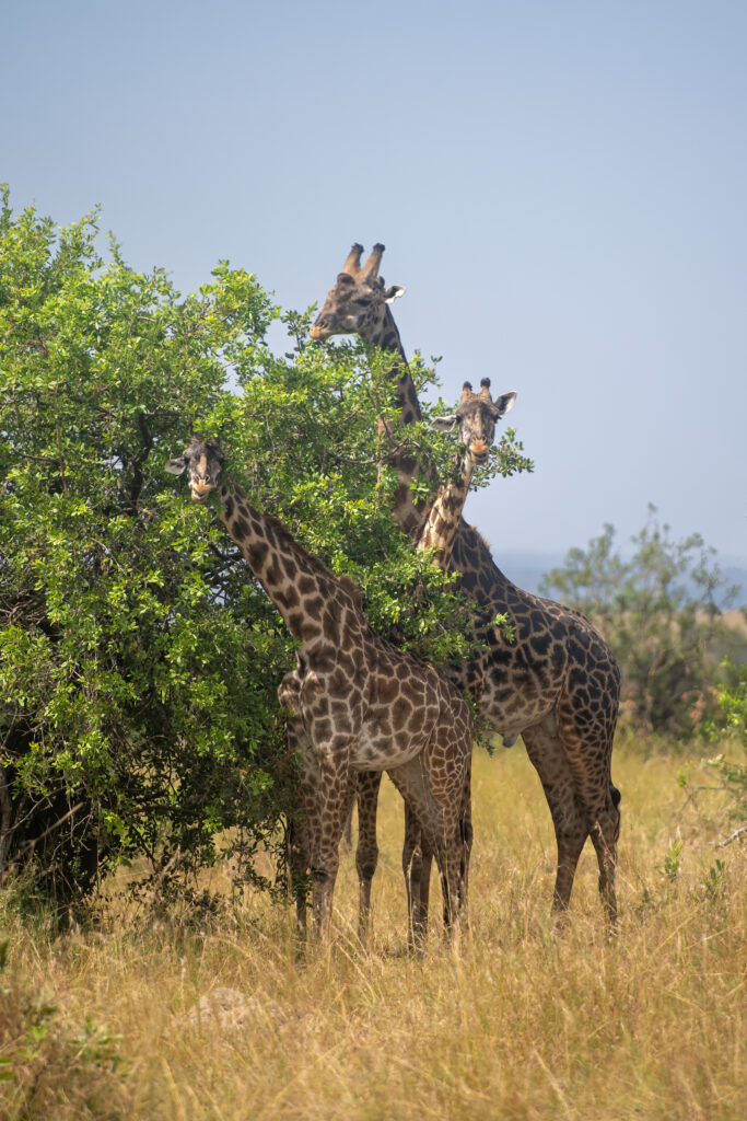
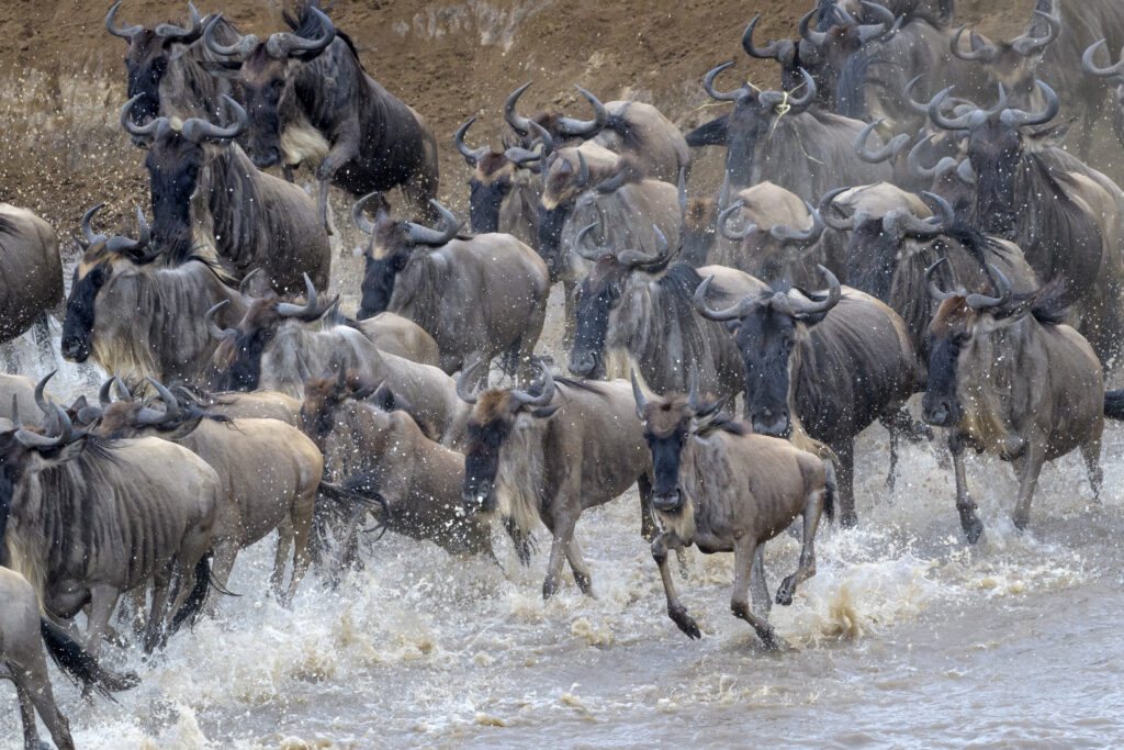
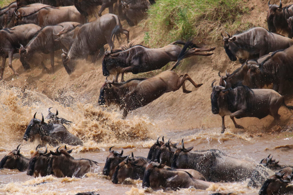
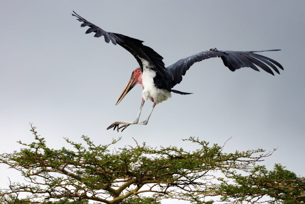
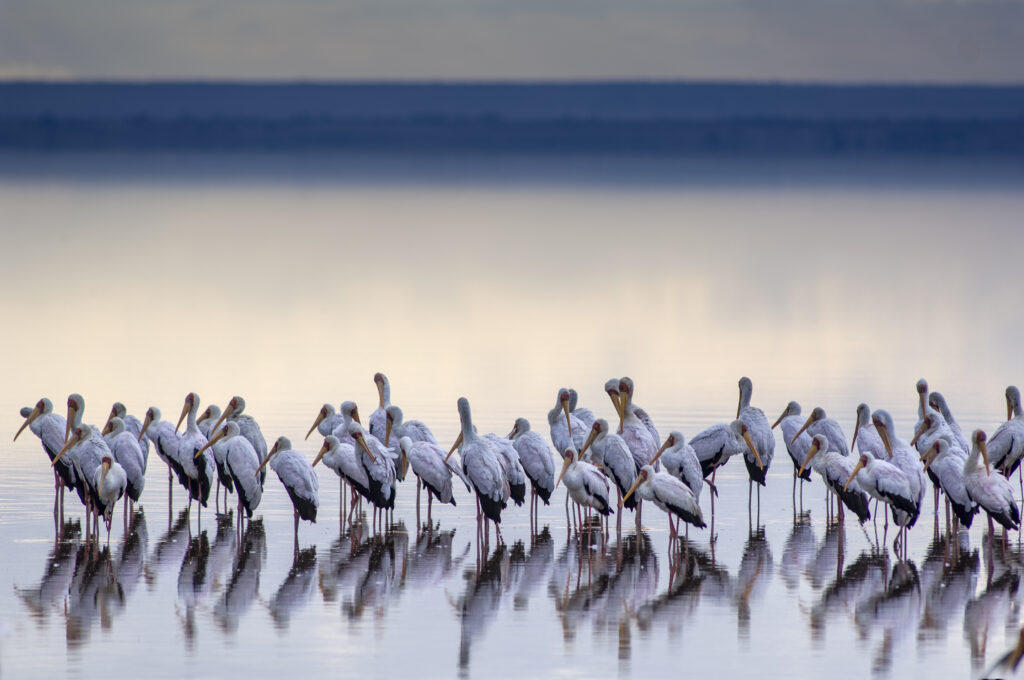
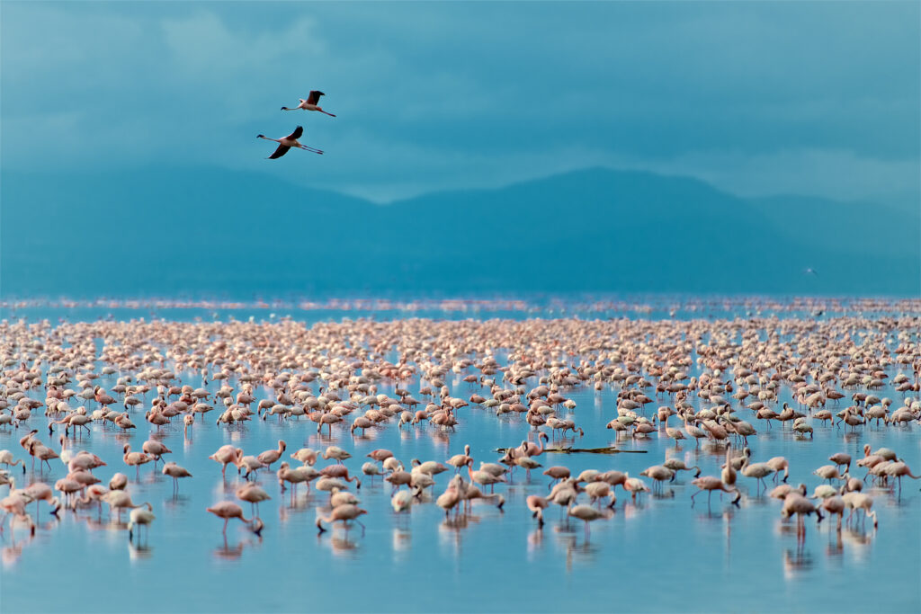
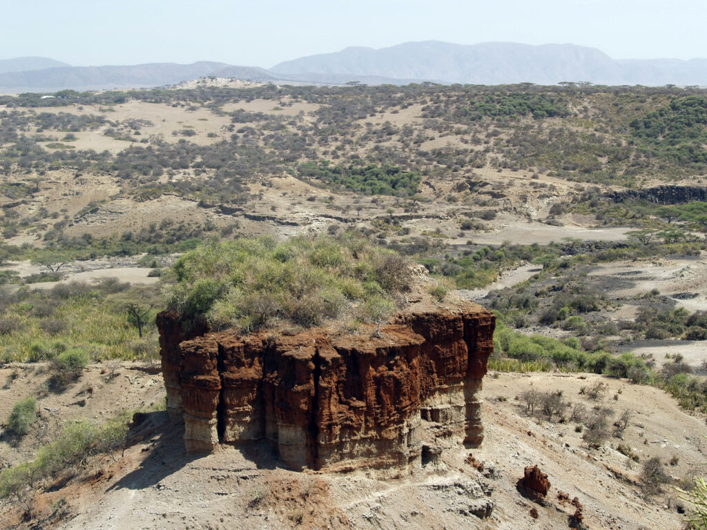
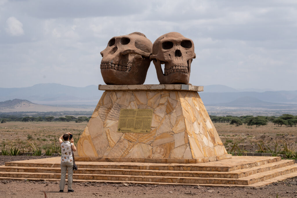
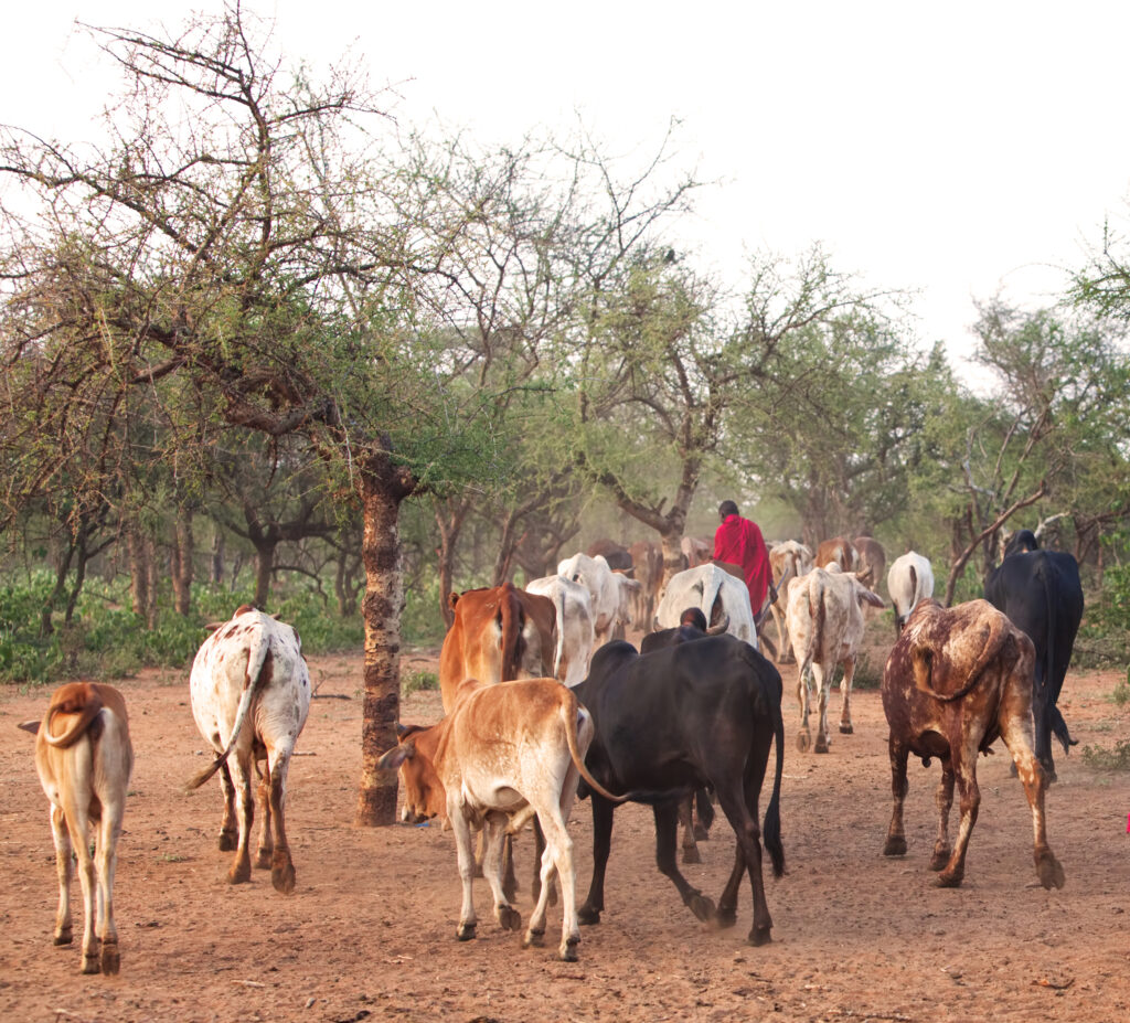
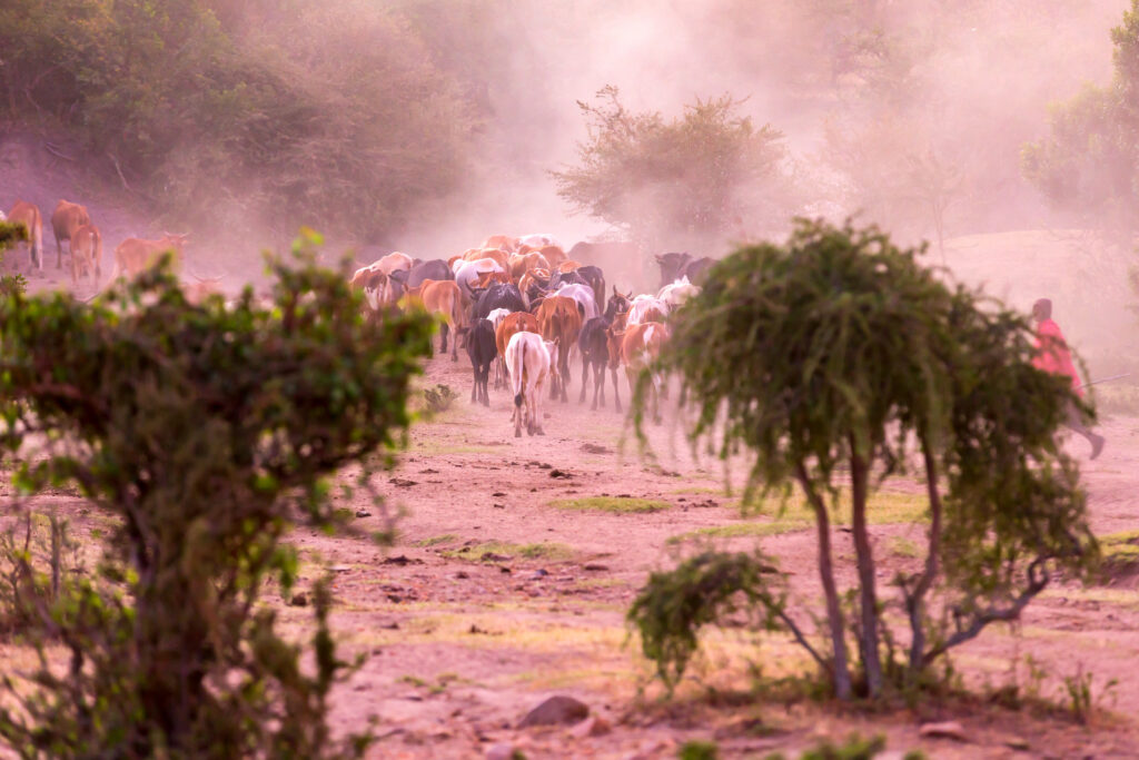
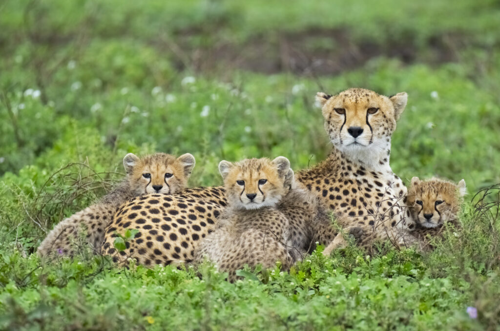
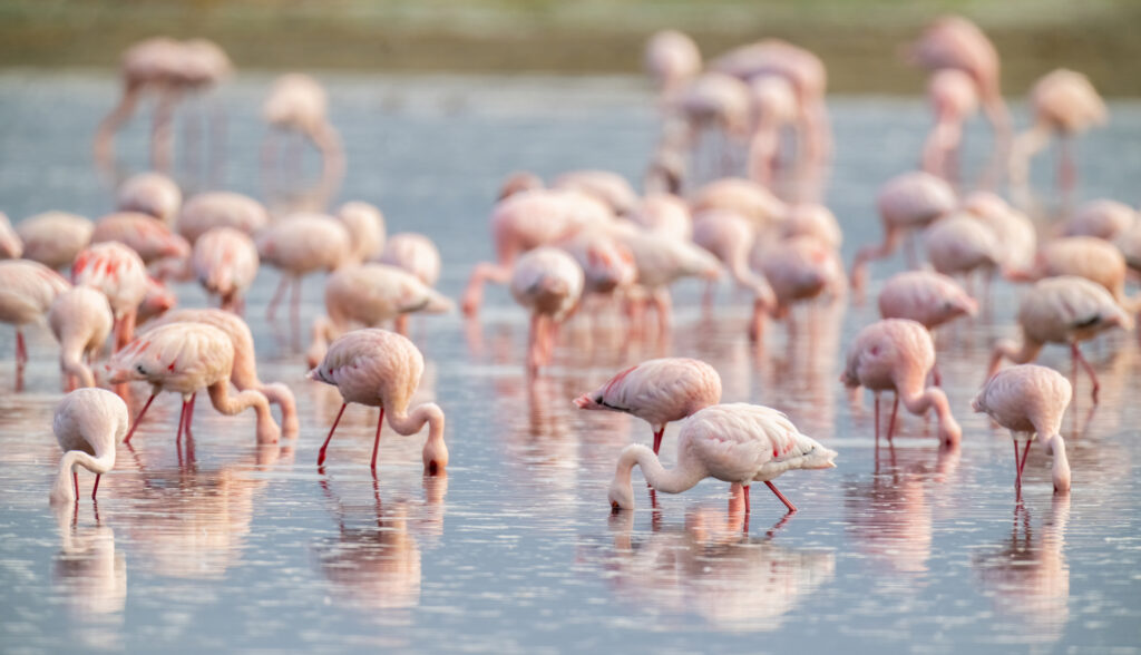
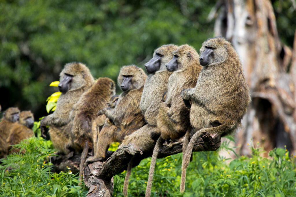
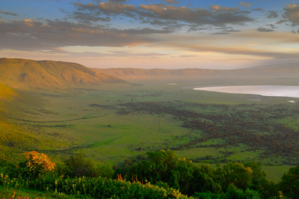
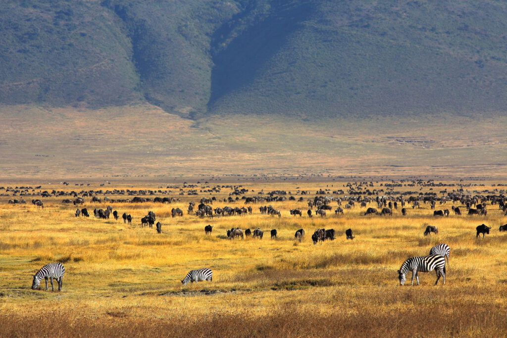
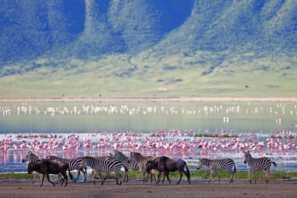
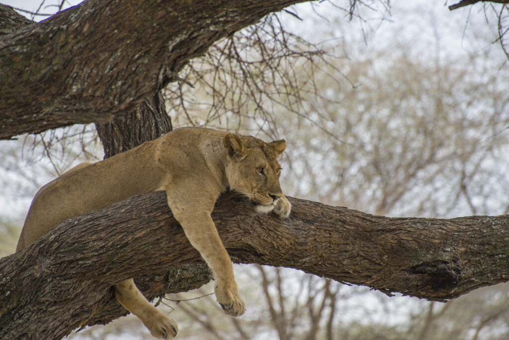
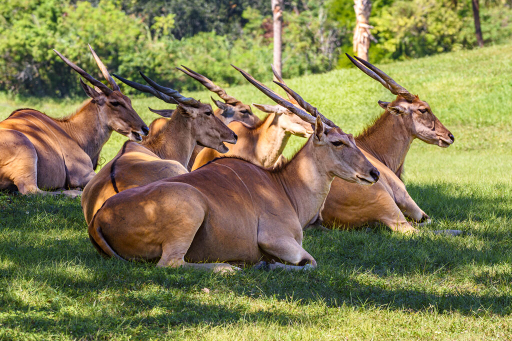
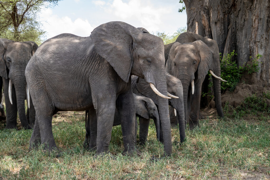
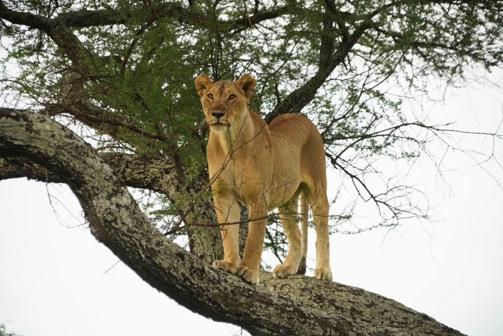
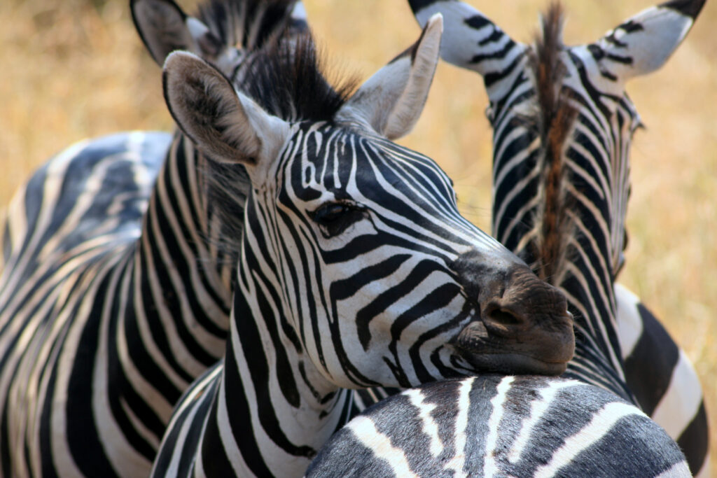
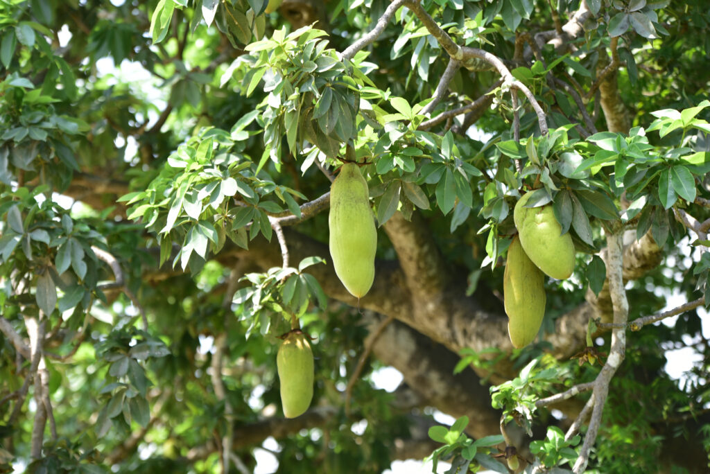
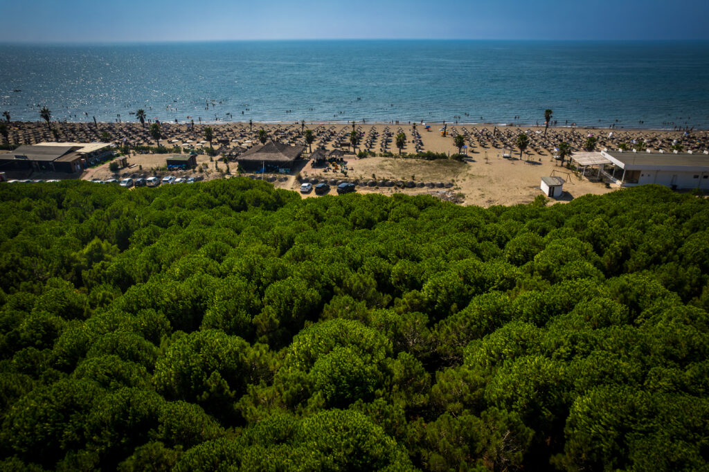
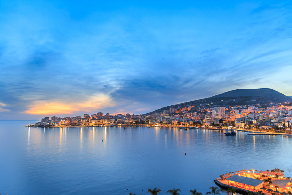
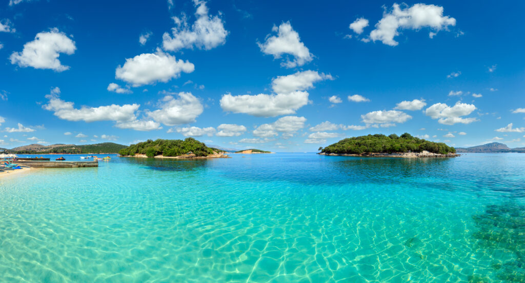
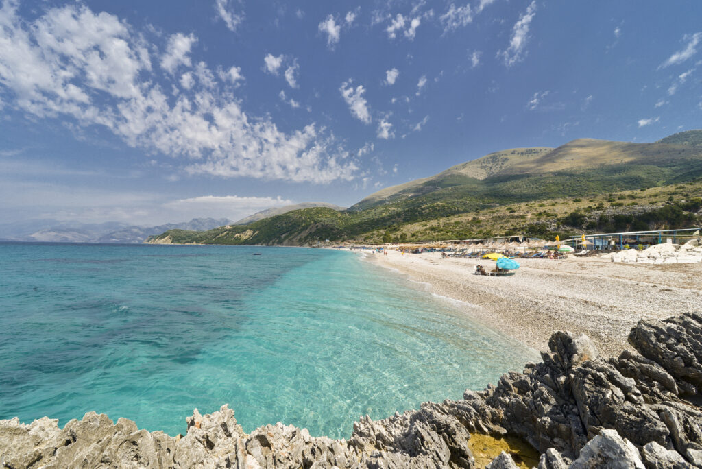
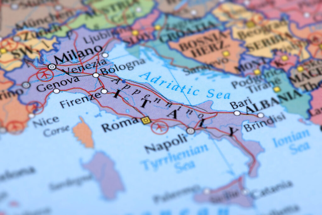
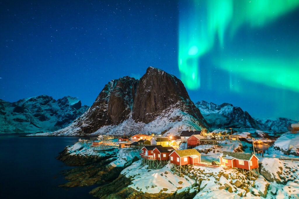
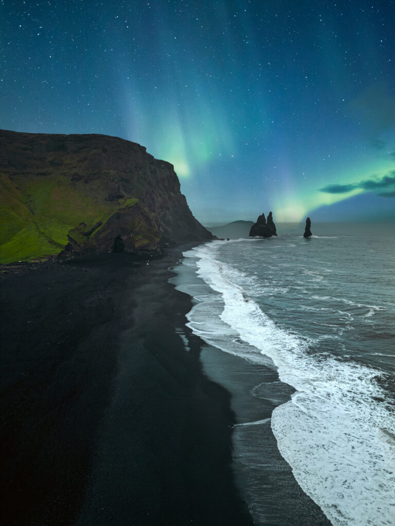
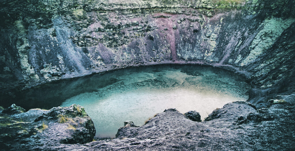
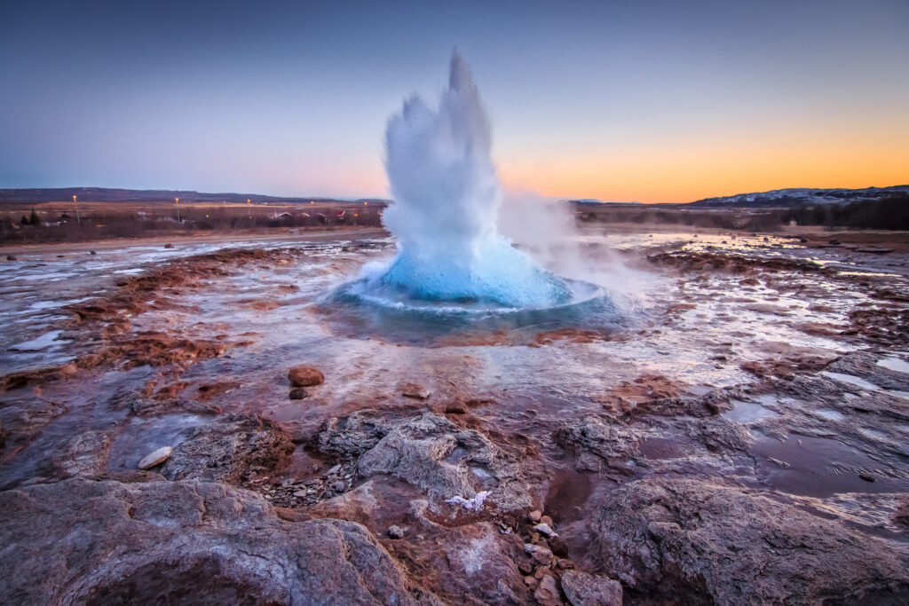
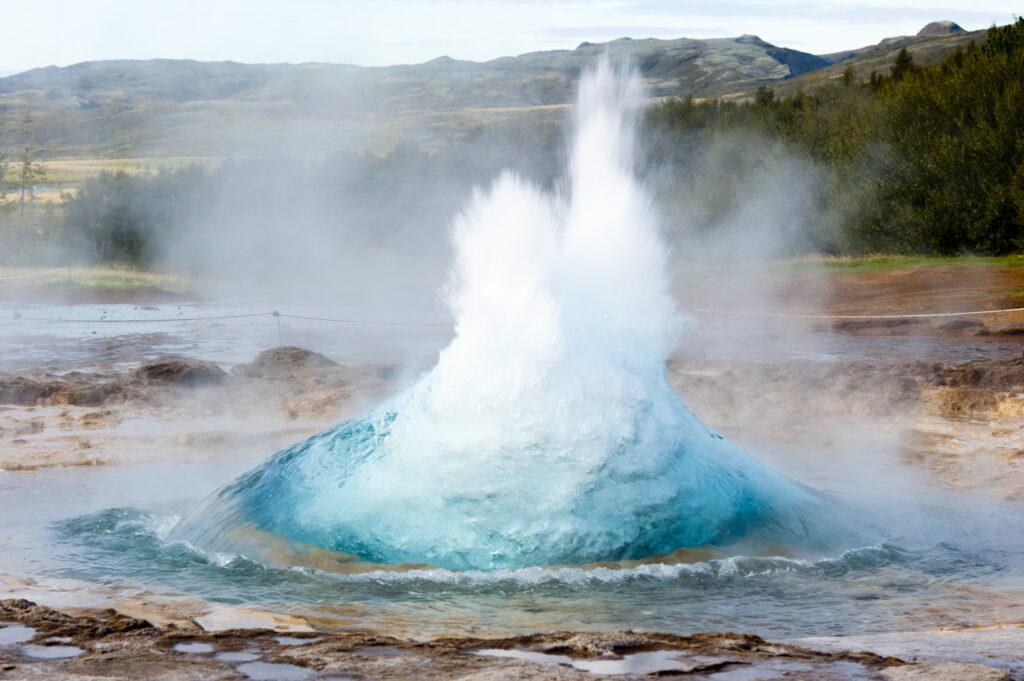
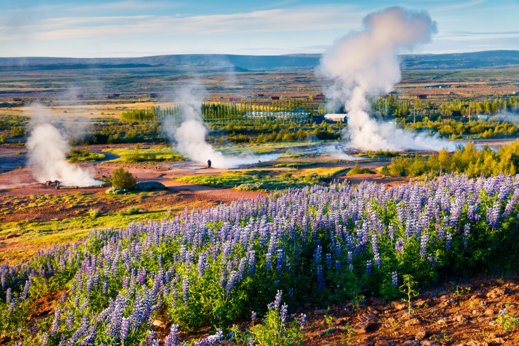
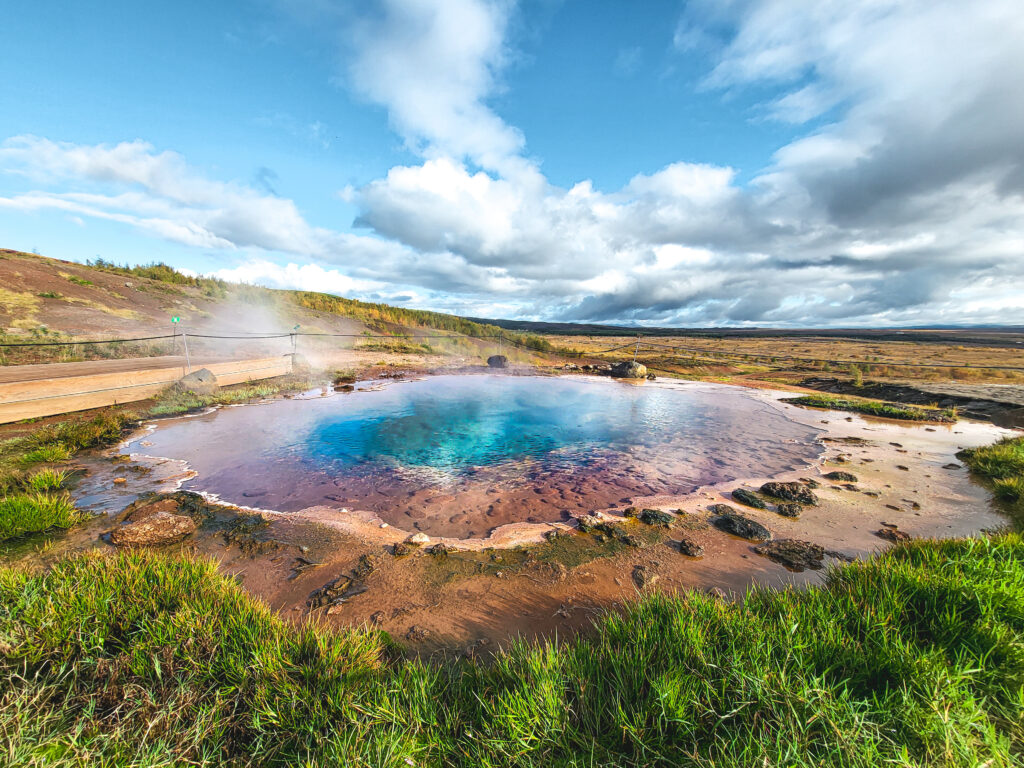
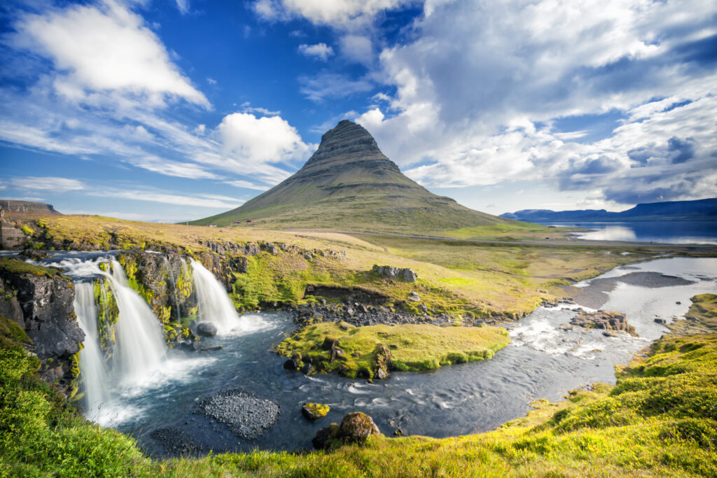
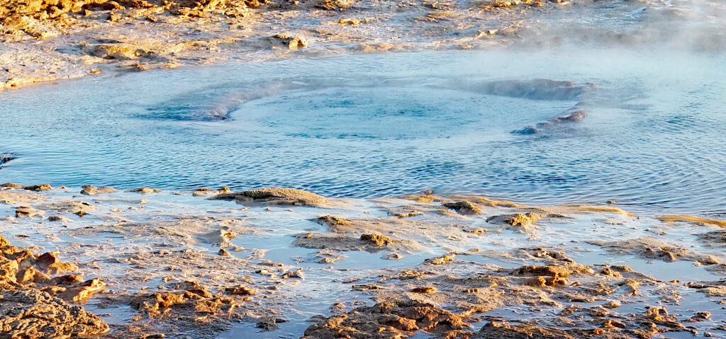
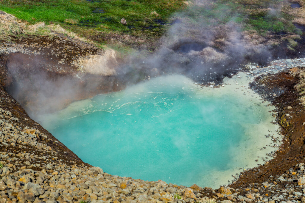
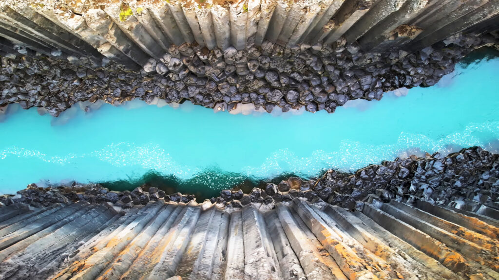
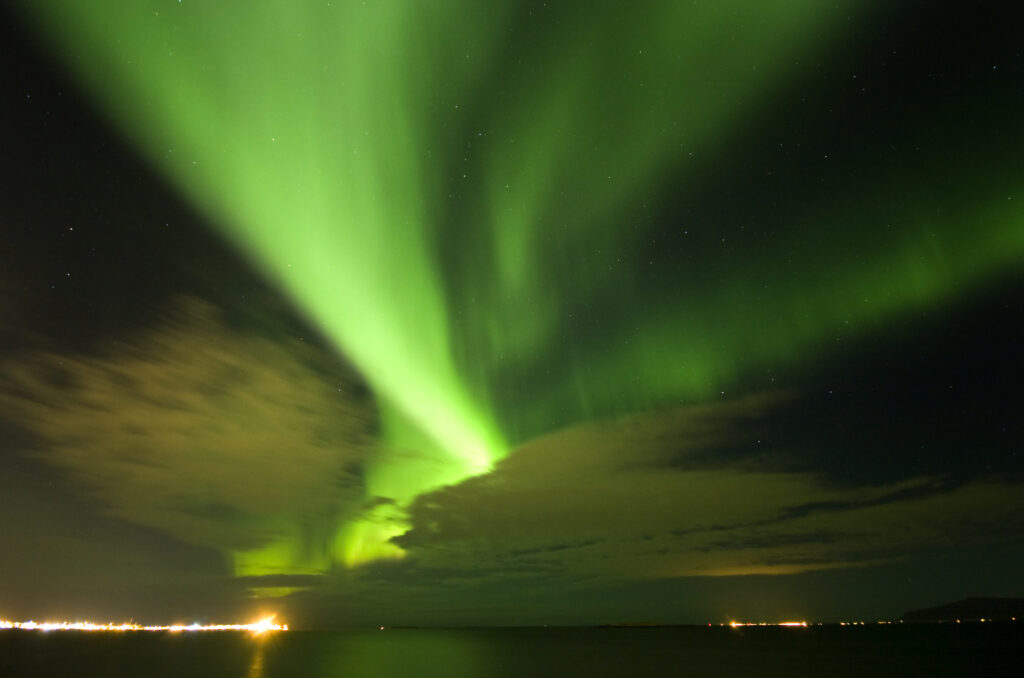
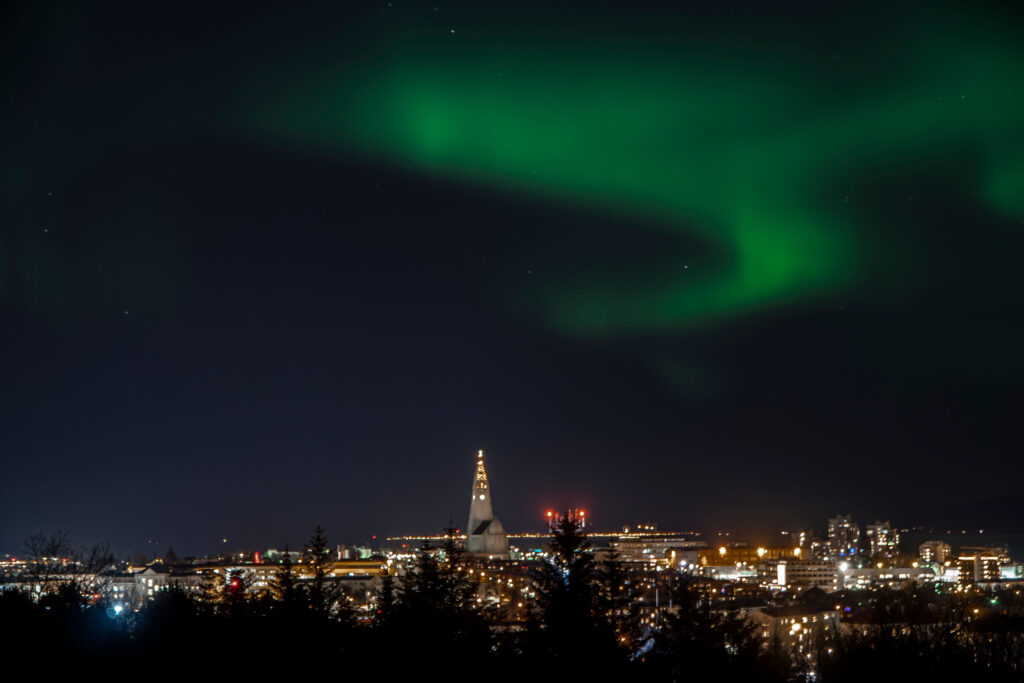
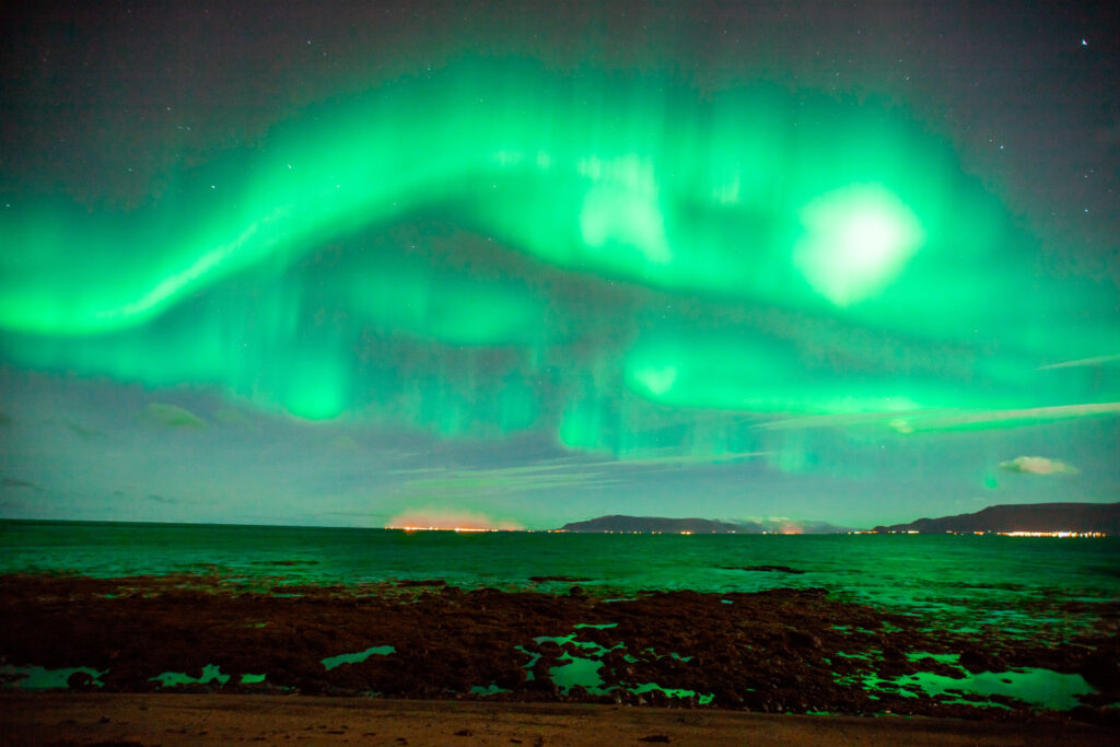
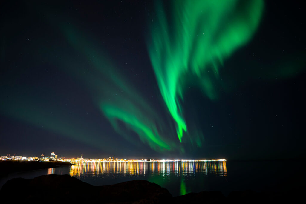
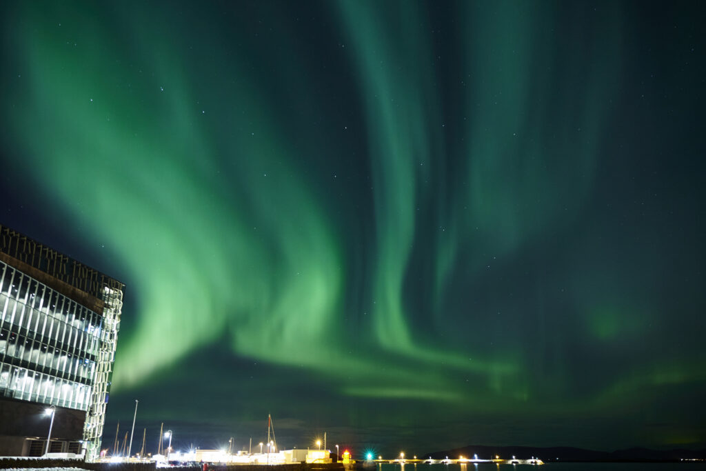
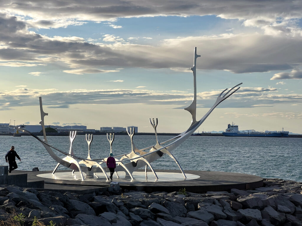
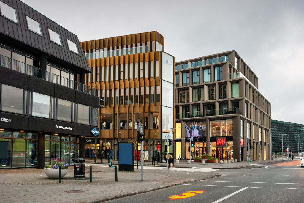
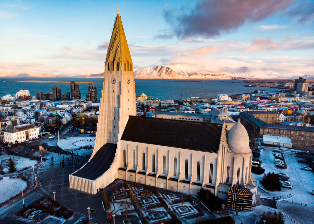
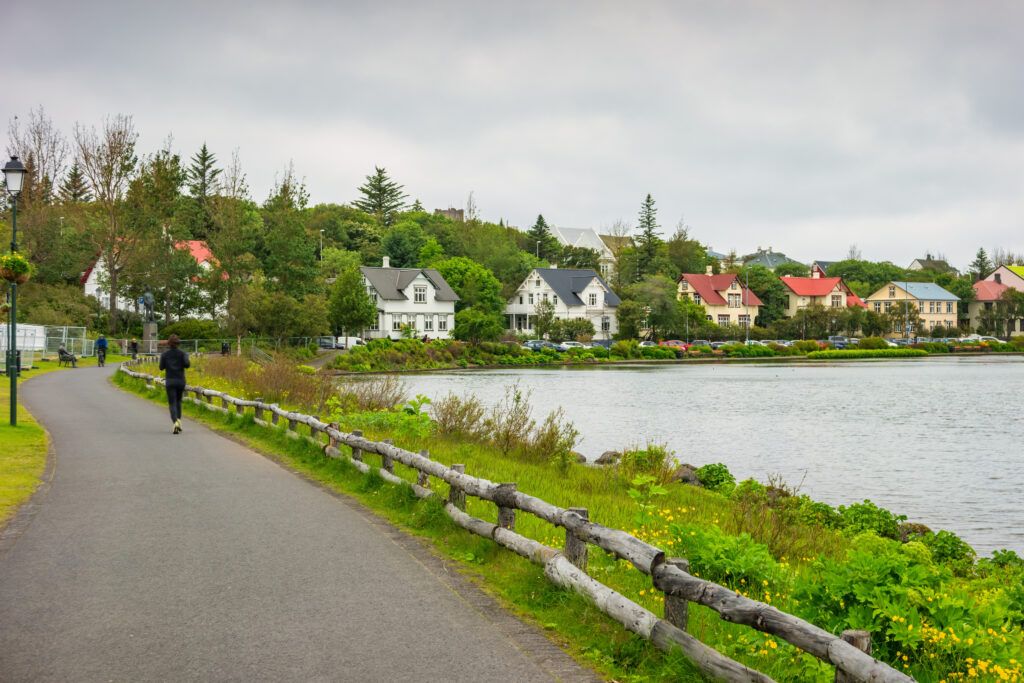
All source data is in the public domain.
Color texture: Made with Natural Earth.
Relief texture and Rivers: SRTM data courtesy of USGS. URL of source image:
https://e4ftl01.cr.usgs.gov//MODV6_Dal_D/SRTM/SRTMGL1.003/2000.02.11/
Water texture: SRTM Water Body SWDB:
https://dds.cr.usgs.gov/srtm/version2_1/SWBD/Marinella Beach, a beautiful free white sand beach in Gallura, in the northeast coast of SardiniaCapriccioli (east) beach, a famous seaside resort in the Costa Smeralda, in the northeast coast of SardiniaOristano, Sardinia, ItalyView of people relaxing along the coastline on the beach in Sardinia, Italy.ortygia, syracuse, sicily, italy.Traditional street in the town of Noto, Sicily. which displays the town’s famous Baroque style architecture. Picture taken during a warm summer day and contains some open restaurants and people walking down the street.Blue Piaggio Vespa parked at sunset while people walking on the street .Ortigia urban area. Syracuse Siracusa, Sicily Italy, summer seasonClassic blue Renault 4 parked. Ortigia urban area. Syracuse Siracusa, Sicily Italy, summer seasonSyracuse ruins, Sicily, ItalyPhoto taken at coast of Ortigia, Syracuse , Sicily.Little chapel hill over the small town Centuripe in Sicily, ItalyAerial view on coast town at the Ionian sea of Sicily. Italy.Drone shot over Tropea, Calabria, ItalyIsola Bella, in Taormina (Sicily), during the summerNoto, Italy – August 19, 2013: Calamosche Beach, near Noto in Sicily. Calamosche is situated inside the wonderful reserve of Vendicari, near Noto in Sicily (province of Siracusa).People are taking a bath, swimming, having fun, having relax on the sand. Colored umbrellas are fixed to the ground for many meters from the shoreline.Siracusa wild beach seascape. Sicilia, Italia, EuropeSiracusa wild beach seascape. Sicilia, Italia, EuropeSyracuse, Sicily, Italy – February 16, 2023: Fountain of Arethusa Fonte Aretusa with papyrus plants at Ionian sea shore on ancient Ortigia island of Syracuse historic old townNoto, Italy – August 19, 2013: Calamosche Beach, near Noto in Sicily. Calamosche is situated inside the wonderful reserve of Vendicari, near Noto in Sicily (province of Siracusa). People are taking a bath, swimming, having fun.Syracuse sityscape, Sicily, Italy. Composite photoSpiaggia Massolivieri beach summer sea landscape (Siracusa, Sicily, Italy). People unrecognizable.Beach in the Gulf of Syracusecalamosche beach probably the more beautiful in ItalyView of Syracuse Promenade at Dawn, Sicily, Italy, Europe, World Heritage SitePanorama Syracuse, Ortiggia, Sicily, Italy, houses facing the sea in the morning, in the background of blue sky and reflections on the seaSyracuse, Italy – September 18, 2023: Long Exposure shot of Syracuse main harbour by the famous Arethusa fountainThe rugged coastline just south of Siracusa, Sicily.Panoramic view of Ortygia, Syracuse, Sicily. Photo taken with drone.Aerial view of Piazza del Duomo in Ortigia, Syracuse, Sicily.Drone view towards the “crocodile head shaped” Ortygia Island connected to Syracuse City with Maniace Castello at the Eastern Coast of Sicily Island towards the Mediterranean Sea under blue summer sky. Syracuse. Maniace Fortress, Ortygia Island, Sicily, Italy, Southern EuropeOrtigia island in Syracuse, Sicily, ItalyMadonna delle Lacrime Basilica (Our Lady of the Tears), also called Madonnina delle Lacrime roman catholic church in the city center of Siracusa – Syracuse in Sicily. Construction started in the year 1966, the first stone for construction was consecrated in 1954. Aerial Drone Point of View Cityscape Stitched Panorama towards the Mediterranean Coast. Syracuse, Sicily Island, Italy, Southern EuropePanoramic view of Ortygia, Syracuse, Sicily. Photo taken with drone.Landscape with medieval town of Noto at night, Sicily islands, Italycloister with church dome backgroundCatania’s Cathedral of Sant’Agata in the city centre of the Sicilian town, Italy. Seen from the terrace of the church nearby.Domes of the Cathedral dedicated to Saint Agatha. The view of the city of Catania, Sicily, ItalySan Berillo in CataniaLandmark of Caltagirone near Catania on Sicily – Scala di Santa Maria del Monte – very long steps covered with painted pottery tiles. Every year in the spring during Scala Infiorita festival steps are covered with flowers.Catania, Italy – 28 Jan 2020: San Berillo o Birillo is a newly recovered pedestrian district with bars and public spaces, from a damaged and deserted neighborhood, in the heart of Catania, Sicily, ItalyPeople in Piazza Università, seat of the University of Catania founded in 1434. This is the main university in Sicily and the oldest.Catania, Italy, 10/14/2016. The facade of the theater dedicated to the musician Bellini in the Sicilian city.Castiglione di Sicilia is a commune in the Metropolitan City of Catania in Sicily, southern Italy.Scenic view in Forza d`Agro, picturesque town in the Province of Messina, Sicily, southern Italy. Forza d’Agro, Sicilian historical city on the rock over Ionian sea, Italy.Aerial view on the port of Catania which is located next to the old town.A beautiful view of Acicastello Sicily … (Italy)Wonderful views of Catania with the largest active volcano in Europe behind … the Etna!Beach near Taormina (Sicily) during the summerIsola Bella, in Taormina (Sicily), during the summer“Aerial view to the small town of Acicastello, nearby Catania; Sicily, Italy.”The norman castle of Aci Castello, Catania, SicilyDrone view towards the “crocodile head shaped” Ortygia Island connected to Syracuse City with Maniace Castello at the Eastern Coast of Sicily Island towards the Mediterranean Sea under blue summer sky. Syracuse. Maniace Fortress, Ortygia Island, Sicily, Italy, Southern EuropeCatania, Sicily: Beautiful old town panorama with the cupola of the 18th-century Duomo di Sant’Agata and a turquoise sea framed (in the foreground) by two baroque architectural flourishes.Catania, Sicily: Beautiful old town panorama with vibrant orange tile roofs; the cupola of the 18th-century Duomo di Sant’Agata is in the foreground and a turquoise sea and harbor in the background.The morning view of the Politeama Garibaldi theater in Palermo, Sicily, ItalyAn aerial panoramic shot of the Tyrrhenian Sea from Cefalu in Sicily, ItalyBeach and old town of Cefalu in the light of sunsetAerial view of Mondello Beach located near Palermo, Sicily. Many umbrellas on the beach.Palermo, Sicily 12.26.2018: Catholic Church of Saint Catherine (Chiesa di Santa Caterina, 1596). Church of Saint Catherine located in heart of historic centre, between Piazza Bellini and Piazza Pretoriadrone aerial view of old famous destination town Palermo is located in the northwest of the island of SicilyAerial view of Mondello Beach located near Palermo, Sicily. Many umbrellas on the beach.Path with vibrant green trees in city park, Villa Giulia. Palermo, Sicily, Italy.Panoramic view of the main Cathedral of the Roman Catholic Archdiocese in Palermo – Sicilythe skyline of palermo, sicily“Palermo Cathedral at dusk, Sicily Italy17mm tilt shift lens used-MORE images from Sicily:”The cloister of the arab-norman church San Giovanni degli Eremiti in PalermoDrone view from above at the old town of Cefalu at sunset, medieval village of Sicily island, Province of Palermo, Italy. Europe. Cathedral of CefaluPalermo, Sicily, Italy – August 8, 2017: view showing Sicily island, boats in the sea, trees, buildings and mountains can be seen on the backgroundTypica Street of PalermoThe interior of the church of Santa Maria dell’Ammiraglio from 12 century, aka as the Martorana, Palermo, Sicily, southern ItalyPalermo, Italy with the Praetorian Fountain at dusk.Palermo Cathedral church building architecture, Sicily, ItalyPalermo, Sicily, Italy – August 8, 2017: view showing Sicily island, boats in the sea, trees, buildings and mountains can be seen on the backgroundAerial view at the city of Palermo. Palermo, Italy – December 10, 2021Aerial view of Pretoria Fountain in Palermo, Sicily, Italy. Piazza Pretoria.Palermo, Italy overlooking Piazza San DomenicoSkyline view of Palermo on a sunny day. High angle view.Mount Etna in Province of Catania, Sicily, with Taormina in the foregroundLofoten Islands, NorwayView to the famous Aurlandsfjord in Norway, a UNESCO World Heritage SitePanoramic sunny view on Aurlandsfjord, NorwayBalestrand. The administrative centre of Balestrand Municipality in Sogn og Fjordane county, Norway.Large passenger ferry and small boat anchored in harbor on the shore in small village Flam, NorwayFlam village with Two cruise at the port during early morning and beautiful water reflectionPanoramic view of Sognefjord, one of the most beautiful fjords in NorwayMoody landscape with boats in the Naeroyfjord from Gudvangen, NorwayNavigation in the Norwegian fjords have been a vital means of transporting goods and people between communities. Delivering produce from farms to markets, ferrying private and commercial vehicles and as part of the growing tourist industry. The infrastructure spans from small private piers and pontoons to large commercial docking stations. With a comprehensive system of ferry routes, tour boats of various sizes and large cruise liners. This image was taken in a very calm and bright morning and it shows the reflection of the fjord and mountains on the boat’s side window. The Nærøyfjord is a UNESCO World Heritage Site.Norwegian flags reflection in Naerøyfjord in NorwayPanoramic shot of the famed Geirangerfjorde featuring seven sisters and suitor waterfallsHires panoramic showing the Seven Sisters water fall on the right and the ‘Suitor (Friaren)’ or Bottle waterfall on the left in a Norwegian fjord on the way to the beautiful town of GeirangerThe Suitor (or Friar) Waterfall over Geirangerfjord viewed from a sightseeing boat in the summer, Sunnmore, More og Romsdal, NorwayGeiranger, Norway – June 29, 2022: Seven Sisters waterfall in Geirangerfjord, NorwayOslo, Norway – July 23, 2015: Oslo cityscape and Norway flag on a Ferry from Akershus to OsloOslo, Norway – August 11, 2019: Tramway at Barcode Project area. A redevelopment on former dock and industrial land in central Oslo.July 2019. Buildings in Bjørvika neighborhood in Oslo, part of Barcode redevelopment Project, NorwayOslo, Norway – August 27, 2016: The Bike Racks at Barcode Project in Oslo.Oslo, Norway – August 15, 2022: Metro Tunnelbane at station Holmenkollen public transport in Oslo, Norway.Oslo, Norway – September 24, 2021: Shopping street in city center of Oslo at night.Oslo, Norway, June 20, 2023: People walk along Karl Johans gate, the main street Oslo that has many tourist attractions such as Royal Palace, Central Station and Stortinget, restaurants, and shops.Oslo, Norway, July 4, 2023 – The Holmen Gate in the Aker Brygge district in downtown Oslo.Oslo, Norway – April 7, 2018: Vippa Food CourtOslo, Norway – September 25, 2021: Ekebergrestauranten restaurant in Ekebergparken park.Oslo, Norway – June 15, 2015: Tourists and local people eating in sidewalk cafes on Karl Johans Gate. One of the main shopping streets with lot of outdoor restaurants and shops.OSLO, NORWAY – AUGUST 26, 2016: Karl Johans gate (street) and The Royal Palace in Oslo in NorwayOslo, Norway – August 12, 2023: A picture of the Royal Palace of Oslo.Stairs in the park of Oslo, Norwayoslo park vigelandColorful building in Oslo NorwayOSLO, NORWAY – JULY 21, 2017: The Fram Museum or Frammuseet is a museum of Norwegian polar exploration. Fram Museum located on Bygdoy peninsula in Oslo, Norway.Lutheran Bygdøy Church in OsloOslo, Norway – September 23, 2021: Construction site of the current Munch Museum at Bjorvika at night.Newly built Munch Museum in Oslo, Norway seen at a winter nightOslo, Norway – August 11, 2019: View of Barcode Project area and Munch Museum. A redevelopment on former dock and industrial land in central Oslo.In summer 2021 a brand new Munch museum opened by Oslo’s waterfrontOslo city hall at day, norway, scandinaviaOslo, Norway – July 19, 2015: Tourists exploring Oslo Opera House, NorwayOslo, Norway – June 1, 2019: Panorama of Oslo waterfront with Oslo Opera HouseOslo, Norway: Rådmannsgården (alderman’s building), the oldest preserved building in the old Christiania, made of imported Dutch brick – the building has steep roof with high gables with blind arcades – Currenty hosts the Oslo Art Society – Christiania Torv, Rådhusgata and Nedre Slottsgate – Kvadraturen area.Des escaliers en pierre et une grande colonne sculptée, dans le parc Vigeland, à Oslo, en NorvègeAker Brygge in Oslo with a sailing ship lying in the Oslofjord with ice floes, Norway, on a beautiful cold sunny day with blue sky.Oslo, Norway, July 6, 2023 – Gol Stave Church in NorwayNorway Oslo Old Town Damstredet, typical old town houses in the old town village of Damstredet Cobblestone Street in Oslo in Summer. Damstredet Street is one of the oldest streets in the historic center of Oslo, Capital of Norway. Damstredet, Oslo, Norway, Scandinavia, Northern Europeview of Oslo HavnelagerOslo modern skyline. Several buildings built on the water’s edge in the Norwegian capital city. Reflections on the water.Idyllic sunset in Oslo fjord“Oslo, Norway – September 5, 2012: View on a side of the National Oslo Opera House on September 5, 2012, which was opened on April 12, 2008 in Oslo, Norway”An aerial shot of Oslo at sunset, with lots of buildings and lights, surrounded by sea, NorwayOslo, Norway – April 14, 2022: Oslo’s Bjorvika (Inner Harbor) during sunrise with the calm water reflecting the famous Oslo Opera House. Norway mapOil rigs under maintenance near Bergen, Norway.Industrial oil rig offshore platform construction site on the North SeacoastStavanger, Norway, September 08 – An oil platform stands out against the horizon of the Stavanger Bay while a Norwegian flag flies in the sun. The oil industry is Norway’s main source of wealth and in particular the Stavanger region, a nerve center for the oil companies operating in the country.Container Oslo, Luftbild, Canon 750 D, Tamron 18 – 200The Stryn lake, Stryn, Norway – NIKON D850 – 16.0-35.0 mm f/4.0 @ 16 mm – 15,0 sec a ƒ / 10 – 64 ISOViking Ship resting alongside Gudvangen Fjord in Norway.wooden huts at Stalheim village in NorwayUpstairs dining room in a medieval inn with food and drink on the tables and shields decorating the walls. 3D illustration.Vector Viking Ships and ShieldsViking ships on the water under the sunlight and dark storm. Invasion in the storm.View of Trolltunga cliff and lake between mountains, picturesque landscape, beauty in nature, paradise on Earth, sunny day, Odda, Norway. cloudy dayNorway fjord landscape. Morning soft blue colors.Perfect reflection of the Reine village on the water of the fjord in the Lofoten Islands, NorwayPerfect reflection of the Reine village on the water of the fjord in the Lofoten Islands, NorwayHighly detailed physical map of Italy in vector format,Traditional view of Grand Canal in Venice, Italy. Cityscape and landscape of Venice. Residential houses on the water. Panorama of the street in the water.Colourful villas and palazzo reflecting in the tranquil waters of the Grand Canal in the Academia district of Venice, Italy.Venice, Italy – June 14, 2018: People at restaurant with tables outdoors near small canal in VeniceThe Doge’s Palace in St Marks square Venice Italy. The Doge’s Palace ( Dukes palace ) was once one of the most powerful buildings in the world. No filters were used on this file.Piazza San Marco with Campanile and Doge’s Palace in Venice, ItalyVenice flooded from the high water http://photo-zona.net/images/user85/album13100/preview/1326990670_bpjw7443_VENICEIMAGES.jpgFantastic sunset on San Marco square with Campanile and Saint Mark’s Basilica. Colorful evening cityscape of Venice, Italy, Europe. Traveling concept background. Artistic style post processed photo.Morning on Piazza San Marco in Venice, next to the Doge’s Palace. In the background is the San Giorgio Maggiore church, and on the right the Column of St Marco.St. Mark’s Square with St. Mark’s Basilica and St. Mark’s Tower in Venice, ItalyVenice panorama, view of Saint Mary of Health Church, the Doge’s Palace, Saint Mark’s Tower and the lagoon.aerial view of venice with saint mark’s squareVenice Grand CanalAerial View of the Grand Canal and Basilica Santa Maria della Salute, Venice, Italy. Venice is a popular tourist destination of Europe. Venice, Italy.Venice canals and architecture, ItalyAerial Sunset or Sunrise Shot of Central Venice city skyline, Italy. Panorama drone top view of famous tourist attraction from above. Basilica di Santa Maria della Salute, Grand Canal and lagoon.Grand Canal and Basilica Santa Maria della Salute in Venice, Italy. Beautifil cityscape at sunset. Famous tourist destination.Aerial View of the Grand Canal and Basilica Santa Maria della Salute, Venice, Italy. Venice is a popular tourist destination of Europe. Venice, Italy.Sunrise over Mount Meru. Arusha, Tanzania.A sunlit waterfall on the jungle covered slopes of mount Kilimanjaro, TanzaniaEvergreen cloud forest on the slopes of Mt. Kilimanjaro. This type of forests is created by a wet and moisture climate and is characterized by a high incidence of low-level cloud cover – the forest is that dence that there is rarely light coming until to the ground.A path in the rain forest on the slopes of Mt. KilimanjaroMount Kilimanjaro is a dormant volcanic mountain in Tanzania. It is the highest mountain in Africa and the highest free-standing mountain in the world at 5,895 metres or 19,341 feet above sea level.Large herd of zebras graze in the African savannah at the foot of Kilimanjaro. Trip to the Horn of Africa. Southeast Kenya, the Amboseli park. Amboseli is a biosphere reserve by UNESCOLandscape of Amboseli National Park with majestic and breathtaking shape of Kilimanjaro volcano in the backgroundArusha, Tanzania – August 17, 2022: A diverse group of hikers trekking across the rugged terrain of Mount KilimanjaroA campsite on Kilimanjaro mountain background under the Milky WaySerengeti, Tanzania – September 17, 2013: hot air balloon taking off during sunrise with cars and people assisting at The Serengeti National Park at dawn.Hot air balloon over the Serengeti National Park in Tanzania at sunrisethe Mara from above – the Mara River seen from above aboard a hot air balloon with other hot air balloons around, with beautiful morning light at sunrise – Serengeti – TanzaniaA bird’e eye view of hot air balloons in mid-flightRhino, Springboks, zebra, Elephant and lion in Serengeti National Park, Tanzania.Herd of Zebra crossing river in the Serengeti, Tanzania.Hippopotamus (Hippopotamus amphibius). Serengeti National Park, Tanzania, AfricaA giraffe with beautiful panorama of the savannah in the plains of the Serengeti National Park Vertical view – TanzaniaBlue wildebeest, brindled gnu (Connochaetes taurinus) herd crossing the Mara river during the great migration, Serengeti national park, Tanzania.Group of wildebeests crossing the river in North Serengeti full of fear and braveness at the same timeA lioness relaxing in a tree in Lake Manyara National Park, Tanzania.Two lionesses in a tree in Lake Manyara National Park, Tanzania.“Leptoptilos crumeniferusLake Manyara National Park, Tanzania”“Yellow-billed Storks (Mycteria ibis) in Lake Manyara National Park, Tanzania”In Lake Manyara In TanzaniaOlduvai Gorge (Oldupai Gorge) is where Dr Leakey discovered an important paleoanthropological site.Tanzania, Africa – March 12, 2023: Statue at the Olduvai Gorge Museum (Ngorongoro Conservation Area). Human Skulls of Paranthropus and Homo HabilisMasai with zebu cattle in African bush. End of dry season, the thorn trees are turning green.Cattle Herd at Masai Mara early in the morning with Masai WarriorNgorongoro Crater Conservation Area, TanzaniaMother Cheetah (Acinonyx jubatus) with cubs. Ndutu region of Ngorongoro Conservation Area, Tanzania, AfricaLesser flamingos (Phoeniconaias minor). Ndutu region of Ngorongoro Conservation Area, Tanzania, AfricaBaboons sitting on a branch in Ngorongoro Conservation Area, Tanzania.The west rim of the Ngorongoro crater at sunrise in TanzaniaNgorongoro Crater truly is a natural wonderland where more than twenty thousand animals live in an edenic environment, protected from the outside world by steep walls.Zebras and wildebeests in the Ngorongoro Crater, TanzaniaA female lion looks out from a vantage point high in a tree. Taken in Tarangire National Park, Tanzania.Herd of common eland antelopes resting in the shadow at noonHerd of elephants, close up, in Tarangire National Park TanzaniaClimbing lions – Tarangire National Park – TanzaniaMongoose on alert in the plains of Tarangire National Park – Vertical View – TanzaniaA family of elephants in Tarangire National park, Tanzania.Closeup view of an African zebra face, Tarangire National park, TanzaniaBoababAerial drone view of Spille beach in Albania with pine forest. High quality photopirate cave dhermi albaniaSaranda bay, sea town in AlbaniaBeautiful Ionian Sea with clear turquoise water and morning summer coast view from beach (Ksamil, Albania). Multi shots stitch panorama.View of south Albania seaside and beachesView of south Albania seaside and beachesView of south Albania seaside and beachesPlazhi i Manastirit (Monastery beach) near Ksamil and Sarande in Albania.Map of Italy.Beautiful aerial view of an Active Volcano with exploding red Lava in IcelandGlowing lava from the volcano eruption in Iceland. Powerful volcanic show from Mother Nature in all its beautyPeople watching icebergs in a beautiful glacial lagoon at sunset (Jokusarlon, Iceland)Colorful northern lightsReynisfjara is a world-famous black sand beach on the South Coast of Iceland. Basalt rocks Reynisdrangar, black volcanic sand and Atlantic ocean in IcelandColorful Kerid (Kerið in Icelandic) Crater Lake, Selfoss, Iceland.Spectacular well timmed capture of geotermal eruption at Gullfoss Geysir, The Great Geysir or Stokkur Geyser the most energetic spouting spring up to 40 meters in Iceland after sunset in twilight. Shot on Canon EOS 60D, 11mm wide lens, f4, ISO 800.detail shot of hot spring strokkur on iceland in the first second of eruption; geothermal region in the golden circle (Gullfoss, Thingvellir, Geysir) of icelandErupting of the Great Geysir lies in Haukadalur valley on the slopes of Laugarfjall hill. Foggy summer morning in Southwestern Iceland, Europe. Artistic style post processed photo.Colorful blue pool Blesi in Haukadalur geothermal field in Iceland. Inactive remains of a geyser.Brauarfoss Waterfall in mid summer, IcelandHaukadalsvegur, Iceland. Eruption of Strokkur geyser.Hot spring near Stokkur geyser – Icelandkirkjufell mountain on snaefellsnes peninsula, icelandIcelandThe clear blue waters of Kirkjufellfoss waterfall tumbling down the mountainside to the ocean fjord beside Grundarfjordur beneath the iconic peak of Kirkjufell framed by the warm glow of sunrise over the Snaefellsnes peninsula in the far east of Iceland.dock and harbor in Sigulfjordur, IcelandJuly 19, 2023 – Akureyri, Iceland. Visitors to the city explore the harbor area of the city.The basalt column formation around the Hjalparfoss waterfall.Geyser chamber filling with waterGeothermal Area In IcelandPrepare to be mesmerized by the breathtaking beauty of Studlagil waterway, a natural wonder nestled in the heart of Iceland. This stunning landscape unveils a basalt canyon that has been carved over centuries by the rushing glacial river. As you stand in awe of the towering basalt columns lining the canyon walls, a sense of grandeur and majesty fills the air. The vibrant hues of the moss-covered rocks provide a striking contrast against the crystal-clear blue waters, creating a scene straight out of a fairytale. Immerse yourself in the untouched tranquility of this Icelandic gem, where the forces of nature have sculpted a masterpiece. Let the serenity of Studlagil waterway transport you to a realm of wonder and awe, where the raw power and delicate beauty of the natural world harmoniously converge.Northern lights in Iceland.Big display of Aurora Borealis in south Iceland.Close to Reykjavik city.A beautiful shot of northern lights over ReykjavikA beautiful shot of the Aurora borealis sky over the snowy field in Iceland, near ReykjavikA low angle shot of the bright green northern lights over Reykjavik, IcelandThe Harpa Concert Hall illuminated with northern lights at night in Reykjavik, Iceland.July 16, 2023 – Reykjavik, Iceland. visitors to the city line up for a photo op in front of the statue. The Sun Voyager (Sólfarið) is a large steel sculpture of a ship, located on the road Sæbraut, by the seaside of central Reykjavík. The work is one of the most visited sights in the capital, where people gather daily to gaze at the sun reflecting in the stainless steel of this monument.Modern stores in downtown Reykjavik, Iceland.Landmark aerial view of Reykjavik, the capital of IcelandTjornin Lake and Park in downtown Reykjavik, Iceland.Wide angle view of the landscape at the Blue Lagoon in Iceland, Europe.Aerial view of Reykjavik at sunset, Iceland.Reykjavik IcelandView up the famous Rainbow Street in Downtown Reykjavik Iceland. Halgrimskirka in the background.